Strong Winds Diminish Later Today Cool Tuesday Wednesday
SHOP THE JOESTRADAMUS STORE
Strong Winds Diminish Later Today Cool Tuesday Wednesday
Yesterday’s major storm which dumped 2 to 4 inches of rain area wide and created strong winds that gusted to hurricane force in some spots is now moving northward. We may still have a few showers running around this morning but sky conditions will begin to improve as the day goes on and we should see some sunshine before too long. Winds will remain strong into midday from the northwest with some gust into the 40 mph+ range but those winds will begin to drop off this afternoon. Cool weather is here today with temperatures in the 50s all day and we should see lows down into the upper 30s and lower 40s over many areas tonight.
SATELLITE LOOP

REGIONAL RADAR

LOCAL RADAR NEW YORK CITY

LOCAL RADAR PHILADELPHIA


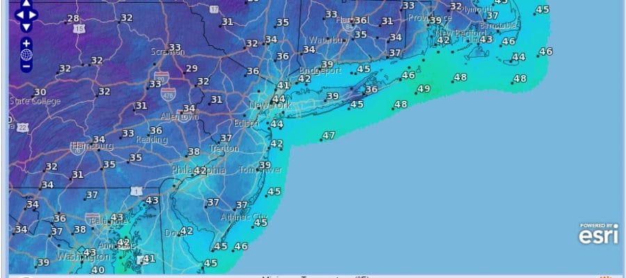
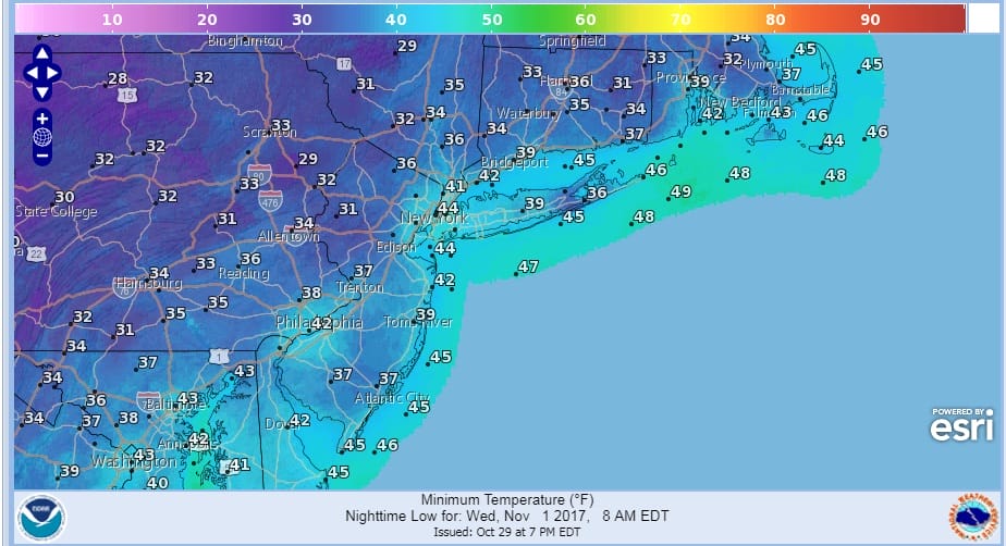
Tuesday and Wednesday look to be rather cool with highs both days 55 to 60. Tuesday night into Wednesday morning it will be quite cool with lows in the 30s in many areas. Some 20s will appear well inland where the first freezes of the season will occur.
The next chance for showers will be on Thursday as the next warm front cold front combination approach. No major storms (thankfully) are on the horizon for this week or this coming weekend.
 GET JOE A CIGAR IF YOU LIKE

FiOS1 News Weather Forecast For Long Island
FiOS1 News Weather Forecast For New Jersey
FiOS1 News Weather Forecast For Hudson Valley
NATIONAL WEATHER SERVICE SNOW FORECASTS
LATEST JOESTRADAMUS ON THE LONG RANGE


