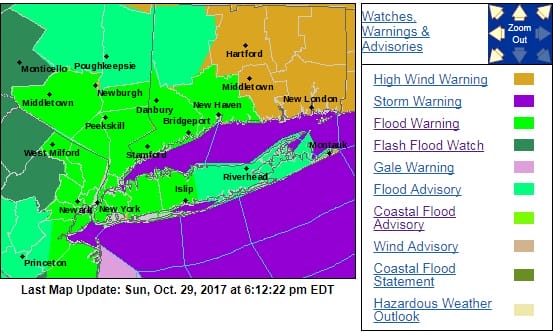
FLOOD WARNINGS HIGH WIND WARNINGS MAJOR STORM TONIGHT
SHOP THE JOESTRADAMUS STORE
FLOOD WARNINGS HIGH WIND WARNINGS
MAJOR STORM TONIGHT
Up until 7pm the rain has been the primary focus here. The satellite loop shows the major storm developing along the Middle Atlantic Coast. It has completely absorbed Tropical Storm Philippe which is now adding extra juice to all this. Numerous Flood Warnings have been posted for New Jersey, New York City, Hudson Valley, Long Island and much of Western Connecticut.
SATELLITE LOOP

The regional and local radars remain loaded and the heaviest of the rain is now sweeping inland from off the ocean with a few thunderstorms in the mix as well. We should easily double the rainfall totals so far which are pushing the upper end of the 1 to 2 inch range.
REGIONAL RADAR

LOCAL RADAR NEW YORK CITY

LOCAL RADAR PHILADELPHIA


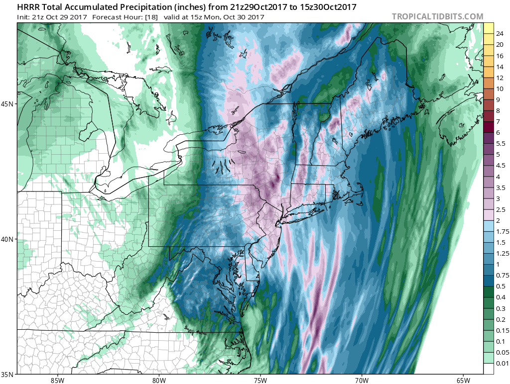
Looking at the ultra short range HRRR model, additional rainfall of a couple of inches or more is achievable.
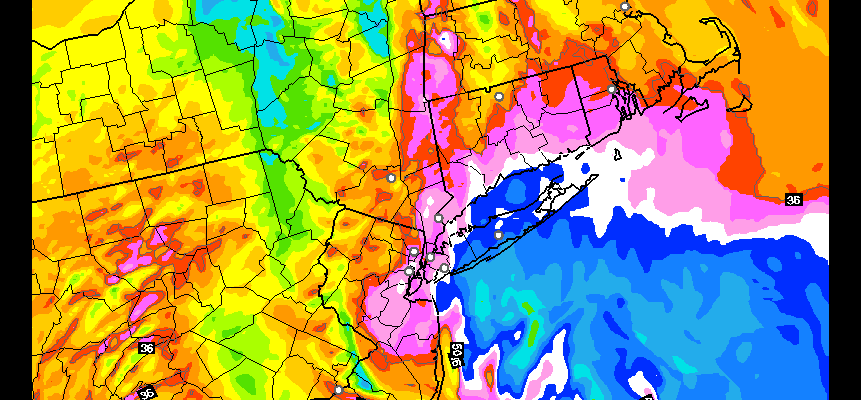
Now comes the wind. Winds will be rapidly increasing in the next few hours. Here is the HRRR model wind gust forecast for 10pm tonight. Fasten your seat belts.
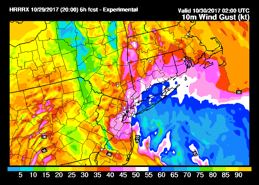
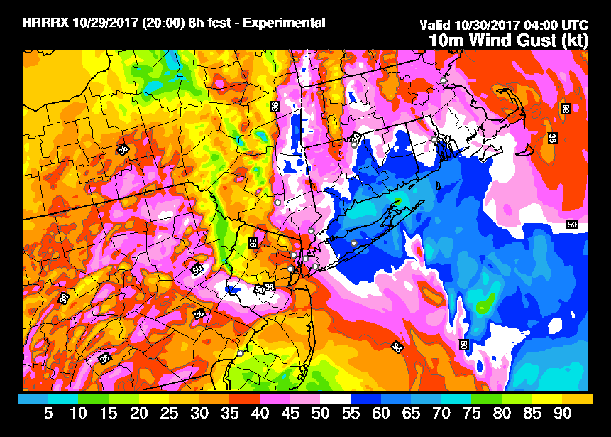
Here is the HRRR model wind gust forecast for Midnight tonight. Note that winds will gust past hurricane force on parts of Long Island.
 GET JOE A CIGAR IF YOU LIKE

FiOS1 News Weather Forecast For Long Island
FiOS1 News Weather Forecast For New Jersey
FiOS1 News Weather Forecast For Hudson Valley


