
Stormy Night Rain Wind Thunderstorms Severe Weather
Stormy Night Rain Wind Thunderstorms Severe Weather
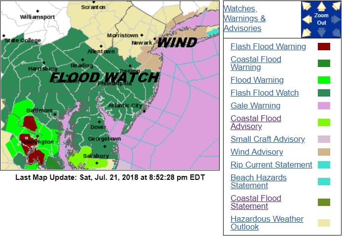
Tonight’s weather system is on course as low pressure moves north northwestward across Delaware and into Eastern Pennsylvania. Radars are loaded at the moment with rain and some heavy rain embedded in the mix. Flash Flood Watch is posted for Central and Southern New Jersey and much of the Eastern half of Pennsylvania. Wind Advisories are up for areas around NYC & the western half of Long Island, Coastal Connecticut and parts of Northeastern New Jersey.
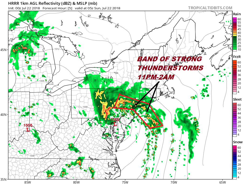
The next 4 to 6 hours will feature downpours of heavy rain, gusty winds along the New Jersey coast northeast to Western Long Island, and some possible severe thunderstorms. Those thunderstorms should sweep northward into the Northeastern New Jersey to NYC and Long Island between 11pm and 2am. The marginal risk for severe weather continues for the New Jersey Coast to Long Island and Coastal Connecticut.

The wide view regional radar shows the large area of rain. Watch the bands offshore now coming into view because that is the band that will produce the severe weather in a few hours. From this some coastal areas in New Jersey and Western Long Island could see some gusts to 50 mph or more. The time of fierce weather will be brief but forceful.


All of this will move to the north by daybreak and we should see some improvement on Sunday. However in the warm and humid conditions we will have on Sunday there will be some scattered downpours that will develop later in the day and there could be some on and off downpours around ins some places Sunday night and again during the day Monday.
FiOS1 News Weather Forecast For Long Island
FiOS1 News Weather Forecast For New Jersey
FiOS1 News Weather Forecast For Hudson Valley
NATIONAL WEATHER SERVICE SNOW FORECASTS
LATEST JOESTRADAMUS ON THE LONG RANGE


