Springlike Sunday Monday Showers Tuesday Minor Weather Systems This Week
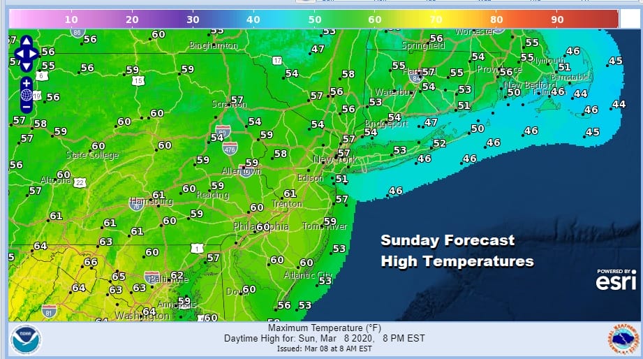
The chill in the air will disappear quickly today as we begin to warm things up. High pressure is off the Southeast Coast of the US and a west wind will be taking over today. That means we warm up. This time of year warm ups tend to outperform weather models as far as high temperatures are concerned. Forecast highs today will be in the mid 50s to near 60 but we could manage to take it a little higher especially away from the ocean. The satellite picture this morning shows mainly clear skies in most areas and we should have a good deal of sunshine. Nothing of consequence will be on the radar today or Monday.
SATELLITE

REGIONAL RADAR

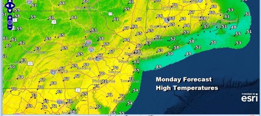
Tonight should be nice and clear and not as cold with most lows in the 30s except lower 40s in warmer urban areas. This sets up a solid launching pad for Monday. We have been arguing that temperatures could reach the upper 60s and lower 70s for the last several days provided we get enough sunshine and I think this will play out for a very nice, warm, springlike day.

Overnight weather models show no real change in how things play out this week. The first of three weather systems arrives on Tuesday with clouds and the chance for showers. Temperatures will be in the 60s. Rainfall amounts will be very light and generally under a tenth of an inch. In fact it is quite likely that much of the time Tuesday it won’t be raining.

These fast moving systems don’t have time to develop nor does the upper air favor them becoming anything of size. The next one comes through with a few showers or a period of rain Wednesday night into Thursday morning. Wednesday day side should be dry with clouds and some breaks of sun with highs in the 50s. Once showers move out Thursday morning we will see clouds and some breaks of sun with highs in the low to mid 50s. Then a third system brings a chance for showers late Thursday night into Friday with Friday’s highs in the 50s. That should be followed by a nice dry but chilly weekend.
BE SURE TO DOWNLOAD THE FREE METEOROLOGIST JOE CIOFFI WEATHER APP &
ANGRY BEN’S FREE WEATHER APP “THE ANGRY WEATHERMAN!
MANY THANKS TO TROPICAL TIDBITS FOR THE USE OF MAPS
Please note that with regards to any severe weather, tropical storms, or hurricanes, should a storm be threatening, please consult your local National Weather Service office or your local government officials about what action you should be taking to protect life and property.


