DOWNLOAD MY NEW FREE JOESTRADAMUS WEATHER APP FOR ALL DEVICES
THE APP IS ABSOLUTELY FREE TO ALL BUT CONSIDERING SUBSCRIBING TO PATREON FOR A WEATHER EXPERIENCE FREE OF ADS, EXCLUSIVE VIDEOS FOR MEMBERS ONLY AND MUCH MORE…STARTS AT $2 A MONTH..MESSAGE ME AT ANY TIME
Springlike Day Clouds Showers 60s Colder Dry Saint Patricks Day
We are waiting for the arrival of a cold front late today and we are seeing clouds and some showers on the radar. The showers this morning are whats left of a line of strong thunderstorms that moved across the Ohio Valley last night. The major storm from the Great Plains is in Canada now in a weaker version of its former self. The cold front from the low extends southward and we will see a couple of lines of showers with some clouds in between. Temperatures will head into the 60s but clouds and a south wind will have a say as to how high temperatures get today.
SATELLITE

REGIONAL RADAR

Checking the regional and local radars this morning we can see areas of showers moving northeastward though there is a large gap between showers near the coast and other showers out to the west. This is not an all day rain so there will be long dry stretches.
LOCAL RADAR NEW YORK CITY

LOCAL RADAR PHILADELPHIA


The last round of showers will move through this evening and then skies should clear out late tonight. Lows will be in the 30s to near 40. Saturday looks like a nice day with some sun and clouds with a gusty wind and highs in the 50s. Sunday Saint Patrick’s Day will be much colder with sunshine. Morning lows Sunday will be in the 20s to near 30 and highs Sunday will be just into the 40s.
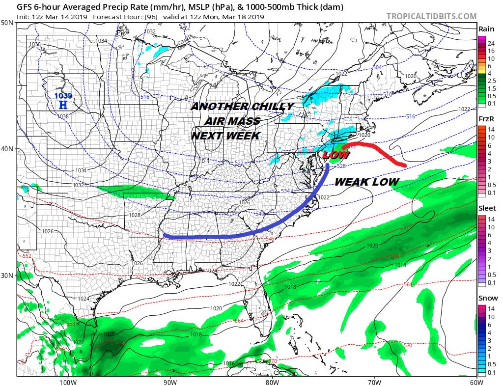
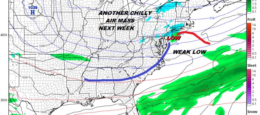
The pattern going forward looks dry for much and possibly all of next week. One weak system moves through late Sunday night early Monday morning. There could be a rain or snow shower with this system as it moves out and that is just about it. Otherwise Monday it will be clouds and some sun with highs just in the 40s. Much of next week will be chilly with another front late in the week that doesn’t have much with it. We may be in a position to string together the longest dry periods we have seen in months. Longer range as far as winter is concerned it would appear to me that it is over as far as snow is concerned and we are likely to finish the month on a warm note.
MANY THANKS TO TROPICAL TIDBITS FOR THE USE OF MAPS
Please note that with regards to any tropical storms or hurricanes, should a storm be threatening, please consult your local National Weather Service office or your local government officials about what action you should be taking to protect life and property.


