
DOWNLOAD MY NEW FREE JOESTRADAMUS WEATHER APP FOR ALL DEVICES
THE APP IS ABSOLUTELY FREE TO ALL BUT CONSIDERING SUBSCRIBING TO PATREON FOR A WEATHER EXPERIENCE FREE OF ADS, EXCLUSIVE VIDEOS FOR MEMBERS ONLY AND MUCH MORE…STARTS AT $2 A MONTH..MESSAGE ME AT ANY TIME
Saint Patricks Day Sunshine Cold Chilly Next Week
The weekend is almost upon us and with Saint Patricks Day on a Sunday this year it means two days of parades in various locations. Whether it is Saturday or Sunday the weekend is looking dry and nice though there will be some temperature differences between Saturday and Sunday. All of this is being driven by the powerful storm that continues to create chaos across the Northern Plains with blizzard conditions tapering off, heavy rains in the Great Lakes that will be changing to snow in some areas, and severe weather today from the Ohio Valley southward. The satellite loop shows the storm making northward progress thought it is past its peak intensity and it is beginning to slowly weaken. Severe weather is breaking out ahead of a cold front to the south and we have seen calm conditions with sunshine through high clouds today. There are no issues for us rain wise tonight into the first part of Friday.
SATELLITE

REGIONAL RADAR

Friday the front will approach but the storm will be weaker and well to the north in Eastern Canada so the amount of shower activity with the front should be rather limited. Once the cold front passes tomorrow evening weather conditions will improve. Friday’s highs will be in the 60s in many areas giving us a nice spring feel to the air though showers will dampen things a bit. Rainfall amounts look to be generally around a quarter of an inch or so.
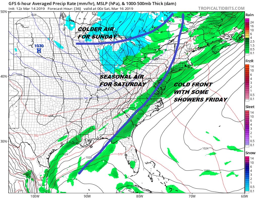
Saturday look for sunshine and some clouds with highs in the 50s. A second front will arrive with not much weather with it but will bring in colder air Saturday night. By Sunday morning lows will be in the 20s to near 30. Sunday looks sunny for most of the day with highs back into the 40s. It will be breezy on Saturday but we should have less wind on Sunday.
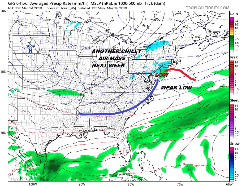
A very weak system from the Great Lakes will be dropping southeastward Sunday night into Monday morning. You can see on the map above this system is small and weak. It could bring a few rain or snow showers through the area early Monday morning. The upper air pattern is very weak and not supportive for any development. Chilly dry air comes back and that carries us through the first half of next week. Clouds will give way to some sunshine by Monday afternoon. Tuesday and Wednesday we will see some sunshine. High each day will be mostly in the 40s though by Wednesday we could be approaching 50.
MANY THANKS TO TROPICAL TIDBITS FOR THE USE OF MAPS
Please note that with regards to any tropical storms or hurricanes, should a storm be threatening, please consult your local National Weather Service office or your local government officials about what action you should be taking to protect life and property.


