Solar Eclipse Sunrise Thursday Cloud Cover Forecast Weekend Outlook

Weather in 5/Joe & Joe Weather Show Latest Podcast
Solar Eclipse Sunrise Thursday Cloud Cover Forecast Weekend Outlook
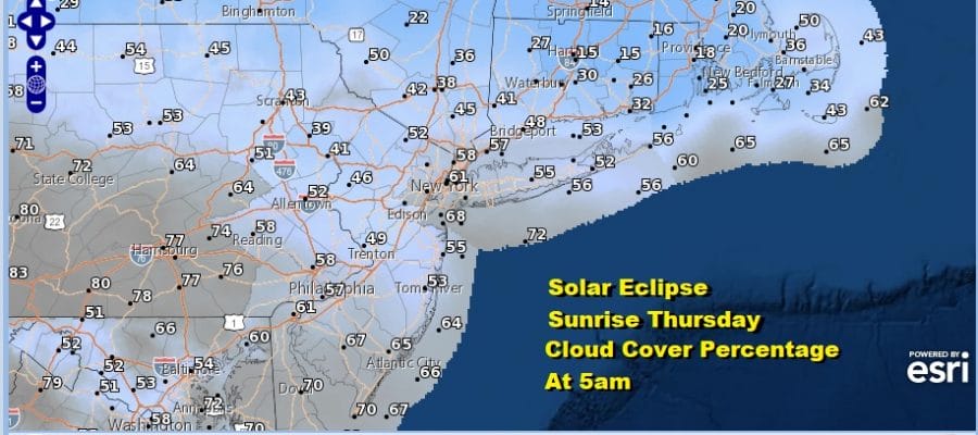
Thursday morning we have a solar eclipse of the sun that will be visible in our area. This is an annular eclipse which is not to be confused with annual. An annular eclipse is a partial eclipse of the moon covering the sun. At sunrise the sun appears large in the sky and with the moon partially covering it, the sun will rise as a large crescent. Add to that the morning haze and some patchy clouds and you could have a rather spectacular view of this event.
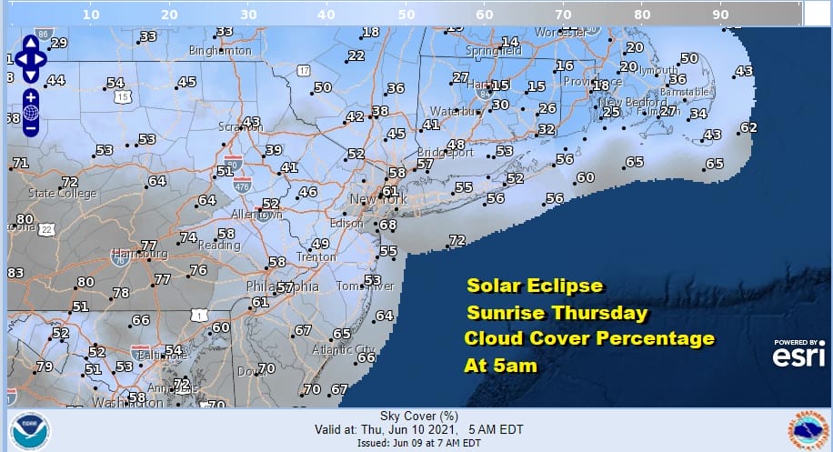
What we don’t want is an overcast sky. Dry air will be heading south tonight behind a weak cold front that will stall to the south. There will be some clouds with the front on either side but the percentage of cloud cover forecast is 50 percent or less north and east of Route 195 in New Jersey. Skies will be more clear to the northeast and more overcast to the southwest of this line. It is a broad border so obviously going to be some variation. Some areas inland are showing higher numbers of 70 to 80 percent sky cover due to both low and high clouds. New England, the Hudson Valley and possibly Long Island could have the best sky conditions to view this event.
SATELLITE

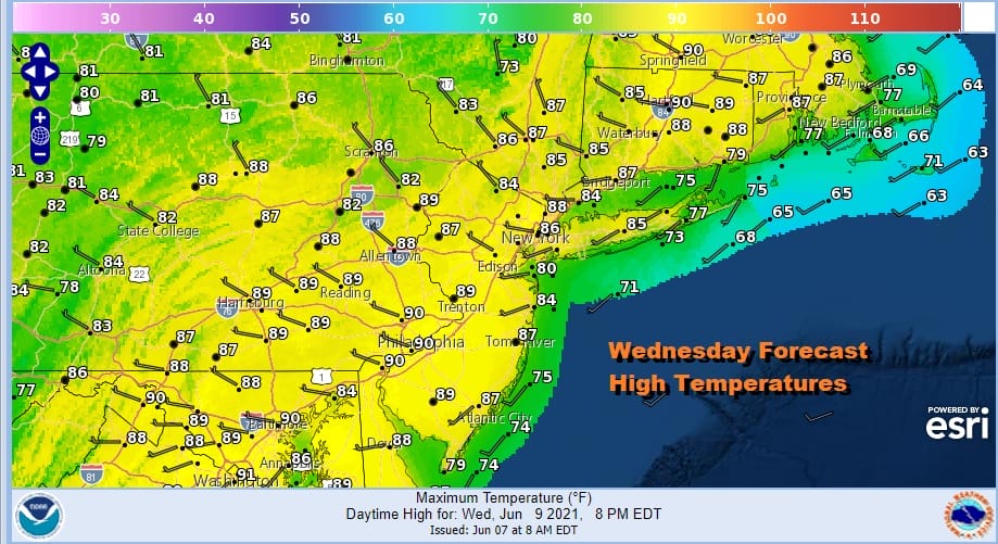
Ahead of the front today we have another hot humid day with high dew points in the lower 70s. This could be another juiced up atmosphere for scattered thunderstorms and some could be on the strong side. There even could be an isolated severe thunderstorm in the mix. Thunderstorms yesterday were widespread in the afternoon and evening. I don’t believe that they will be as widespread this time around. Highs this afternoon will be in the upper 80s to lower 90s as winds turn more to the west as the day wears on.
Once we get done with any thunderstorms look for leftover clouds tonight with some partial clearing of skies north of the frontal boundary. Lows will be in the 60s to near 70. Thursday will be a day of clouds and some sun. South of the frontal boundary it will be a more solid overcast and temperatures will reach into the 80s with humid conditions. while north of the boundary highs will be in the upper 70s to lower 80s with lower humidity and more sunshine.

The front does sink further south as the day wears on Thursday as a high builds off the New England coast. Rain is forecast to develop along the boundary during the afternoon Thursday but is rather far from us. One major change in the forecast is that the high is going to be successful in suppressing the rain further south into the Mid Atlantic states going forward.
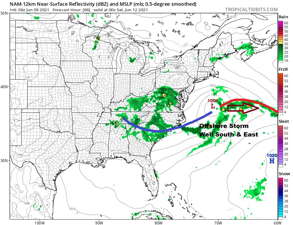
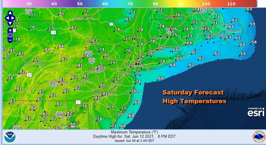
The developing low offshore on Friday will be well to the south and east and that low pulls cool dry air southward. Most of the area will see sunshine Friday with clouds possible from Southern Pennsylvania and Southern New Jersey southward. Highs will be in the 70s. The weekend is look ok for the most part. Saturday we will see some sunshine. Highs will be in the 70s to near 80 degrees.
Sunday a cold front will approach. It should be dry most of the day with a chance for some thunderstorms late in the day. Highs will be in the upper 70s to lower 80s. Another front arrives late Monday with a chance for showers and thunderstorms. Next week looks to be rather cool for this time of year as a strengthening jet stream from Canada brings upper air northwest winds as far south as Georgia. This will leave us in below normal temperatures along with low humidity for much of next week.

BE SURE TO DOWNLOAD THE FREE METEOROLOGIST JOE CIOFFI WEATHER APP &
ANGRY BEN’S FREE WEATHER APP “THE ANGRY WEATHERMAN!
MANY THANKS TO TROPICAL TIDBITS FOR THE USE OF MAPS
Please note that with regards to any severe weather, tropical storms, or hurricanes, should a storm be threatening, please consult your local National Weather Service office or your local government officials about what action you should be taking to protect life and property.


