Very Warm Humid Into Wednesday Scattered Thunderstorms
Solar Eclipse Weather Outlook

Weather in 5/Joe & Joe Weather Show Latest Podcast
Very Warm Humid Into Wednesday Scattered Thunderstorms Solar Eclipse Weather Outlook
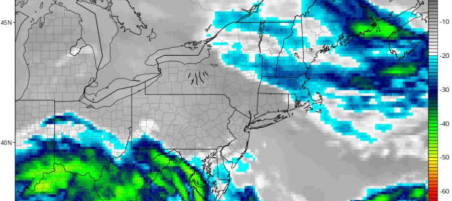
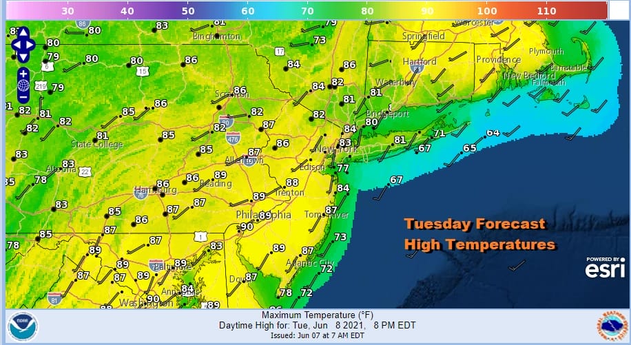
We do get a bit of a break today from yesterday’s scorching highs in the low to mid 90s away from the ocean. The break comes in the form of clouds which are already showing up on the satellite pictures. This will cut the amount of sun back today. However there will still be enough sun to boost temperatures to the 80s to near 90 degrees in some places. The wind is bending around to the southwest today vs south from yesterday and that helps to keep things very warm to borderline hot and it will definitely be humid.
SATELLITE

The clouds are from an upper air disturbance that sat over Texas for the last 10 days and is finally exiting that part of the country. It is only moving very slowly but it will finally get kicked away to the east on Wednesday thanks to a cold front heading south from Southeastern Canada. The result of all this moisture, high dew points, and instability will be thunderstorms scattered around this afternoon and evening with one or two stronger cells but no severe weather is forecast.
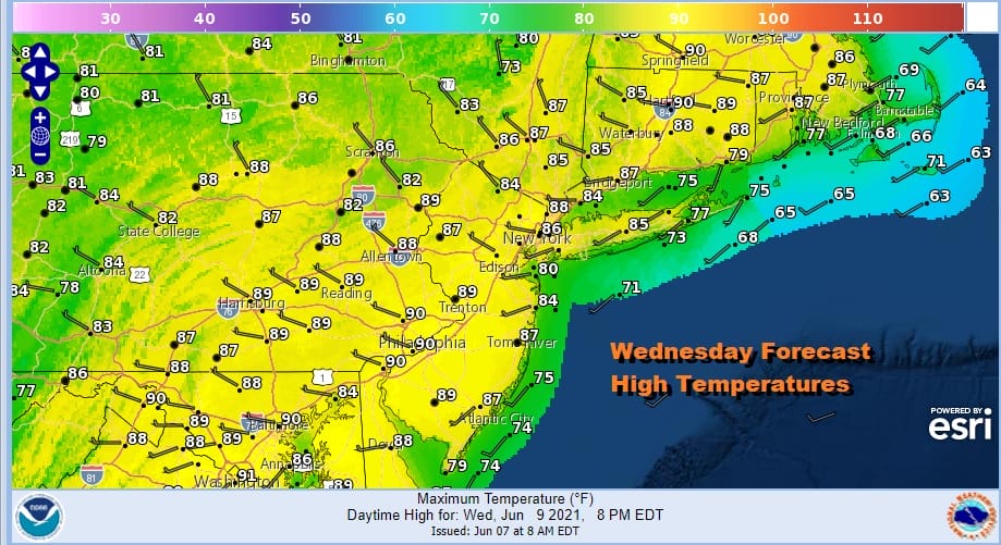
Wednesday brings that cold front we mentioned and another shot for a shower or thunderstorm as the front passes. Highs will be in the 80s to near 90. It will be another day of clouds and sun with high humidity.
Now we come to the all important part of the forecast which is sunrise Thursday when we will be potentially seeing a solar eclipse of the sun. It could be an interesting and potentially strange and spectacular show depending on the sky condition. It will be all about the cold front stalling to our south, probably somewhere across Southern New Jersey.
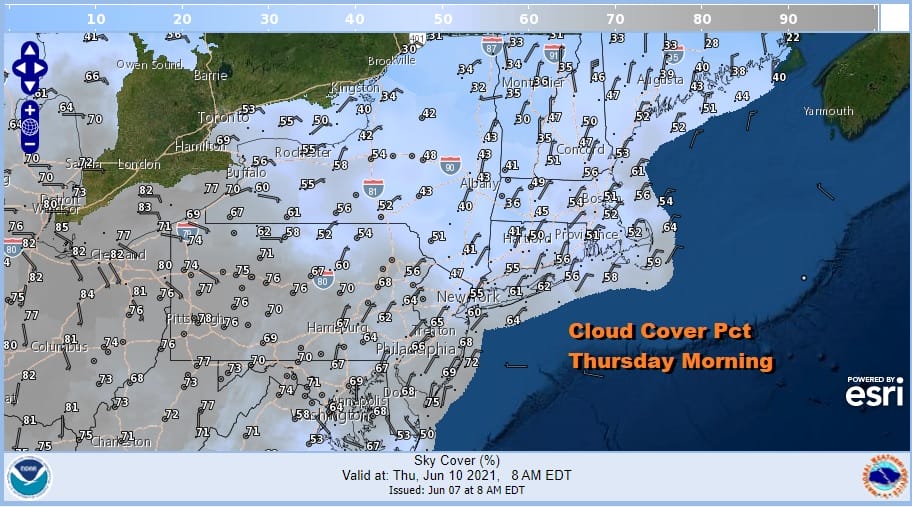
How much dry air gets in here is the question as well as how much clearing. It would seem that there should be enough to get some partial clearing of skies over New England and New York State and possibly Long Island but it will be a tougher sell for areas to the south and west of NYC where the frontal boundary lies. We are talking about a very short window for the first hour after sunrise.
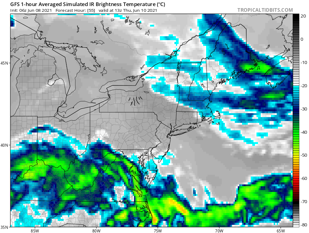
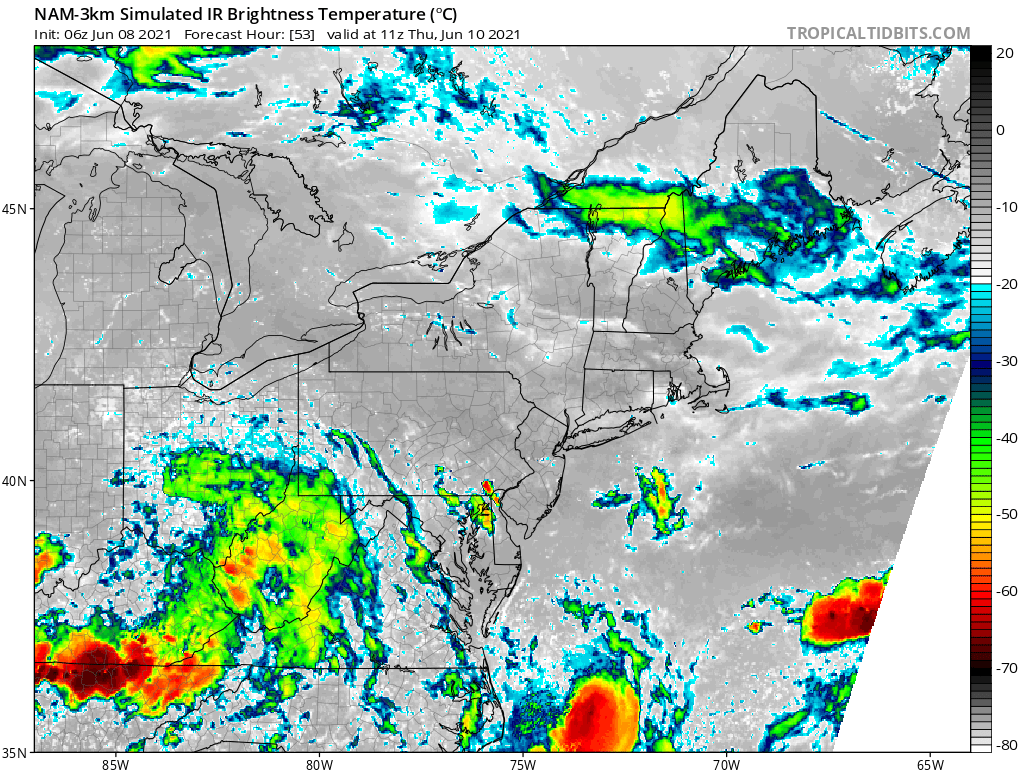
Both NAM and GFS models show a lack of high clouds Thursday morning which is a plus. Actually a little high cloudiness might not be a bad thing as it could create some distortion of colors in the sky. As far as low clouds are concerned which would be more problematic, it seems they are there at 2am but they disappear before sunrise.
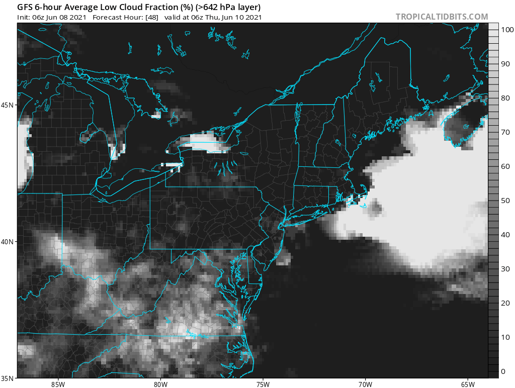
I’m going to stay optimistic for those of you north of the frontal boundary that the eastern sky will have fewer clouds. However the further south you go, the more problematic this will be.
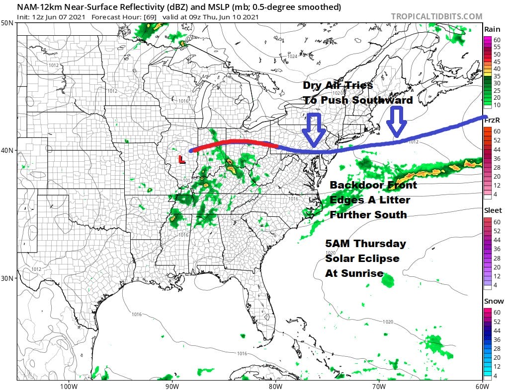
Thursday we see the front lying to the south and not doing much so look for clouds and some sun with highs in the upper 70s north and east of NYC to low and mid 80s southeast and southwest of Philadelphia.
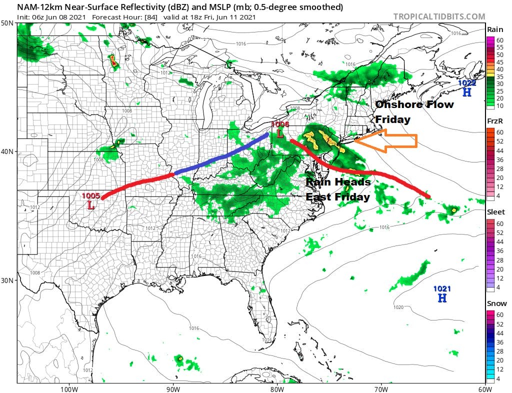
Friday low pressure heads east across the Ohio Valley and exits the coast Friday night east of Delmarva. This creates a east to southeast flow off the ocean and a good chance for rain. Now even though the flow is onshore, it is not coming around a cold high to the north but an ocean where water temperatures are in the 60s. Land temperatures Friday will be in the 60s as well and if you are near the coast it may feel a bit raw considering how warm we have been. The low moves away Saturday and we should see some improvement. It should turn warmer Sunday ahead of a cold front and there is the chance for a late day shower or thunderstorm as that front nears. Saturday highs will be in the mid to upper 70s and Sunday we should reach the upper 70s and lower 80s.

BE SURE TO DOWNLOAD THE FREE METEOROLOGIST JOE CIOFFI WEATHER APP &
ANGRY BEN’S FREE WEATHER APP “THE ANGRY WEATHERMAN!
MANY THANKS TO TROPICAL TIDBITS FOR THE USE OF MAPS
Please note that with regards to any severe weather, tropical storms, or hurricanes, should a storm be threatening, please consult your local National Weather Service office or your local government officials about what action you should be taking to protect life and property.


