
Snow Today Winter Weather Advisory Northeast PA, Northern NJ,
Hudson Valley Connecticut

Weather in 5/Joe & Joe Weather Show Latest Podcast
Snow Today Winter Weather Advisory Northeast PA, Northern NJ, Hudson Valley Connecticut
We have Winter Weather Advisories posted this morning for snow today. The advisories cover Northeast Pennsylvania, parts of Northern New Jersey, the Catskills, Hudson Valley, Connecticut north of 1-95 and Rhode Island, Winter Storm Warnings are posted for much of Massachusetts.
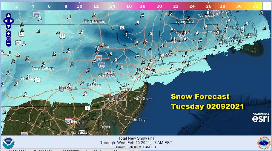
There isn’t much change in the forecast on the southern flank where there will be a sharp cut off to the snow but numbers have been pushed a little higher north and northeast of the coast. It looks like there could be at least several inches from Northeast Pa and the northwest corner of New Jersey to areas in NY State and New England north of Route 84.
SATELLITE

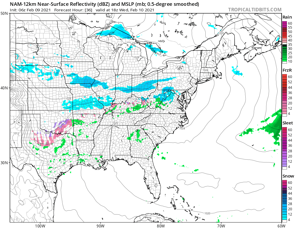
Snow is streaking eastward as is evident on the radars below. The band is narrow but it will expand some as we head into the afternoon. Much of the snow should be done by early after noon in areas from NYC and the Hudson River west and a bit later across New England. Highs will be in the 20s north of the coast where the snow falls and low to mid 30s to the south where there could be a little bit of rain.
F5 WEATHER RADARS


Once this system goes by our attention turns to the next weather system which will be coming out of the Southern Plains. This one will go south which means the snow accumulation zone will be different than today. First though weather conditions improve tonight and Wednesday should be dry with some sunshine and highs mostly in the 30s.
NYC seems to be the pivot point this week with today’s snow passing just to the north and Thursday’s snow just to the south. Wednesday night into Thursday, this could produce several inches across Central and South Jersey south into Southern Pennsylvania, Maryland, Delaware and Virginia. There is a chance this could nudge a little northward and we will keep an eye on this but the bulk of it this time will go south.

Also I think there is a chance we could see numbers go up in parts of Maryland south into Virginia. This low passes out to the south Thursday night and Friday and then our attention turns to a stronger storm system that will swing around from the Gulf States and head northeastward. Weather models are not handling this well at all regarding the evolution or the potential snow from this system. With two systems in front of us we will focus on those first before moving on to the weekend. The pattern overall remains cold and active in the medium and long range so there is more fun to come.
BE SURE TO DOWNLOAD THE FREE METEOROLOGIST JOE CIOFFI WEATHER APP &
ANGRY BEN’S FREE WEATHER APP “THE ANGRY WEATHERMAN!
MANY THANKS TO TROPICAL TIDBITS & F5 WEATHER FOR THE USE OF MAPS
Please note that with regards to any severe weather, tropical storms, or hurricanes, should a storm be threatening, please consult your local National Weather Service office or your local government officials about what action you should be taking to protect life and property.


