
Winter Weather Advisory Northeast PA, Parts of Northern NJ,
Hudson Valley, Connecticut

Weather in 5/Joe & Joe Weather Show Latest Podcast
Winter Weather Advisory Northeast PA, Parts of Northern NJ, Hudson Valley Connecticut
The next weather system is taking aim for parts of the Northeast on Tuesday. It is a small and relatively weak system and it should produce no more than a coating to at most several inches in some places north and west of the coast. It is also the kind of system that can surprise in 2 ways. The first being that locally some areas could get small surprise. The other is trying to figure out the southern extent of any kind of accumulating snow down to a coating to an inch.
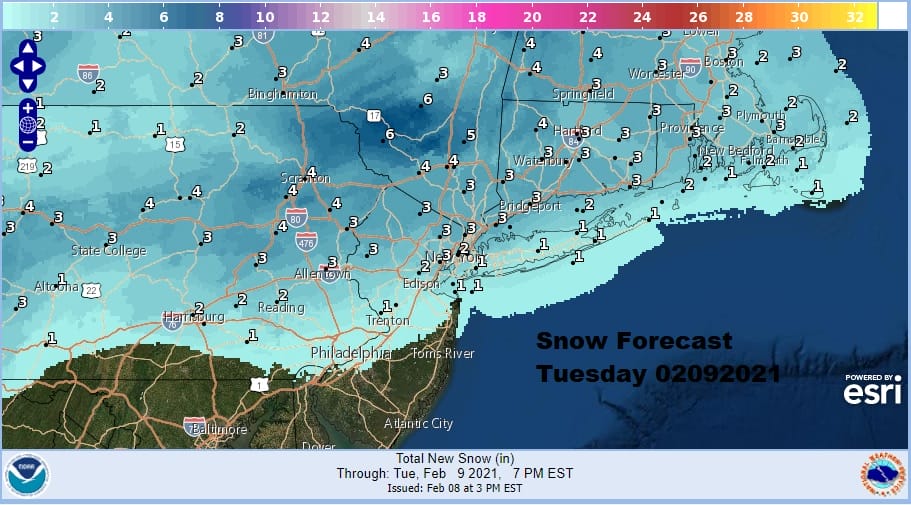
My thinking this morning was that the southern extent of the snow line would be along Route 78 in Pennsylvania and New Jersey. To the east Long Island is in a rather tricky location. It could briefly be cold enough for some snow as precipitation arrives tomorrow morning and then just go over to some light sleet or even rain for a short time before it ends. That area is one to watch closely in case we wind up a degree or two colder.
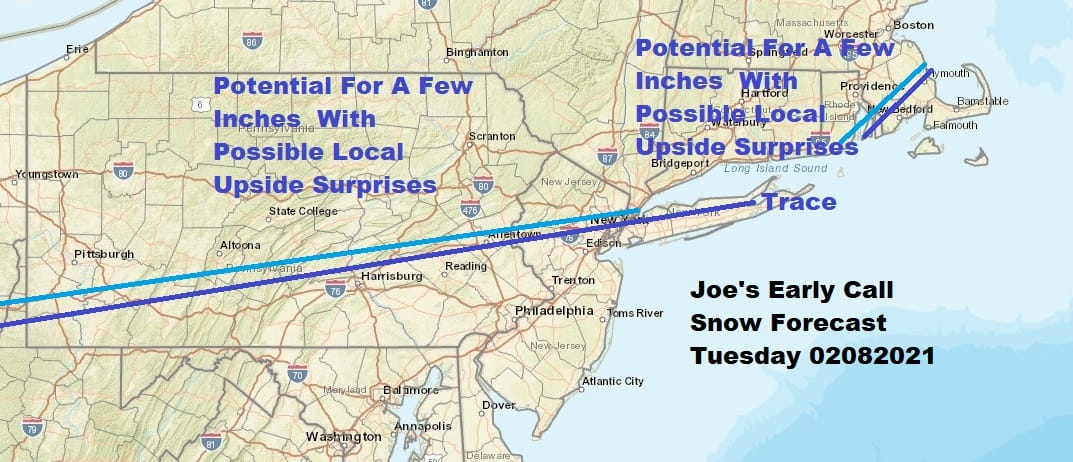
My early call snow forecast map is above and I didn’t see any reason to change this. Conflicting model ideas are in front of me at the moment but for now this seems a fair assessment of the situation at hand.
SATELLITE

It was a beautiful day for most areas from the standpoint of sunshine even though temperatures didn’t go anywhere. Many areas did not get out of the 20s. The radars are mostly quiet. A few echoes are showing up in parts of Pennsylvania as they run into the dry air and diminish at least for now.
F5 WEATHER RADARS


We may have partially clear skies for awhile tonight and lows will bottom probably in the teens to lower 20s in many areas and then they should level off as clouds increase. Snow will arrive in Northeastern Pennsylvania and Northwest New Jersey in the early morning hours and then reach Southern New England and Long Island around daybreak.

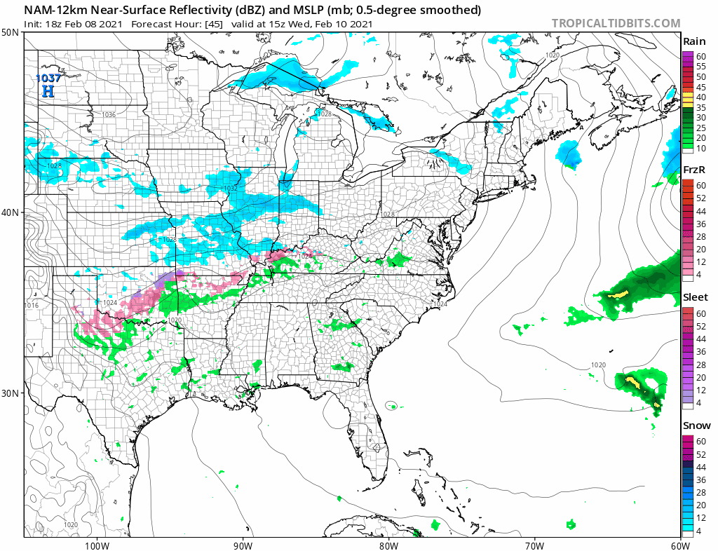
Even though the NAM model has the hot hand lately I used the HRRR model this afternoon as it shows the track from 1am to 6pm Tuesday. Once this is done we clear out and we should see some sunshine on Wednesday. Highs will be in the mid 20s in areas where it snows tomorrow and lower 30s along the coast. Wednesday will be colder again with highs just in the upper 20s and lower 30s.
Thursday’s system will be to the south rather than to the north and there are hints on some models that this will be suppressed to to the south, impacting areas from Virginia northward into Southern Pennsylvania and Southern New Jersey with little to the north of there. This could mean a break for a few days. The weekend is uncertain as again we have a lot of conflicting model outputs at the moment that cover a wide range from a snow and ice storm to little or nothing. We could be in one of those periods where models lose things only to bring them back later so we will hold off on a verdict on the weekend for another couple of days.
BE SURE TO DOWNLOAD THE FREE METEOROLOGIST JOE CIOFFI WEATHER APP &
ANGRY BEN’S FREE WEATHER APP “THE ANGRY WEATHERMAN!
MANY THANKS TO TROPICAL TIDBITS & F5 WEATHER FOR THE USE OF MAPS
Please note that with regards to any severe weather, tropical storms, or hurricanes, should a storm be threatening, please consult your local National Weather Service office or your local government officials about what action you should be taking to protect life and property.


