Snow Thursday NAM Model Analysis
Snow Thursday NAM Model Analysis
Tonight’s NAM model seems to be continuing the trend of prior runs as it takes a developing wave across the Ohio Valley and off the Delaware Coast. However tonight’s run continues the NAM trend of showing a slower more developed system as it approaches the Delaware Coast. In fact it takes the surface low east of New Jersey and South of Long Island by 1pm Thursday.
NAM MODEL UPDATE CLICK TO ANIMATE
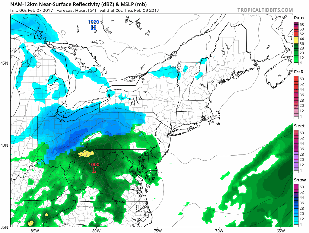
The NAM model would imply a large area of 6 inch plus snows from New Jersey RT 195 northward into the Hudson Valley and Southern New England, however I would caution that we need to see agreement from other models. The NAM holding course however lends more credence to its idea. The model shows a more “phased” look. It doesn’t mean its right but its consistency suggests we need to pay attention at this point.
JOES SNOW FORECAST MAP FOR THURSDAY 02092017 NO CHANGES

There are no changes in the forecast maps nor am I changing my snow fall forecast from earlier.

The maps below are the National Weather Service forecast snow maps with the most likely snowfall prediction.