
Snow Forecasts Thursday Freezing Rain Advisory
Freezing Rain Advisory This Morning NW New Jersey
Hudson Valley Connecticut North of RT 15
Latest National Weather Service Snow Forecasts for Thursday
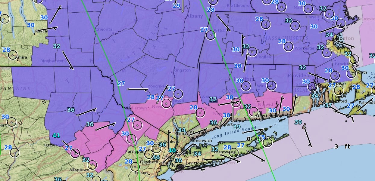
We have Freezing rain advisories for the Hudson Valley and Northwest New Jersey in the counties in pink while Winter Weather Advisories are posted for the counties in blue mainly north and west of Route 84. Rain is advancing on the radar this morning as what comes through during the morning commute will be hitting areas where temperatures are close to freezing so exercise caution. I do not expect this to be a major icing event as warmer air will change it all to rain as the day wears on. The rain will be mainly from Rt 78 in New Jersey northeastward into New England including NYC and Long Island. It will be of the on and off variety with the main shot between 11am and 6pm. Afterwards we could see another shower or two overnight as temperatures hold in the 40s to near 50.


The maps below are the National Weather Service forecast snow maps with the most likely snowfall prediction. Overnight weather models are leaning away from a major snowfall here as they take the system further south and east. Some models are still holding on to a deeper more northern track but they are becoming outsiders here as far as the forecast is concerned. At the moment we will wait until later today when the midday weather models confirm things one way or the other.
As for Wednesday it will be quite mild with some with some sunshine. Highs will be in the 50s to near 60. However it will begin to turn colder during the afternoon and temperatures will fall further Wednesday night into Thursday as low pressure develops to our south.


SNOW THURSDAY WEATHER MODEL ANALYSIS SHORT AND LONG RANGE


