
Snow Threats Next Week Anything or Nothing

Snow Threats Next Week Anything or Nothing
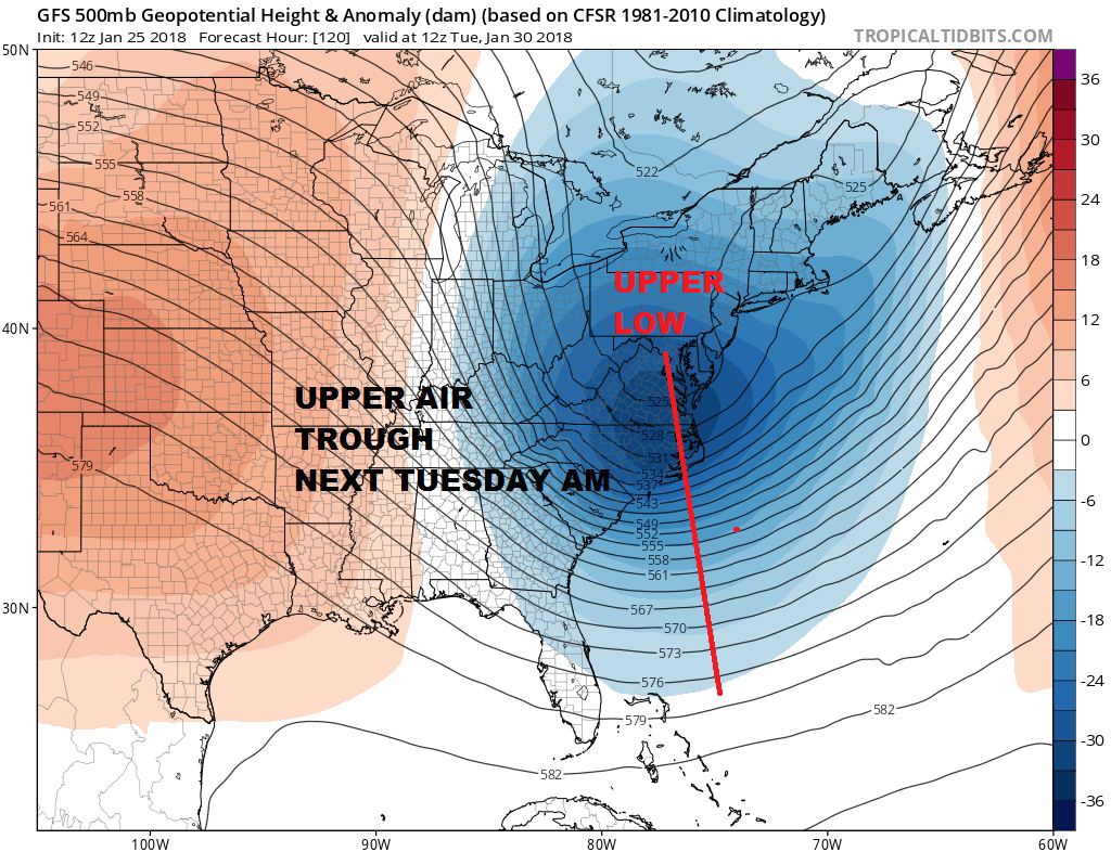
As if forecasting snow isn’t difficult enough we have two situations next week that bear some watching but they are the sorts of systems that are almost impossible to forecast especially the first one for Tuesday. We have a wave coming out of the Northeastern Gulf of Mexico that moves up the coast offshore. We will have rain showers on a frontal boundary Sunday as it moves through. That is a no brainer. Then we will watch the wave of low pressure develop as it moves northeastward. The low might skim the coast with some rain on Monday but will be primarily offshore. The snow comes from the upper air trough that is swinging around to the coast from the Great Lakes.
GFS MODEL FORECAST MONDAY INTO WEDNESDAY CLICK TO ANIMATE
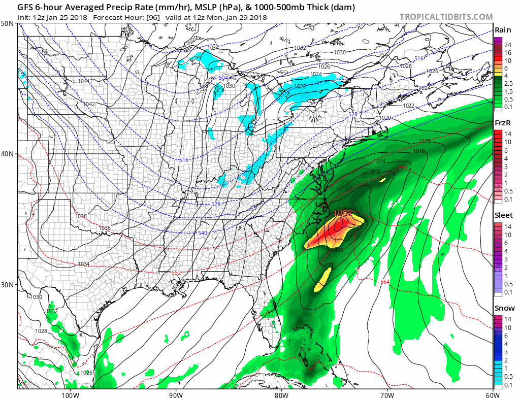
The cold air to support snow with the surface low is too far west to make snow. Unless the upper trough is stronger this should not be a worry. However once the upper trough swings around Snow will develop and swing into coastal areas. This is what is known as a Norlun trough.
Norlun Trough: An axis of shifting winds on the NW side of a low. They are known to bring very localized, very heavy bands of snow so that one town gets buried and the next is spared. These monsters are wicked fickle and are very hard to forecast.
The problem with norlun troughs is the last line of that definition…hard to forecast..in fact almost impossible to forecast. One series of model runs will show snow in one place and the next run another. Last night it was over Long Island and Southern New England. Today it is more focused over Central and South Jersey. One the European model it is focused from Southern New Jersey to the Delmarva Peninsula while the Canadian model has nothing.
The GFS has the most dynamic view of all the models with this system at the moment. We have plenty of time to watch this so to speculate on what if anything falls is a waste of time.
GFS FORECAST FRIDAY FEBRUARY 3, 2018

The second system is for the end of next week as another cold front with a wave on it approaches and moves through. The GFS has the most bullish view by bringing an arctic boundary through first and then developing a wave on it. This produces a moderate snowfall in a rain changing to snow situation. The European however has the opposite idea with the wave going by first before the cold air comes in which means the rain either ends as flurries or basically shuts off. At this point it is sort of a waste of energy trying to decipher which way this goes so we will just let it lay there for now.
SHOP THE JOESTRADAMUS STORE
MANY THANKS TO TROPICAL TIDBITS FOR THE WONDERFUL USE OF THE MAPS

GET JOE A CIGAR IF YOU LIKE!
FiOS1 News Weather Forecast For Long Island
FiOS1 News Weather Forecast For New Jersey
FiOS1 News Weather Forecast For Hudson Valley
NATIONAL WEATHER SERVICE SNOW FORECASTS
LATEST JOESTRADAMUS ON THE LONG RANGE
Weather App

Don’t be without Meteorologist Joe Cioffi’s weather app. It is really a meteorologist app because you get my forecasts and my analysis and not some automated computer generated forecast based on the GFS model. This is why your app forecast changes every 6 hours. It is model driven with no human input at all. It gives you an icon, a temperature and no insight whatsoever.
It is a complete weather app to suit your forecast needs. All the weather information you need is right on your phone. Android or I-phone, use it to keep track of all the latest weather information and forecasts. This weather app is also free of advertising so you don’t have to worry about security issues with your device. An accurate forecast and no worries that your device is being compromised.
Use it in conjunction with my website and my facebook and twitter and you have complete weather coverage of all the latest weather and the long range outlook. The website has been redone and upgraded. Its easy to use and everything is archived so you can see how well Joe does or doesn’t do when it comes to forecasts and outlooks.
Just click on the google play button or the apple store button on the sidebar for my app which is on My Weather Concierge. Download the app for free. Subscribe to my forecasts on an ad free environment for just 99 cents a month.
Get my forecasts in the palm of your hand for less than the cost of a cup of Joe!