Snow Threat Increases Interior Northeast
Snow Threat Increases Interior Northeast
Today’s weather models continue to point to a snow threat for the interior Northeast for this weekend, specifically later Saturday night and lasting into Monday as low pressure develops over the northeast. The European Model and the Canadian Model are the most robust because of how they handle the upper low that is going to strengthen along the coast. Both weather models are much deeper and further south than the GFS model.
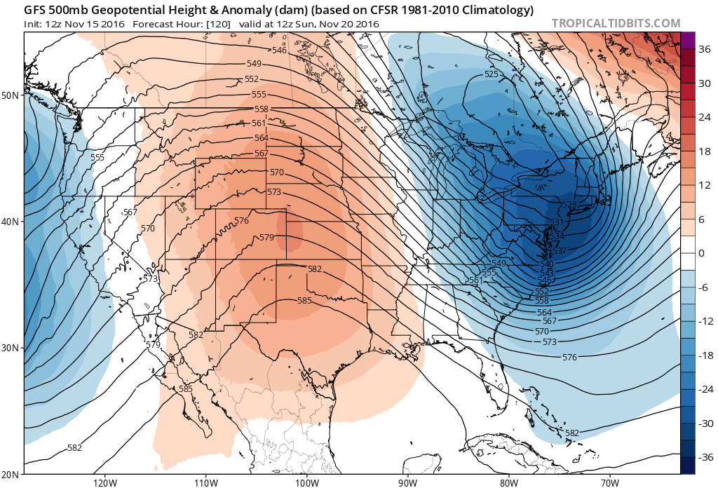
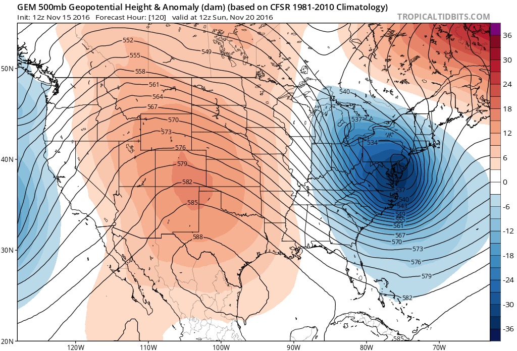
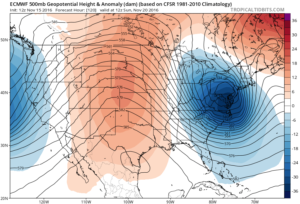
The three models above show the position of the very strong and very cold upper air system in the east. The GFS is the weakest and basically treats this as a cold front with a deepening low over Southeastern Canada. The other two models take the upper low much further south and much more intense. If the European and the Canadian models are correct we will have a surface low developing overhead. This could create some hefty snows for places like the western half of Pennsylvania, Western NY with a very active lake effect machine going to work.
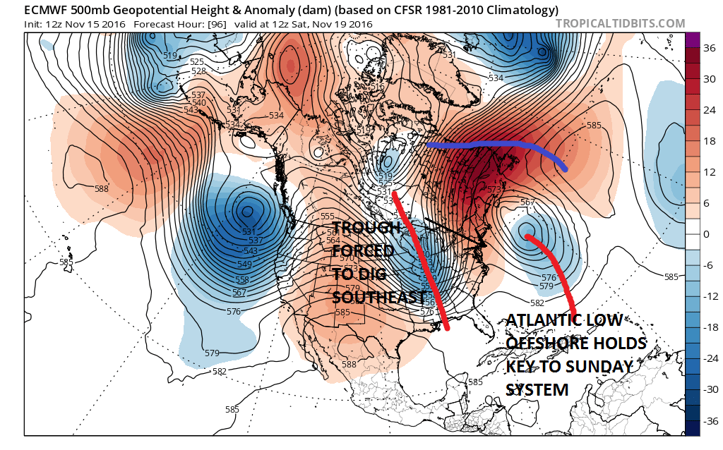 The key to the weekend event lies in the low that has moved through today as that upper feature cuts off in the Atlantic. A stronger low to the east will force the next trough to dig southeast toward our coastline, rather than the GFS idea of basically moving it straight across to the east. Either way it gets cold here beginning Saturday night and lasting through next week as the strong blocking pattern and crashing North Atlantic Oscillation index take complete control of the weather pattern going forward. This may open the door for a chance for precipitation late next week. The developing blocking pattern is going to make models very unstable going forward so look for wild swings in outlooks from model run to model run.
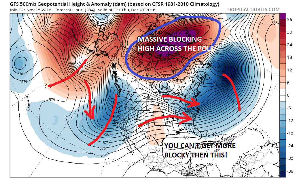 With regards to the longer term in general, I’m showing you the GFS upper at day 16 which is December 1st. If this even comes close to verifying, it would illustrate a dominate blocking pattern we have not seen probably since 2010-2011. Upper air indicators which first suggested this blocking and pattern change developing back at the beginning of November continue to point to the pattern continuing at least into Early December and possibly beyond that. Something like this would suggest opportunities for early cold and snow changes going forward.
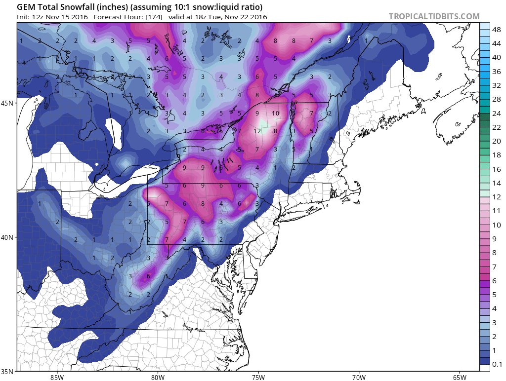

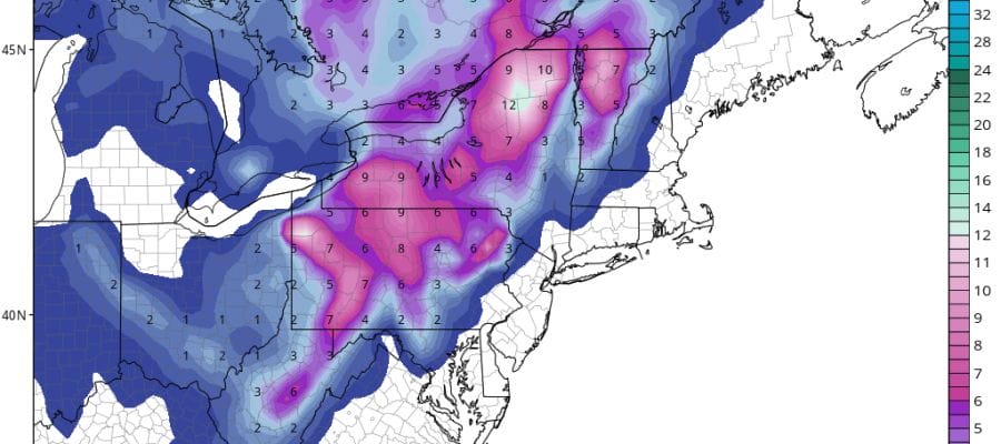
Back to this weekend you can see the GFS and Canadian snowfall forecast maps above. The European snowfall map can’t be shown however if you take the Canadian map and double the snow amounts.
MANY THANKS TO TROPICAL TIDBITS FOR THE WONDERFUL USE OF THE MAPS
SNOW REMOVAL COMPANIES FOR YOUR WINTER NEEDS
LONG ISLAND ROCKLAND COUNTY Connecticut

![]()


WINTER 2016-2017 PART 1 OCEAN WATER TEMPERATURES
WINTER 2016-2017 PART 2 ARCTIC SEA ICE AND SIBERIAN SNOW COVER
FiOS1 News Weather Forecast For Long Island
FiOS1 News Weather Forecast For New Jersey
FiOS1 News Weather Forecast For Hudson Valley
NATIONAL WEATHER SERVICE SNOW FORECASTS
LATEST JOESTRADAMUS ON THE LONG RANGE
Weather App

Don’t be without Meteorologist Joe Cioffi’s weather app. It is really a meteorologist app because you get my forecasts and my analysis and not some automated computer generated forecast based on the GFS model. This is why your app forecast changes every 6 hours. It is model driven with no human input at all. It gives you an icon, a temperature and no insight whatsoever.
It is a complete weather app to suit your forecast needs. All the weather information you need is right on your phone. Android or I-phone, use it to keep track of all the latest weather information and forecasts. This weather app is also free of advertising so you don’t have to worry about security issues with your device. An accurate forecast and no worries that your device is being compromised.
Use it in conjunction with my website and my facebook and twitter and you have complete weather coverage of all the latest weather and the long range outlook. The website has been redone and upgraded. Its easy to use and everything is archived so you can see how well Joe does or doesn’t do when it comes to forecasts and outlooks.
Just click on the google play button or the apple store button on the sidebar for my app which is on My Weather Concierge. Download the app for free. Subscribe to my forecasts on an ad free environment for just 99 cents a month.
Get my forecasts in the palm of your hand for less than the cost of a cup of Joe!
![]()
