DOWNLOAD MY NEW FREE JOESTRADAMUS WEATHER APP FOR ANDROID
THE APP IS ABSOLUTELY FREE TO ALL BUT CONSIDERING SUBSCRIBING TO PATREON FOR A WEATHER EXPERIENCE FREE OF ADS, EXCLUSIVE VIDEOS FOR MEMBERS ONLY AND MUCH MORE…STARTS AT $2 A MONTH..MESSAGE ME AT ANY TIME
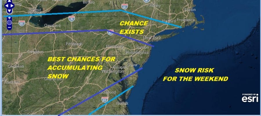
Snow Threat Grows Mid Atlantic States
Chance For Coastal New Jersey Southern New England
We draw a day closer to the chance for snow this weekend and I think we can say that the threat for accumulating snow for the Middle Atlantic States is increasing. This would include areas from Southern Pennsylvania and Southern New Jersey southward. To the north we see the chance for some snow is on the table but the question of where we are talking a cheap thrill or something more than that is still in the land of uncertainty.

The problem is from the standpoint of getting more specific we are still in the throws of uncertainty thanks to a complex split flow jet stream and the strength of each part of this split flow. The northern jet has to get out of the way for the best chance area to get into accumulating snow. The area in the best chance for accumulating snow looks to be far enough south to get into some of the heavier accumulating snow from this system
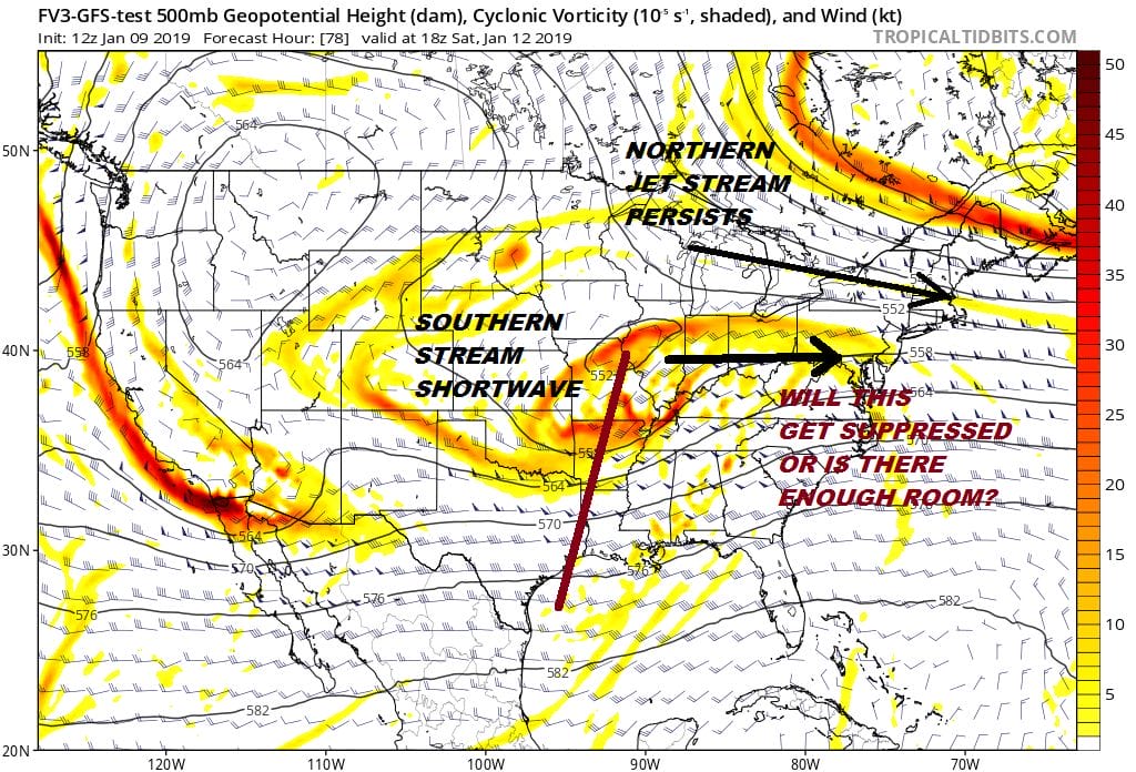
Today’s model runs did open up a bit more room suggesting that the northern jet could ease just enough to allow the northern fringe of snow to move further north but there is disagreement here as always. The European model has come somewhat further north today with its precipitation shield and brings a couple of inches of snow to as far north as NYC, Northern New Jersey and Southern New England with higher amounts of several inches over Central & South Jersey, Southern Pennsylvania to Delaware south and west into Virginia (except the southeast). It is early in the game to talk specific amounts but I think it is soon enough to provide a broad brush view of what exactly we are dealing with here.
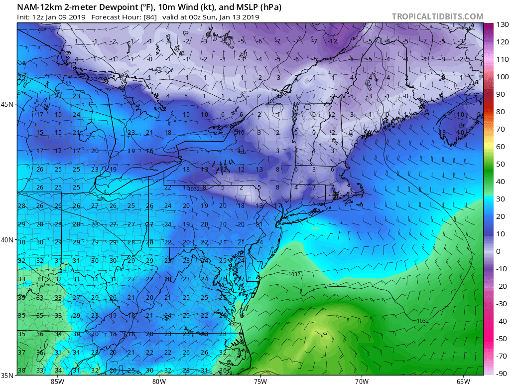
One very important factor her to consider is the amount of cold dry air that we will be sitting in Friday night into Saturday morning . We are talking arctic tundra dry with dew points in the single digits to below zero. Notice where those low dew points lie. They are across Northeastern Pennsylvania into the Hudson Valley and Connecticut along and north of Route 84. This suggests to me that this could be the northern wall of snow with the dry air so abundant here that any snow that reaches this area on the radar would have a tough time reaching the ground if at all. From NYC & Long Island southward the low level atmosphere is a bit more moist and that will likely be due to a northeast wind off the ocean saturating the air somewhat. The amount of dry air to the north is a function of the southern extent of the northern jet stream and will be a strong factor in cutting snow amounts down to a minimum in areas to the north of the immediate coast. This will be an important factor to watch. These things are never simple.
MANY THANKS TO TROPICAL TIDBITS FOR THE USE OF MAPS
Please note that with regards to any tropical storms or hurricanes, should a storm be threatening, please consult your local National Weather Service office or your local government officials about what action you should be taking to protect life and property.