Snow Storm Thursday Off The Table

Snow Storm Thursday Off The Table
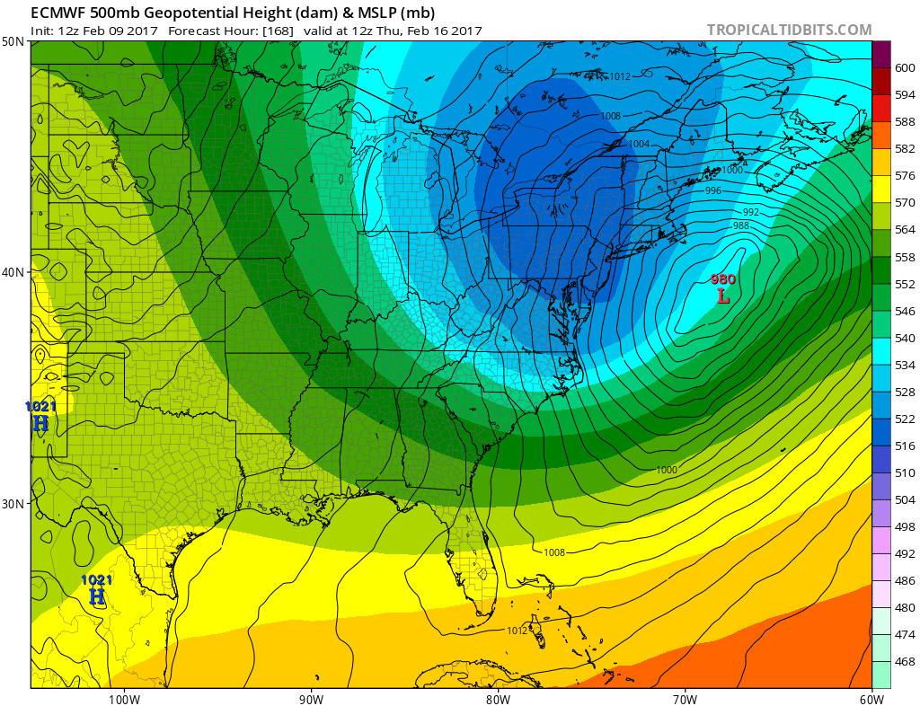
Since the chatter about Thursday and the possibility of another storm I thought this would be a good time to explain why Thursday’s storm is likely NOT TO HAPPEN. This all began a few days ago when the European model spat up a major storm south of Long Island and east of the New Jersey coast.
SNOW STORM OFF THE TABLE EUROPEAN RUN FROM TUESDAY AFTERNOON
This map is from the European model run from last Thursday afternoon. What has changed since Thursday? Well to see that we need to look at the upper air structure that was being forecast by this model.
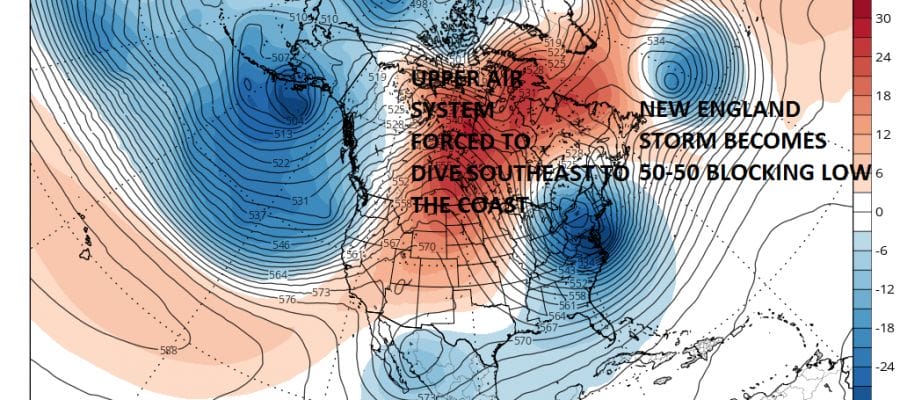
SNOW STORM OFF THE TABLE EUROPEAN UPPER AIR FORECAST FOR THURSDAY FROM LAST TUESDAY’S MODEL RUN
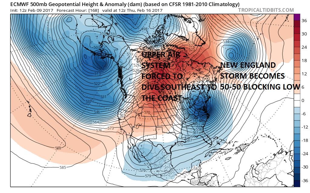
There are three main ingredients at play. The first and probably most important ingredient involves the major storm that is going to develop Monday off the coast of New England. It moves east out to 50 degrees North 50 Degrees West. That in combination with the blocking ridge to the northeast of that storm creates a chain reaction forcing the strong upper air system in the Great Lakes to dig southward and develop a storm just off the east coast. This major storm that forms Monday needs to hold position to the east to allow the Great Lakes energy to dig south. The third is a system in the southwest that needs to move east faster than forecast to get involved with all this.
SNOW STORM OFF THE TABLE TODAY’S EUROPEAN MODEL RUN FOR THURSDAY
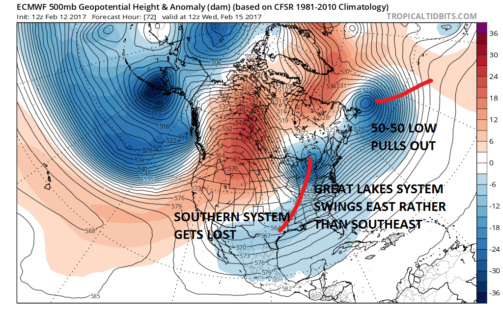
What appears to be happening is that the 50-50 pulls out to the northeast which opens the door for the Great Lakes system to move further east rather than dig southeast from the Great Lakes. The southern system basically gets absorbed by the north. The result is a surface that looks like the map below.
EUROPEAN MODEL FOR THURSDAY
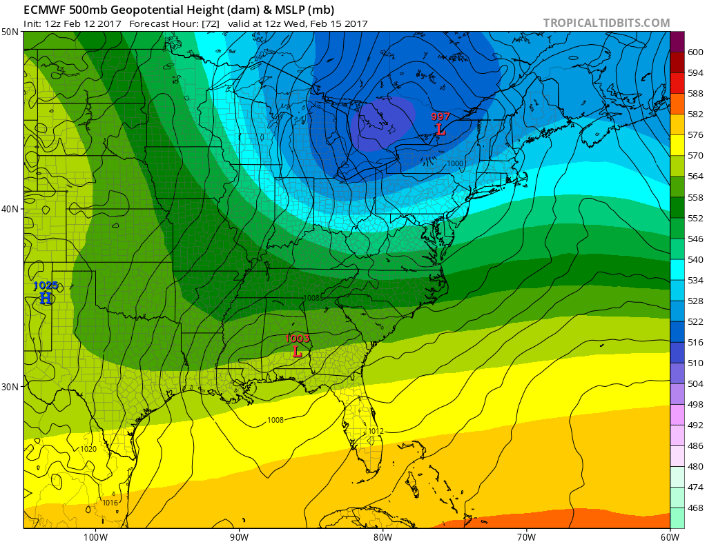
In order for Thursday’s storm to occur you would need the 50-50 low in the Atlantic to hold, the Great Lakes trough to dig fiercely southeast, and the system in the southern portion of the jet stream to move east much faster than currently forecast. The European’s look here and the other models are similar would basically amount to a cold front moving through and nothing else. For the model to be wrong on all three of these features seems like a very long long shot.
CANADIAN MODEL RUN FOR THURSDAY CLICK TO ANIMATE
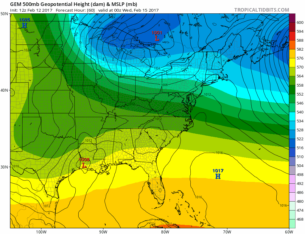
The only model that makes it remotely close is the Canadian model which wants to try to dig the upper trough further west. follow the dark blue colors and you can see where the trough in the east winds up. You would need it to be even further west for this to be anything other than another storm for Eastern New England.
SNOW STORM OFF THE TABLE FOR THURSDAY VIDEO ANALYSIS OF THE LONG RANGE
MANY THANKS TO TROPICAL TIDBITS FOR THE WONDERFUL USE OF THE MAPS
GET JOE A CIGAR IF YOU LIKE!

SNOW REMOVAL COMPANIES FOR YOUR WINTER NEEDS
LONG ISLAND ROCKLAND COUNTY Connecticut

![]()

ROCKLAND COUNTY TRI STATE SNOW REMOVAL JOHNSTOWN PA


FiOS1 News Weather Forecast For Long Island
FiOS1 News Weather Forecast For New Jersey
FiOS1 News Weather Forecast For Hudson Valley
NATIONAL WEATHER SERVICE SNOW FORECASTS
LATEST JOESTRADAMUS ON THE LONG RANGE
Weather App

Don’t be without Meteorologist Joe Cioffi’s weather app. It is really a meteorologist app because you get my forecasts and my analysis and not some automated computer generated forecast based on the GFS model. This is why your app forecast changes every 6 hours. It is model driven with no human input at all. It gives you an icon, a temperature and no insight whatsoever.
It is a complete weather app to suit your forecast needs. All the weather information you need is right on your phone. Android or I-phone, use it to keep track of all the latest weather information and forecasts. This weather app is also free of advertising so you don’t have to worry about security issues with your device. An accurate forecast and no worries that your device is being compromised.
Use it in conjunction with my website and my facebook and twitter and you have complete weather coverage of all the latest weather and the long range outlook. The website has been redone and upgraded. Its easy to use and everything is archived so you can see how well Joe does or doesn’t do when it comes to forecasts and outlooks.
Just click on the google play button or the apple store button on the sidebar for my app which is on My Weather Concierge. Download the app for free. Subscribe to my forecasts on an ad free environment for just 99 cents a month.
Get my forecasts in the palm of your hand for less than the cost of a cup of Joe!
![]()
