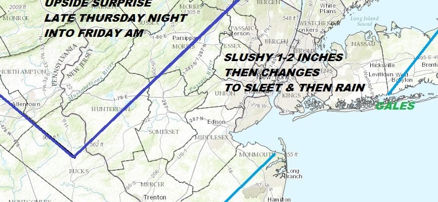
COLD NIGHT AHEAD SNOW SLEET ARRIVE THURSDAY
SNOW CHANGES TO SLEET & FREEZING RAIN INLAND, RAIN AT THE COAST
CHANCE FOR UPSIDE SURPRISE EARLY FRIDAY AM NORTHWEST NJ, HUDSON VALLEY

This is a very complex forecast due to the fact that we have a surge of precipitation moving northward Thursday into the cold air. Snow will be developing during Thursday and we think that the forecast from yesterday still holds overall but there are some changes today that lead me to think there could be an upside surprise in parts of NW New Jersey, the Hudson Valley, and in Connecticut north of Route 84.
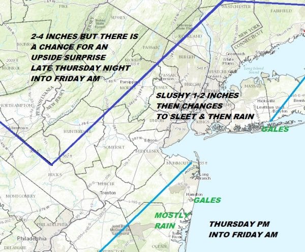
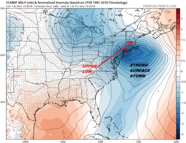
The issue is that we have a strong surface low that will be just east of the New Jersey coast. For areas along the coast it will be gales with a change to rain. Rain heavy at times will fall Thursday night into Friday morning. However this is complicated by a vigorous upper air low that is going to be moving northeast from Eastern Kentucky to Northwest New Jersey by Friday morning as well. This could create a zone of strong lift in the atmosphere and what we call dynamic cooling where the atmosphere basically cools from the top down. The European is very aggressive with this and would argue for a prolonged period of sleet and freezing rain in the area inside the dark blue lines (roughly). Other models show this idea but not as aggressive. It would seem to me that elevation could drive this part of the event and we will monitor this very closely.
High clouds to the south have been close by all day and they should still be around tonight though they may sink southward somewhat this evening and through the first part of tonight only to come back northward late tonight and thicken up Thursday morning.
EASTERN SATELLITE

REGIONAL RADAR

Snow develops Thursday from south to north arriving in Southern Pennsylvania to Route 78 between 9 and noon and then north and east of there after lunch time. There will be a burst of heavy precip going into the evening. The coast changes to rain while areas just inland could see a prolonged period of sleet and freezing rain into Thursday night.
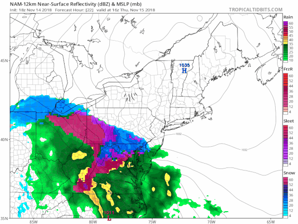
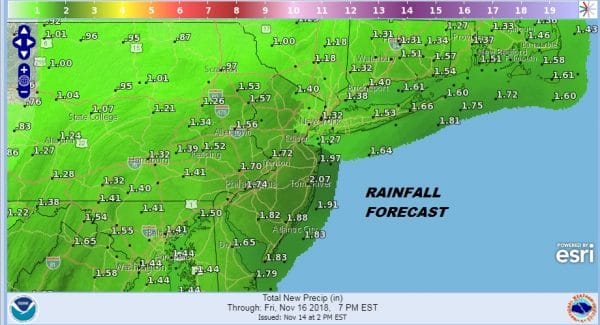
The new NAM is rather consistent with the prior runs with this gif showing the motion from 11am to 6pm Thursday. The evening commute Thursday will be difficult especially where we have a burst of heavy snow and sleet falling. Total liquid amounts of precip will be in the 1 to 2 inch range in many places.
All the coast it could get wind with gales along the immediate coast. Weather conditions will improve later Friday morning into the afternoon as the system moves out to the northeast.
SUBSCRIBE TO PATREON FOR A WEATHER EXPERIENCE FREE OF ADS, EXCLUSIVE VIDEOS FOR MEMBERS ONLY AND MUCH MORE…STARTS AT $2 A MONTH..MESSAGE ME AT ANY TIME

MANY THANKS TO TROPICAL TIDBITS FOR THE USE OF MAPS
Please note that with regards to any tropical storms or hurricanes, should a storm be threatening, please consult your local National Weather Service office or your local government officials about what action you should be taking to protect life and property.
LATEST JOESTRADAMUS ON THE LONG RANGE

