Snow Showers Around Tonight And Monday Night, Mostly Cold Week Ahead,
Late Week Storm Chance Not Very High

Weather in 5/Joe & Joe Weather Show Latest Podcast
Snow Showers Around Tonight And Monday Night, Mostly Cold Week Ahead,
Late Week Storm Chance Not Very High
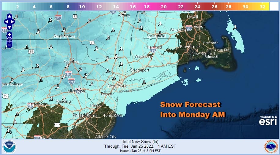
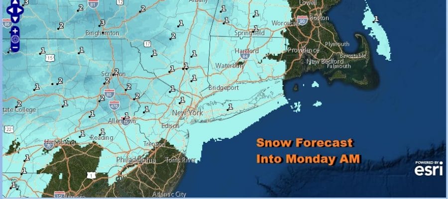
There is no real change in the outlook from earlier today. We have a cold front approaching and it will move through overnight. Ahead of it an area of mostly light snow showers cover Pennsylvania and have moved into New Jersey and will likely continue to move eastward. Most of what we are seeing on the regional radar is aloft, that is it evaporates before reaching the ground but some snow showers in the green echoes are reaching the ground. This is a coating to maybe a half inch in some places. Some places may not see a flake. The National Weather Service has added the coast in the area getting snow showers and may a coating of snow or a bit more (or less). This is a minor system and there really is no upside to this.
SATELLITE

WEATHER RADAR

We could see these patchy snow showers linger into the early morning hours, otherwise once the front goes by temperatures will ease with most lows in the low 20s warmer urban areas and coast and some teens inland. Monday we will be on the cloudy side. Perhaps some sun could break through the clouds for a few hours before coming back in ahead of a warm front. Again we could see some snow showers late in the day or Monday night. Temperatures Monday will be in the 20s to near 30 and probably hold around those levels Monday night.
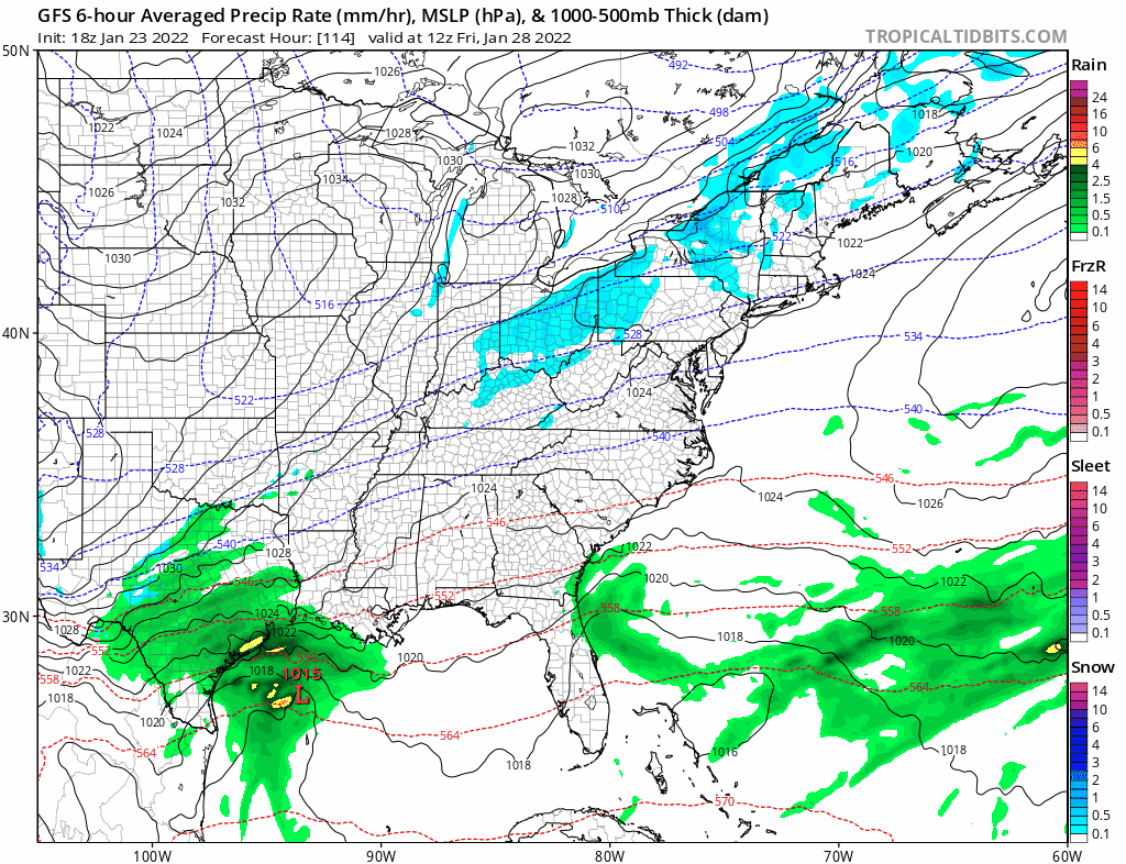
Tuesday will be the one day this week where temperatures will be near average for this time of year. Some sun is possible through some clouds. Weather models are showing an arctic front coming in and moving through Tuesday evening but there isn’t much for this front to work on. We will throw in the chance for an isolated rain shower at the coast and a rain or snow shower inland. Highs will be in the upper 30s and lower 40s. Much colder weather takes over Wednesday into Friday with highs Wednesday and Thursday in the 20s and lows Wednesday night in the single digits and low teens. It should be mainly sunny Wednesday and for at least part of Thursday. Friday yet another in these endless arctic fronts approaches from the northwest. To the south we have low pressure developing off the southeast coast and heading northeast. On the latest GFS run, and this makes 4 runs in a row, we have an offshore track because the upper flow is going to be more west to east than north to south. We are still about 144 hours away and while there could be some changes, it seems the models are starting to zero in on the idea of an all offshore track. We will assess again on Monday. There are still some models like the Canadian that have a more robust storm close to the coast but they remain the outliers at this point. A significant pattern change shows up in the long range during the first week of February and the new pattern could hang around for a bit. More on this Monday.
BE SURE TO DOWNLOAD THE FREE METEOROLOGIST JOE CIOFFI WEATHER APP &
ANGRY BEN’S FREE WEATHER APP “THE ANGRY WEATHERMAN!

MANY THANKS TO TROPICAL TIDBITS & F5 WEATHER FOR THE USE OF MAPS
Please note that with regards to any severe weather, tropical storms, or hurricanes, should a storm be threatening, please consult your local National Weather Service office or your local government officials about what action you should be taking to protect life and property.


