Another Chance for Snow Showers Tonight, Colder Mid & Late Week
Watching Storm Offshore Late Week

Weather in 5/Joe & Joe Weather Show Latest Podcast
Another Chance for Snow Showers Tonight, Colder Mid & Late Week
Watching Storm Offshore Late Week

The new week is here and looking at what is going today, it appears that it is going to be a rather interesting one, particularly toward the end of the week. More on that later but meanwhile we had some snow showers last night. Today we have a cold shot of air that is moving in but it will also be moving out rather quickly as a warm front is approaching from the Great Lakes. Today we will see some sun through the clouds and then more clouds later in the day. Highs will reach into the low and middle 30s.
SATELLITE

WEATHER RADAR

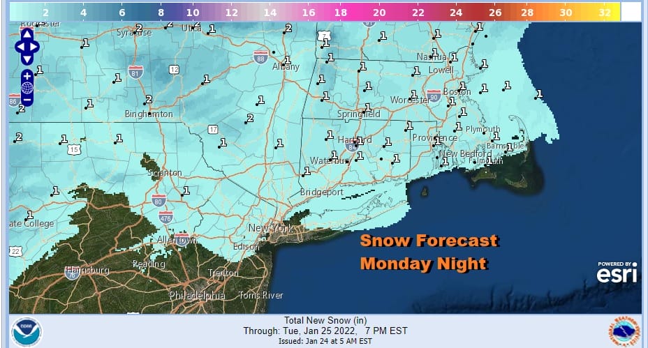
A warm front will be passing by to our north tonight so there is a chance for snow showers but this time they will happen probably from Northern Pennsylvania with the southern edge to Northern New Jersey, NYC and Long Island. New England will see most of this but for all that we are talking about here, the most we are looking at is a coating with some areas to the north getting up to an inch or so. Of course some folks won’t see much of anything.
Tuesday is the one day this week where we will be on the “warm” side. Another cold front is headed our way. We will see some and some clouds. I’m going to thrown in the chance for a rain shower when the front passes Tuesday evening just in case but there is a good chance it just goes through dry. Highs will reach the low and middle 40s. Colder air follows behind the front. Colder air is back for Wednesday and Thursday. It will also be dry and we will have sunshine for Wednesday but it will be cold with highs just in the 20s. Wednesday night into Thursday morning we will be down in the single digits and low. Thursday will be cold as well with sunshine. Highs again will be in the 20s.
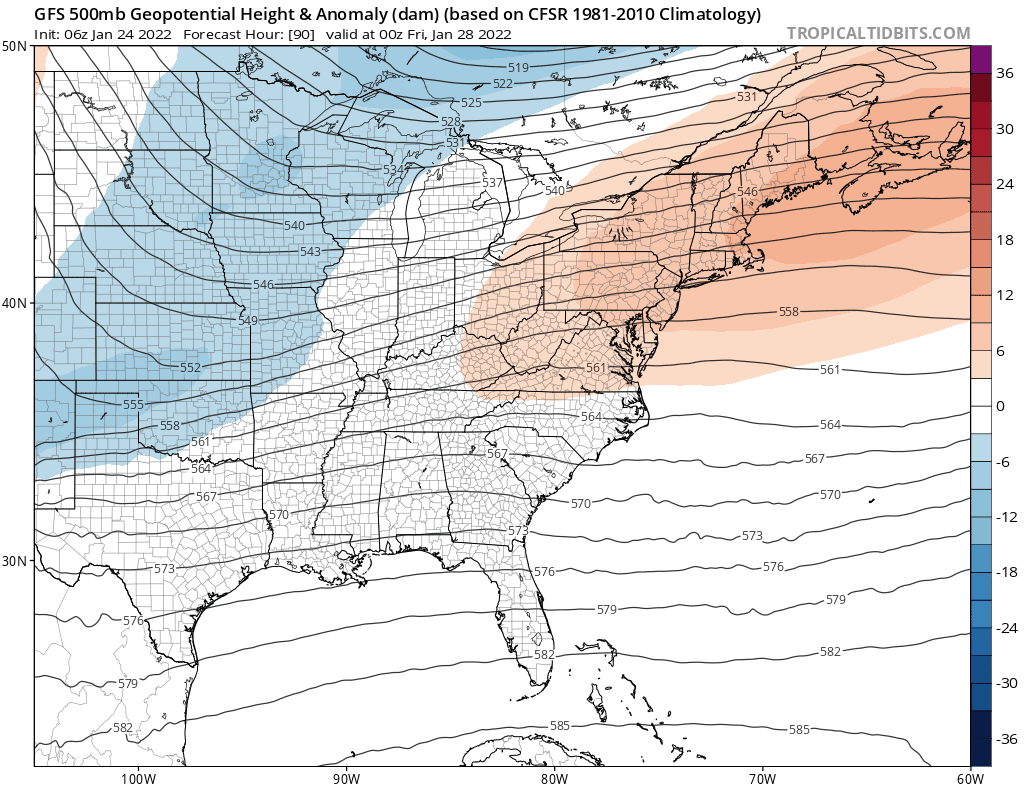
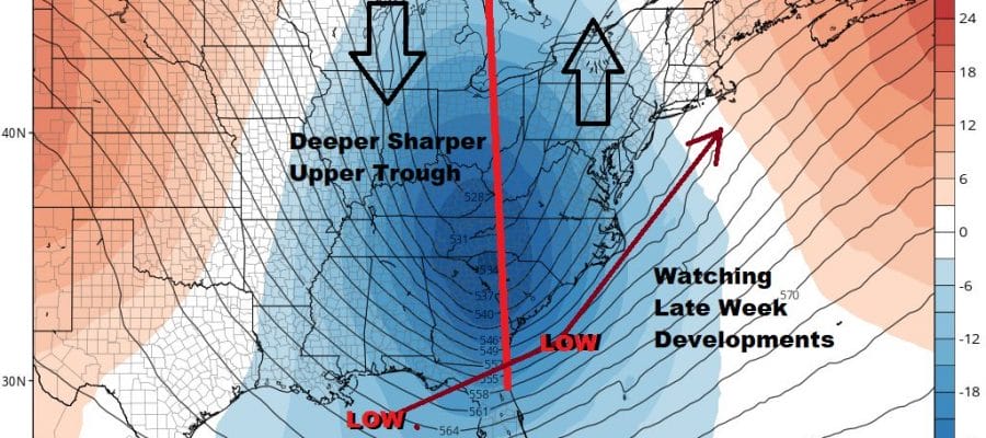
Attention then turns to a very strong upper air trough that will be dropping into the Northern Plains and swinging to the east coast Friday into Saturday. Over the last week we have been watching the models struggling with whether this system was going to be a weak progressive system. In other words it would move from west to east and offshore and well to our south, or whether we will be dealing with a sharpening upper air trough as it nears the coast and that results in a strengthening storm offshore but more tucked in to the coastline.
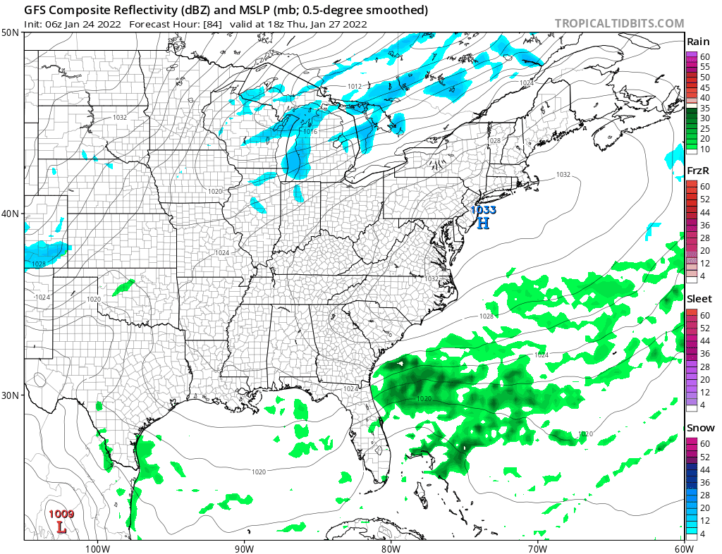
Overnight we see models seem to be now keying toward the stronger more coastal solution and even the recently horribly inconsistent European model is coming along for the ride, though it is further east than the others. We are getting into the 5 day time frame here and if we continue to see models show this very strong solution ni later turns we will begin to raise the risk level for a storm Friday night and Saturday. Expect more jumping around left or right. The sharper the upper trough (which is the loop above the surface map) the further left the low will get. For you model watchers I WOULD NOT focus on snow maps now as they are only reflecting the literal position of the storm as depicted and we will see large changes in those numbers over the next few days. Those numbers will change in both directions. I think at this stage we can say that a storm along the East Coast is on the table for late this week and the the risks are higher than yesterday though not high enough to make it certainty, at least not yet.
BE SURE TO DOWNLOAD THE FREE METEOROLOGIST JOE CIOFFI WEATHER APP &
ANGRY BEN’S FREE WEATHER APP “THE ANGRY WEATHERMAN!
MANY THANKS TO TROPICAL TIDBITS & F5 WEATHER FOR THE USE OF MAPS
Please note that with regards to any severe weather, tropical storms, or hurricanes, should a storm be threatening, please consult your local National Weather Service office or your local government officials about what action you should be taking to protect life and property.


