
Snow Monday Morning Later Tuesday

Snow Monday Morning Later Tuesday
Tricky Forecast Ahead
At first glance we look at the prospects for the next 2 days and it seems rather obvious. There are 2 systems playing through. The first one will come through tonight with mix precipitation along the coast or just plain rain depending on where you are. For areas inland of the coast there will be some wet snow that will accumulate a coating to an inch or so. There might be a little bit more in elevated areas. Liquid precipitation amounts being forecast are in the a tenth to 2 tenths of an inch of liquid. This is not going to be any big deal. Some slick spots could develop in a few areas where temperatures might be close to freezing like in Northwest New Jersey and inland areas of the Hudson Valley and for Connecticut north of route 15. Temperatures are marginal at best but it is cold aloft which would support some wet snow.

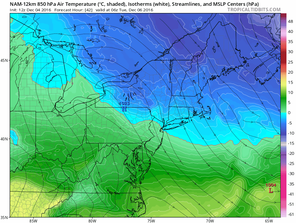
We look at the 850 mb level or about 5000 feet to often times determine rain versus snow. The Nam model as well as the other weather models have it cold enough. The light blue would indicate where temperatures at that level are below 32. The darker blues are colder. Intensity of precipitation would argue for a colder atmosphere if it falls heavy enough to cool the bottom part of the atmosphere. The best chances for this will be inland.
The tricky part of the forecast comes later Tuesday. The NAM model initially warms things up where it would be all rain however as it develops the coastal low some colder air aloft appears and this could be the reason why the NAM model is more aggressive with snow regarding the second shot for later Tuesday into Tuesday night.

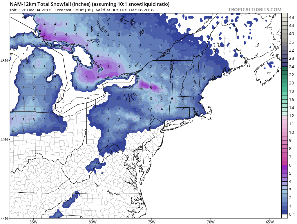
The NAM model which has had the hot hand lately shows the coating to an inch or so with the first shot of snow tonight, again way from the coast. This makes sense and is in line with other models.
It is with the second shot that some differences occur with the NAM more aggressive inland. The snow on this map is cumulative so it includes the first shot.
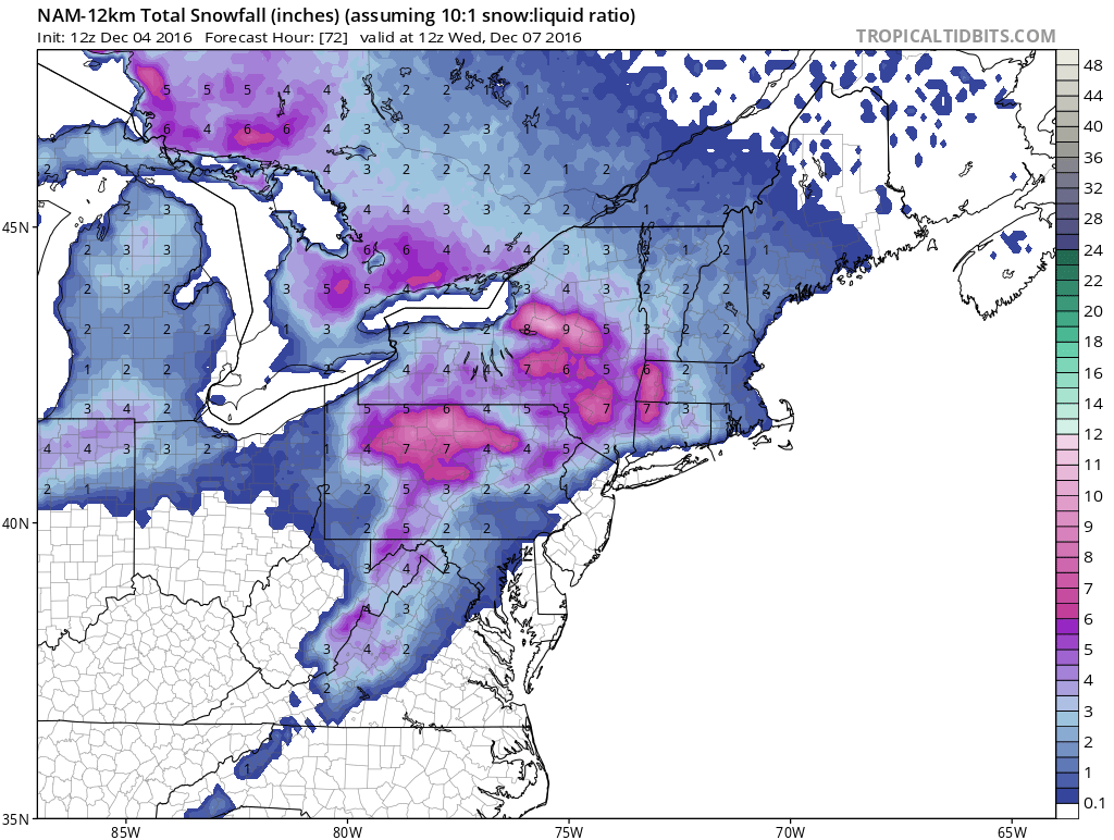

The GFS snow map through Wednesday morning has about 1/2 the amount of the NAM model though it is about even with it in areas well to the north.
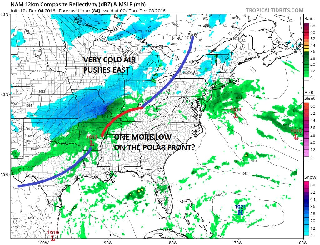
In the meantime we will wait to see what the European has to say about the short and the longer range. The NAM is suggesting that the coldest of the cold air for later in the week may have to wait for one more low on the polar front to move through on Thursday. The European model last night suggested the same idea.
MANY THANKS TO TROPICAL TIDBITS FOR THE WONDERFUL USE OF THE MAPS
SNOW REMOVAL COMPANIES FOR YOUR WINTER NEEDS
LONG ISLAND ROCKLAND COUNTY Connecticut

![]()


FiOS1 News Weather Forecast For Long Island
FiOS1 News Weather Forecast For New Jersey
FiOS1 News Weather Forecast For Hudson Valley
NATIONAL WEATHER SERVICE SNOW FORECASTS
LATEST JOESTRADAMUS ON THE LONG RANGE
Weather App

Don’t be without Meteorologist Joe Cioffi’s weather app. It is really a meteorologist app because you get my forecasts and my analysis and not some automated computer generated forecast based on the GFS model. This is why your app forecast changes every 6 hours. It is model driven with no human input at all. It gives you an icon, a temperature and no insight whatsoever.
It is a complete weather app to suit your forecast needs. All the weather information you need is right on your phone. Android or I-phone, use it to keep track of all the latest weather information and forecasts. This weather app is also free of advertising so you don’t have to worry about security issues with your device. An accurate forecast and no worries that your device is being compromised.
Use it in conjunction with my website and my facebook and twitter and you have complete weather coverage of all the latest weather and the long range outlook. The website has been redone and upgraded. Its easy to use and everything is archived so you can see how well Joe does or doesn’t do when it comes to forecasts and outlooks.
Just click on the google play button or the apple store button on the sidebar for my app which is on My Weather Concierge. Download the app for free. Subscribe to my forecasts on an ad free environment for just 99 cents a month.
Get my forecasts in the palm of your hand for less than the cost of a cup of Joe!
![]()
