Snow Ice Threat Bitter Cold Late Week Ahead

Snow Ice Threat Bitter Cold Late Week Ahead
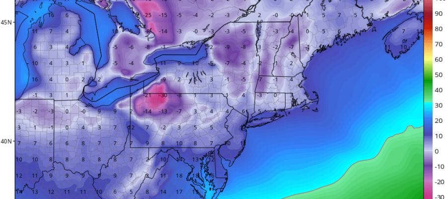
This is going to be an interesting week ahead. We have two primary events to look forward to. The first is the arrival of bitter cold air for Thursday and Friday. For both those days temperatures will be no higher than the 20s and we will be down in the single digits and low teens by Friday morning with some record low temperatures possible in some areas.
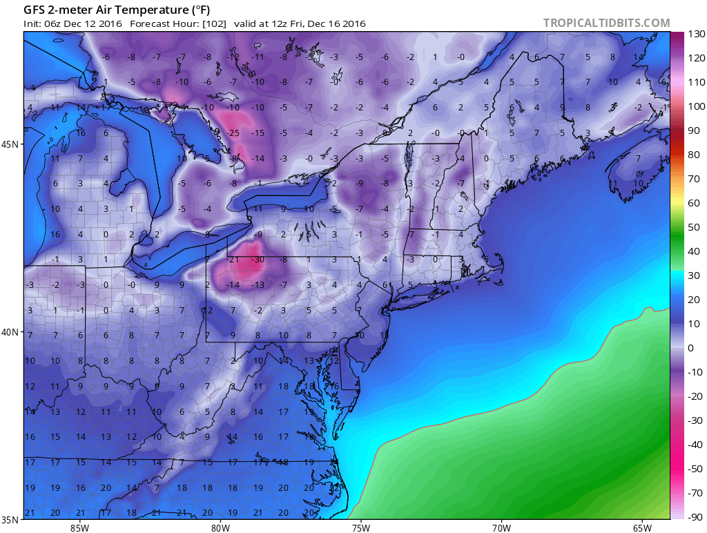
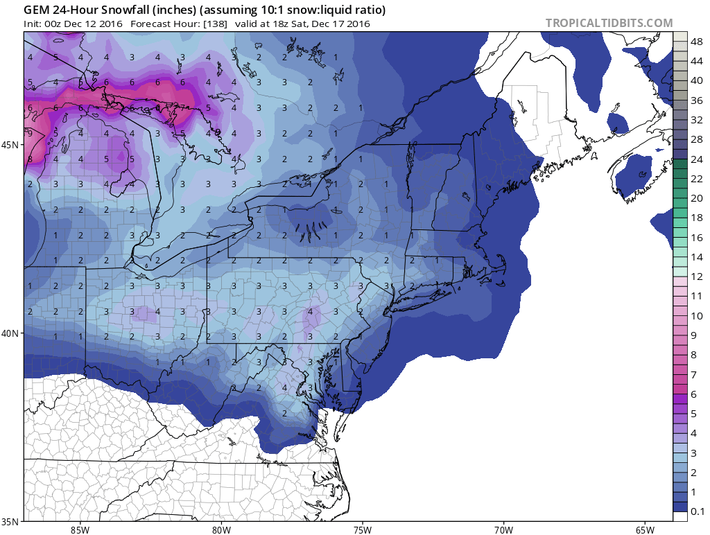
With the arrival of the arctic air beginning anytime from Wednesday night into Friday morning there could be some snow showers and snow squalls in some areas. Those squalls could easily whiten the ground up in areas and there is even the chance that someone could get an inch or so a heavier squall. The second thing that is of some concern is Friday night, Saturday and Saturday night. The arctic air will be pulling out but some of it will be left behind. As low pressure begins to swing into the Midwest we will see a snow to ice to rain situation develop here. I think it is the kind of set up that could produce several inches of snow in some places then followed by icing especially away from the coast. Of course it is early in the game here but weather models have been showing this for many days in one form or another. All models show some snow and I am putting up the Canadian model snowfall for Saturday which is a good compromise between the GFS & European Models.
How this play out of course will depend on how the core of the arctic air moves out and where the high pressure center winds up exiting. Does it move off shore near us or to our south? Or does it exit to the north and northeast. That could make a huge difference especially when it comes to the ice part of this. We will focus more on this possibility later today.
MANY THANKS TO TROPICAL TIDBITS FOR THE WONDERFUL USE OF THE MAPS
SNOW REMOVAL COMPANIES FOR YOUR WINTER NEEDS
LONG ISLAND ROCKLAND COUNTY Connecticut

![]()


JOHNSTOWN PA
COLOSIMO LAWNCARE

FiOS1 News Weather Forecast For Long Island
FiOS1 News Weather Forecast For New Jersey
FiOS1 News Weather Forecast For Hudson Valley
NATIONAL WEATHER SERVICE SNOW FORECASTS
LATEST JOESTRADAMUS ON THE LONG RANGE
Weather App

Don’t be without Meteorologist Joe Cioffi’s weather app. It is really a meteorologist app because you get my forecasts and my analysis and not some automated computer generated forecast based on the GFS model. This is why your app forecast changes every 6 hours. It is model driven with no human input at all. It gives you an icon, a temperature and no insight whatsoever.
It is a complete weather app to suit your forecast needs. All the weather information you need is right on your phone. Android or I-phone, use it to keep track of all the latest weather information and forecasts. This weather app is also free of advertising so you don’t have to worry about security issues with your device. An accurate forecast and no worries that your device is being compromised.
Use it in conjunction with my website and my facebook and twitter and you have complete weather coverage of all the latest weather and the long range outlook. The website has been redone and upgraded. Its easy to use and everything is archived so you can see how well Joe does or doesn’t do when it comes to forecasts and outlooks.
Just click on the google play button or the apple store button on the sidebar for my app which is on My Weather Concierge. Download the app for free. Subscribe to my forecasts on an ad free environment for just 99 cents a month.
Get my forecasts in the palm of your hand for less than the cost of a cup of Joe!
![]()
