Snow Burst Before Rains Takeover
Snow Burst Before Rains Takeover
Snow Burst Before Rains Takeover
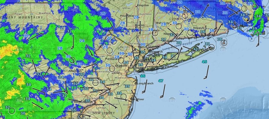
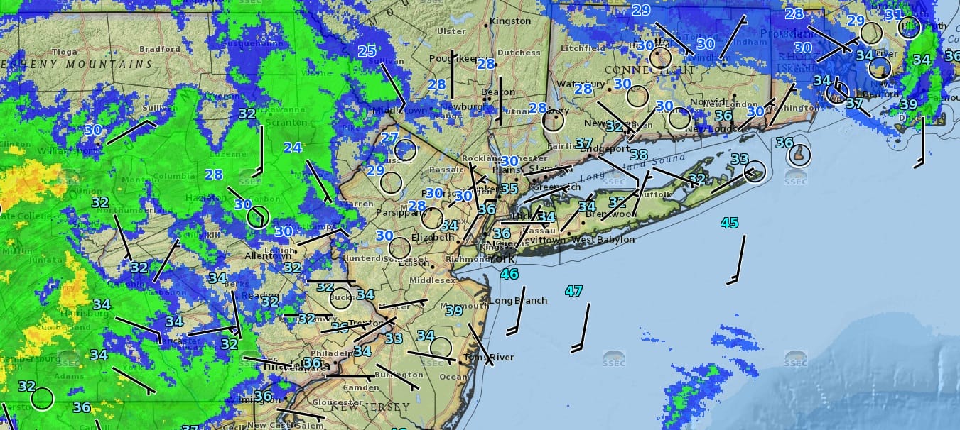
Radars are loading up right now as we can see on the regional and soon on the local radars below. Snow is moving across Pennsylvania and warm air is poised to sweep inland so it is a matter of timing. Inland areas of Northern New Jersey and the Hudson Valley as well as Western Connecticut could see one more burst of snow between 1am and 4am before warm air sweeps northward and changes the snow to rain in those areas. Along the coast temperatures should begin to rise shortly. The burst of snow could produce another quick coating to an inch or so in some areas before the rains take over.


I have overlayed the radar onto the temperatures as of 12:30am Monday and you can see the precipitation and where temperatures still remain below freezing. Notice temperatures along the coast are now above freezing so it won’t be too long before that warm air sweeps inland.
The rain should be overwith by mid morning in most places and by noon in eastern areas before we see some breaks of sunshine in the afternoon and temperatures in the 40s to even some 50s as you go south into New Jersey and over Long Island. Colder air is poised to come back in Monday night and bitter cold air for this time of year is set to come in later in the week. We will have more on this and the prospects for snow later today.
SNOW REMOVAL COMPANIES FOR YOUR WINTER NEEDS
LONG ISLAND ROCKLAND COUNTY Connecticut

![]()

FiOS1 News Weather Forecast For Long Island
FiOS1 News Weather Forecast For New Jersey
FiOS1 News Weather Forecast For Hudson Valley
NATIONAL WEATHER SERVICE SNOW FORECASTS
LATEST JOESTRADAMUS ON THE LONG RANGE
Weather App

Don’t be without Meteorologist Joe Cioffi’s weather app. It is really a meteorologist app because you get my forecasts and my analysis and not some automated computer generated forecast based on the GFS model. This is why your app forecast changes every 6 hours. It is model driven with no human input at all. It gives you an icon, a temperature and no insight whatsoever.
It is a complete weather app to suit your forecast needs. All the weather information you need is right on your phone. Android or I-phone, use it to keep track of all the latest weather information and forecasts. This weather app is also free of advertising so you don’t have to worry about security issues with your device. An accurate forecast and no worries that your device is being compromised.
Use it in conjunction with my website and my facebook and twitter and you have complete weather coverage of all the latest weather and the long range outlook. The website has been redone and upgraded. Its easy to use and everything is archived so you can see how well Joe does or doesn’t do when it comes to forecasts and outlooks.
Just click on the google play button or the apple store button on the sidebar for my app which is on My Weather Concierge. Download the app for free. Subscribe to my forecasts on an ad free environment for just 99 cents a month.
Get my forecasts in the palm of your hand for less than the cost of a cup of Joe!


