Snow Friday North Rain Moving North Weekend
Snow Friday North Rain Moving North Weekend
We are transitioning over to milder air this weekend as the latest shot of cold air with us tonight begins to move out to the east. Other than a few passing clouds, skies should be clear for most of the night. Lows will be in the teens and single digits by morning.
The satellite picture shows clouds to our north and west as the next system comes out of the Northern Plains and Rockies and heads into the Midwest with some snow. Clouds offshore with yesterday’s weather system lies across Florida and into the Gulf of Mexico where moisture is building in the Western Gulf of Mexico. This is our system for late Saturday and Sunday.
US SATELLITE
REGIONAL RADAR
On Friday an area of snow will be going to our north and in some parts of the Hudson Valley and Northwest New Jersey there could be a quick coating of snow. After that there is no cold air to speak of so we will see a lot of clouds on Saturday. The next in a series of storms will move to the northeast with rain developing late Saturday and more rain on Sunday. It will not be the prettiest of weekends.
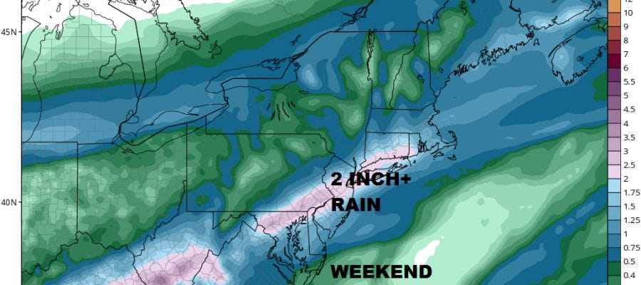
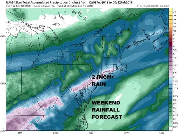
The NAM and the GFS weather models are in remarkable agreement on rainfall amounts showing a solid 2 inches plus for the area. I think this makes sense given the dynamics with solid gulf moisture, a wave developing on the front and solid moisture inflow from the Atlantic. Rain could linger into Monday before weather conditions improve. Temperatures this weekend will hold generally in the 40s to near 50. No snow is on the horizon through the at least the middle of next week.
 GET JOE A CIGAR IF YOU LIKE
FiOS1 News Weather Forecast For Long Island
FiOS1 News Weather Forecast For New Jersey
FiOS1 News Weather Forecast For Hudson Valley


