Snow Friday No Changes In Forecast

GET JOE A CIGAR IF YOU LIKE
Snow Friday No Changes In Forecast
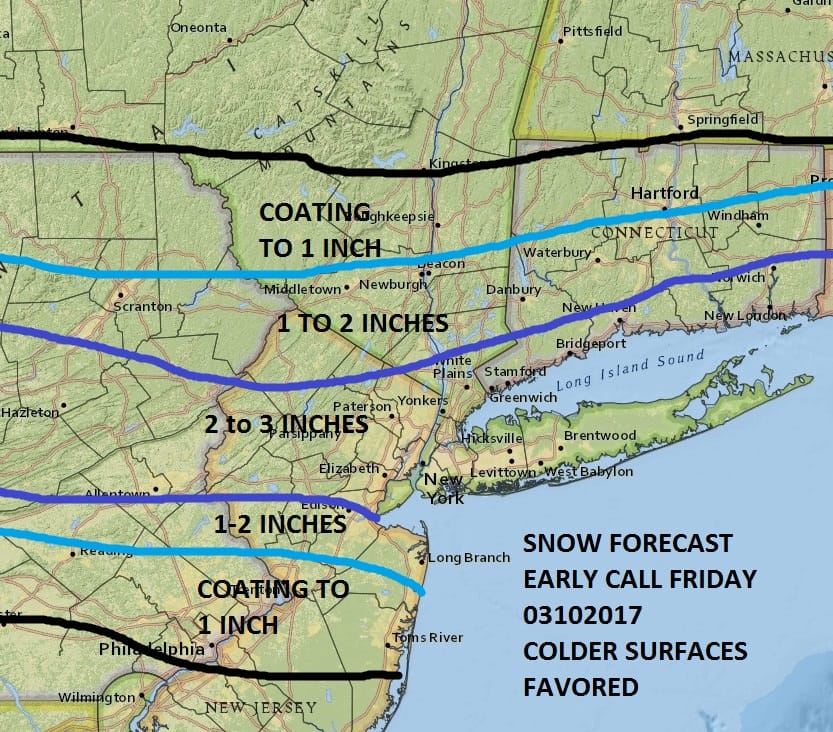
After reviewing weather models this morning I didn’t see any need to change. The NAM model was a little more aggressive and a little further south. It was also a healthy producer of precipitation of 1/2 to 3/4 of an inch of liquid which is pretty high. However there are issues with timing and temperature so I dont want to do anything with this at the moment. As with all of these things there is bust potential. We will just wait and ride things along until Thursday when we can get a better idea of timing and temperature issues. I still think this WILL NOT be a big issue especially on roads after 8am given the sun angle. Basically this winter for snow you have to be north of Route 78 in New Jersey and Pennsylvania and I don’t think its any different this time around.
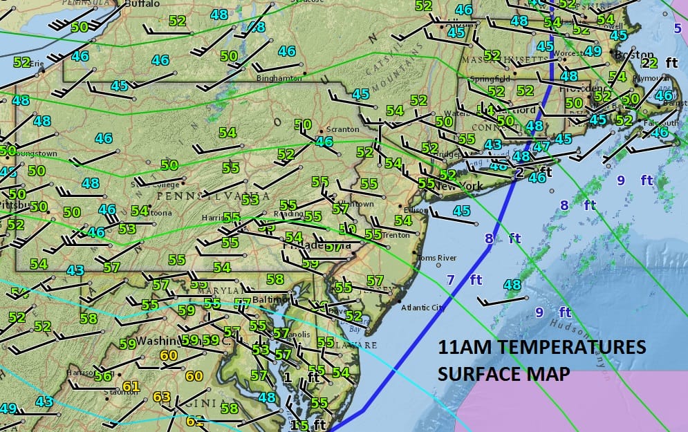
Weather conditions are improving across the area now as skies have gone mostly sunny and temperatures are responding and rising into the 60s in some places. No more rain is forecast through Thursday evening. Skies will clear tonight with most lows in the 30s to near 40. Thursday we will see sunshine give way to afternoon clouds with highs into the 50s. Then look for snow to arrive after midnight Thursday night and lasting into midday Friday. The weekend looks dry and cold and so does Monday with highs just in the 30s and lows in the teens to low 20s.


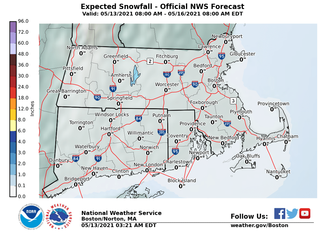
The maps below are the National Weather Service forecast snow maps with the most likely snowfall prediction. It appears that though midday Wednesday they have not changed their forecast. These maps will update automatically later today.