Snow Forecasts National Weather Service 12172016
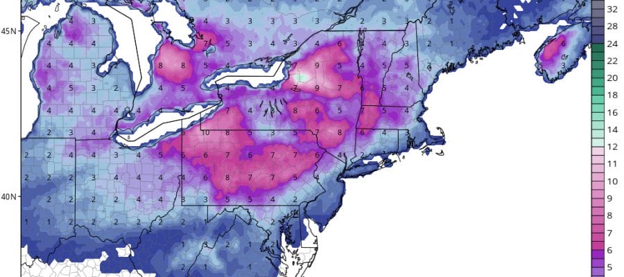
Snow Forecasts from the National Weather Service as they were updated this morning are now available. Please check the time stamp to make sure that they are the latest forecasts. Winter Storm Watches are likely to go up for some areas for late Friday night and Saturday. Snow is forecast to develop after midnight Friday night and last into Saturday morning before changing to rain between 7am-10am in most areas.
Areas in upstate NY as well as parts of Northern Pennsylvania and Western New England are focusing on lake effect snows going on into tonight and may not reflect the Friday night Saturday event.
NEW YORK CITY AND VICINITY SNOW

NEW YORK CITY & VICINITY ICE

NEW JERSEY & PARTS OF NE PA

SOUTHERN AND SOUTHEAST NEW ENGLAND

NORTHERN NEW ENGLAND

WESTERN NEW ENGLAND

MIDDLE AND UPPER HUDSON VALLEY

CENTRAL NEW YORK & NE PA

WESTERN NEW YORK

CENTRAL & SOUTH CENTRAL PA

VIRGINIA & MARYLAND

DAILY NORTHEAST SNOWFALL

These are my early call maps for the Northeast and Middle Atlantic States. These maps will be updated this morning once we examine all the overnight weather models.

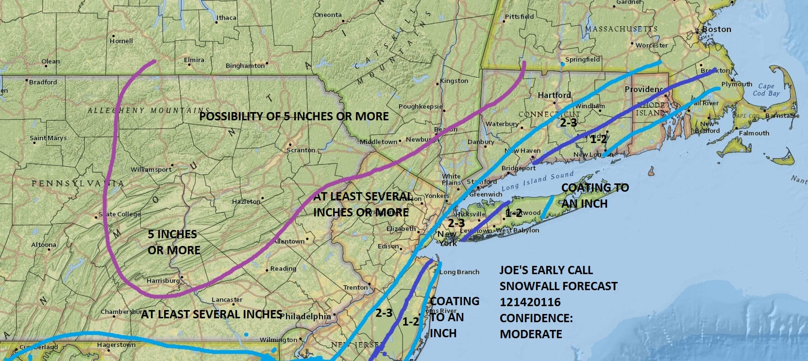
Please be advised that these are National Weather Service Forecast Maps and they auto update. Each office may update at different times and some offices are slower to update then others. Maps are usually updated before 5am and & 5pm however they may be updated at other times depending on forecast conditions. These are not my forecasts. My forecasts can be found on the JOE’S SNOWFORECAST PAGE. Individual forecasts for specific areas may also be found when conditions warrant on the my area forecasts. Those can be found on the website menu. Click on forecasts and then select your specific area.
SNOW REMOVAL COMPANIES FOR YOUR WINTER NEEDS
LONG ISLAND ROCKLAND COUNTY Connecticut

![]()


JOHNSTOWN PA
COLOSIMO LAWNCARE
