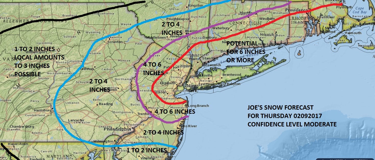
Snow Forecasts Mid Atlantic & Northeast 02092017
JOE’S SNOW FORECAST FOR THE ENTIRE REGION
Weather models this morning are beginning their new cycle and so far they seem on course to produce a 6 inch plus snowfall for a large portion of the area from Central New Jersey through all of New York City, the lower Hudson Valley and Southern New England. Amounts were adjusted slightly higher as weather models are a bit colder overall.
Look for snow to begin between 1 and 7 am and end between 1pm and 7pm from west to east. Amounts will be impacted by how much rain falls at the start. This could be important for areas along the New Jersey shore east of the Garden State Parkway as well as areas in South Central and Southeastern Pennsylvania.
JOE’S LONG ISLAND SNOW FORECAST
JOE’S SNOW FORECAST SOUTH CENTRAL PENNSYLVANIA
NORTH CENTRAL MARYLAND
My forecast map for snow is above and the National Weather Service snow forecast maps follow below. Be sure to check the time stamps to make sure you are seeing the latest forecast for Thursday.
Snow Forecasts Mid Atlantic & Northeast 02092017
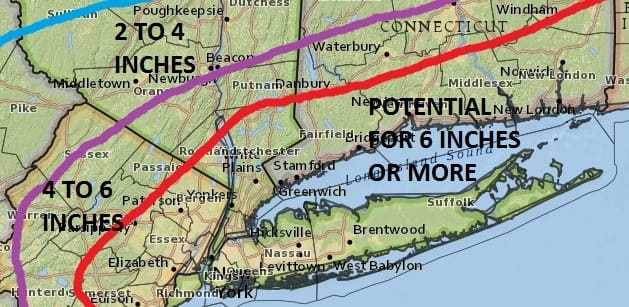
NEW YORK CITY AND VICINITY SNOW

NEW YORK CITY & VICINITY ICE

NEW JERSEY & PARTS OF NE PA

SOUTHERN AND SOUTHEAST NEW ENGLAND

NORTHERN NEW ENGLAND

WESTERN NEW ENGLAND

MIDDLE AND UPPER HUDSON VALLEY

CENTRAL NEW YORK & NE PA

WESTERN NEW YORK

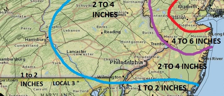
CENTRAL & SOUTH CENTRAL PA

VIRGINIA & MARYLAND

DAILY NORTHEAST SNOWFALL

Please be advised that these are National Weather Service Forecast Maps and they auto update. Each office may update at different times and some offices are slower to update then others. Maps are usually updated before 5am and & 5pm however they may be updated at other times depending on forecast conditions. These are not my forecasts. My forecasts can be found on the JOE’S SNOWFORECAST PAGE. Individual forecasts for specific areas may also be found when conditions warrant on the my area forecasts. Those can be found on the website menu. Click on forecasts and then select your specific area.
SNOW REMOVAL COMPANIES FOR YOUR WINTER NEEDS
LONG ISLAND ROCKLAND COUNTY Connecticut

![]()

ROCKLAND COUNTY TRI STATE SNOW REMOVAL JOHNSTOWN PA