Snow Forecasts Amounts Increased Slightly Saturday
Snow Forecasts Amounts Increased Slightly Saturday
The latest snow forecasts from the National Weather Service show that they have increased their amounts slightly for areas in the Northern half of New Jersey and over Long Island. We have very cold air overhead and so ratios will be high on the order of at 15 to 18-1 which means that an a quarter of an inch of liquid precipitation which would normally yield about 2-3 inches could yield amounts over 4 inches. The issue of how much melted precipitation is the big question. It seems prudent at this point given the bitter cold dry conditions that it may be better to lean on the low side rather than the high side. My feeling on this is that a 1-2 inch snowfall seems likely with some higher amounts possible in favored areas to the east. Snow will fall from mid morning until early evening so this is a relatively short duration event. Another shot of bitter cold air follows for Sunday through Tuesday with lows Monday and Tuesday morning in the single digits to below zero.
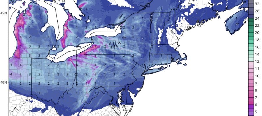
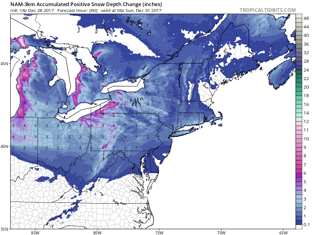
NAM MODELS SNOW FORECASTS FOR SATURDAY

GET JOE A CIGAR SO HE CAN RELAX!
NEW YORK CITY AND VICINITY SNOW

NEW YORK CITY & VICINITY ICE

NEW JERSEY & PARTS OF NE PA

SOUTHERN AND SOUTHEAST NEW ENGLAND

NORTHERN NEW ENGLAND

WESTERN NEW ENGLAND

MIDDLE AND UPPER HUDSON VALLEY

CENTRAL NEW YORK & NE PA

WESTERN NEW YORK

CENTRAL & SOUTH CENTRAL PA

VIRGINIA & MARYLAND

DAILY NORTHEAST SNOWFALL

Please be advised that these are National Weather Service Forecast Maps and they auto update. Each office may update at different times and some offices are slower to update then others. Maps are usually updated before 5am and & 5pm however they may be updated at other times depending on forecast conditions. These are not my forecasts. My forecasts can be found on the JOE’S SNOWFORECAST PAGE. Individual forecasts for specific areas may also be found when conditions warrant on the my area forecasts. Those can be found on the website menu. Click on forecasts and then select your specific area.