Snow Forecast Saturday 01072017
Snow Forecast Saturday 01072017
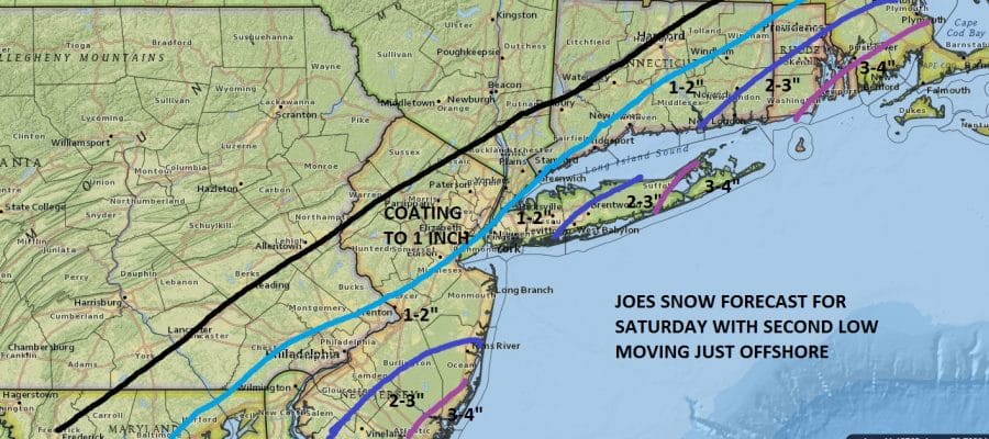
With regards to Saturday’s event most models overnight did come back westward including the European model which paints a broad brush 3 to 6 inches over a good chunk of the area east of a line from Trenton NYC New Haven Hartford. I will remain with my snow forecast map from a few days ago since we are close to the new model runs. I want to see if there is a sense of consistency between the two
Now bear in mind that I could easily double these amount based on the overnight models but given that the NAM model essentially underperformed last night, Im sticking with this for now. Radar shows the first area of snow moving out and the second round of precipitation beginning to develop to the south.


The maps below are the National Weather Service forecast snow maps with the most likely snowfall prediction.


The National Weather Service has a Winter Storm Watch for Ocean Southeast Burlington Atlantic and Cape May Counties in New Jersey. Other watches are possible later this morning but they would be confined to coastal areas in my view unless we see a huge westward shift.
SNOW REMOVAL COMPANIES FOR YOUR WINTER NEEDS
LONG ISLAND ROCKLAND COUNTY Connecticut

![]()

ROCKLAND COUNTY TRI STATE SNOW REMOVAL jOHNSTOWN PA


