Snow Forecast Final Call
Snow Forecast Final Call
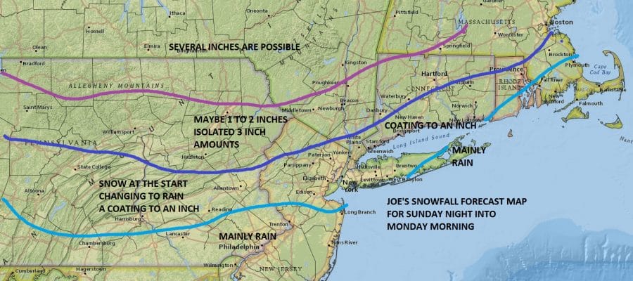
After reviewing all of the models that have come in so far tonight (I have not seen the European) it is hard for me to fight the model trends and the fact that the system and the associated warm front is just not that impressive to me. I think there could be a quick burst of snow at the start along coastal areas but at most a coating to an inch will accumulate. Further inland in Northwest New Jersey and interior areas of the Hudson Valley up to a couple of inches or possible. Higher amounts will fall as you go further north. The track and system structure to me doesn’t look to support more than this. By Monday morning with rising temperatures for many areas it will have already changed over to rain.
Snow Forecast Final Call

Today looks like a nice day with sunshine and a gusty breezy but it will be cold with most highs in the mid to upper 30s. Radars have been showing the lake effect snow activity in Upstate NY but this will be winding down in short order today.


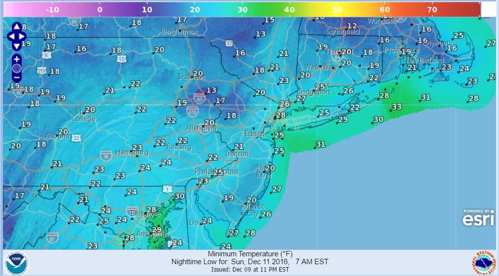
Skies will be clear tonight with less wind and it will be cold by Sunday morning. Most lows will be in the low to mid 20s with teens in the cold spots.
SUNDAY MORNING FORECAST LOWS
Sunday we will see arriving clouds with highs in the 30s. Then Sunday night will be cloudy with a burst of snow or mixed precipitation developing during the evening in western areas and by midnight in eastern areas. After a few hours a gradual change to rain will occur and by Monday morning the change over line will be moving northward toward route 84 in Pennsylvania, New York State and Connecticut.
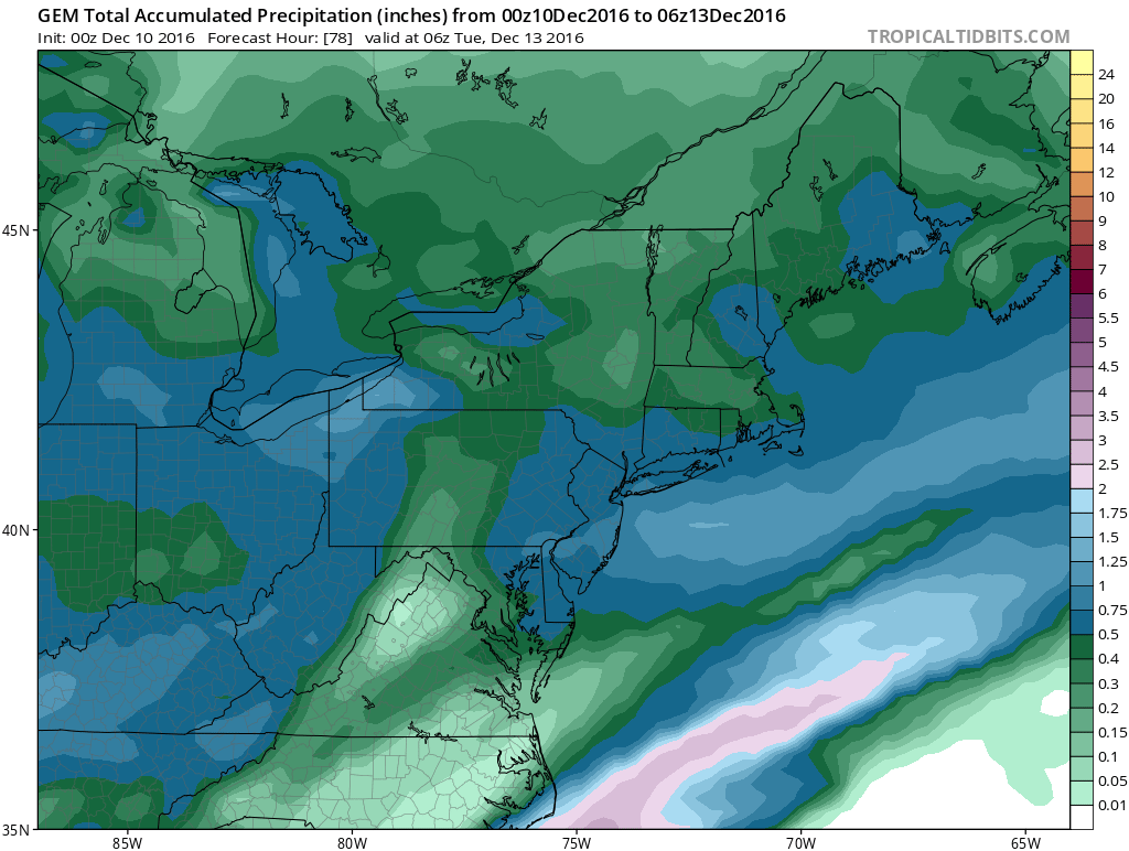
Rainfall amounts will be in the half to three quarters of an inch range which will dent the drought a little bit more. Monday temperatures will rise through the 40s to near 50 in some areas and into the 50s in Central and South Jersey and Southeastern Pennsylvania. We will dry out with seasonal temperatures Tuesday. Then much colder air arrives on Wednesday as low pressure develops to the south and east. Some snow with that low could possibly scrape Southern New Jersey and areas to the south briefly as the cold air arrives but it does not look like the wave will have any impact on areas further to the north.
SNOW REMOVAL COMPANIES FOR YOUR WINTER NEEDS
LONG ISLAND ROCKLAND COUNTY Connecticut

![]()

FiOS1 News Weather Forecast For Long Island
FiOS1 News Weather Forecast For New Jersey
FiOS1 News Weather Forecast For Hudson Valley
NATIONAL WEATHER SERVICE SNOW FORECASTS
LATEST JOESTRADAMUS ON THE LONG RANGE
Weather App

Don’t be without Meteorologist Joe Cioffi’s weather app. It is really a meteorologist app because you get my forecasts and my analysis and not some automated computer generated forecast based on the GFS model. This is why your app forecast changes every 6 hours. It is model driven with no human input at all. It gives you an icon, a temperature and no insight whatsoever.
It is a complete weather app to suit your forecast needs. All the weather information you need is right on your phone. Android or I-phone, use it to keep track of all the latest weather information and forecasts. This weather app is also free of advertising so you don’t have to worry about security issues with your device. An accurate forecast and no worries that your device is being compromised.
Use it in conjunction with my website and my facebook and twitter and you have complete weather coverage of all the latest weather and the long range outlook. The website has been redone and upgraded. Its easy to use and everything is archived so you can see how well Joe does or doesn’t do when it comes to forecasts and outlooks.
Just click on the google play button or the apple store button on the sidebar for my app which is on My Weather Concierge. Download the app for free. Subscribe to my forecasts on an ad free environment for just 99 cents a month.
Get my forecasts in the palm of your hand for less than the cost of a cup of Joe!