Snow Forecast Dilemma Saturday

Snow Forecast Dilemma Saturday
As we approach the arrival of snow for Saturday I though we should discuss the forecast dilemma that exists for coastal areas, specifically Long Island where there is the question of whether some mixing will get involved in all this and where. Also there is the issue of temperatures which are rather tenuous as the hover around the freezing mark. A few clues have shown up today which are important to this whole equation. The solid high cloud cover that moved into today was responsible for knocking down temperatures about 5 degrees lower than they otherwise would have been and what weather models had forecast.
6PM TEMPERATURES & RADAR
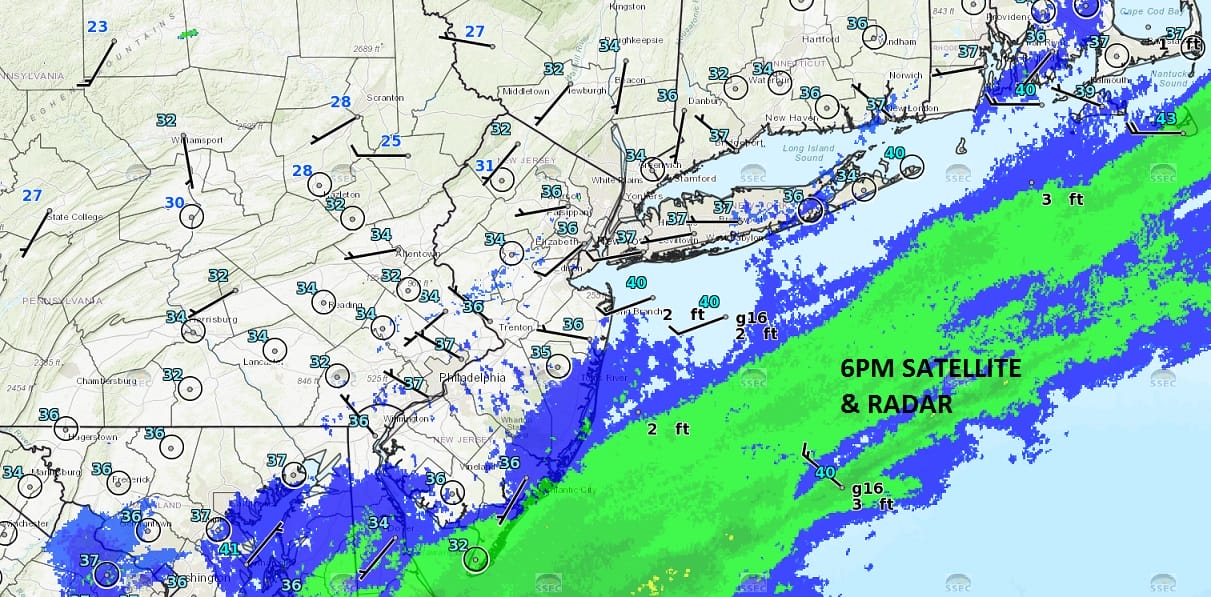
Snow is indicated in the blue with rain in green. This moisture is just offshore with some snow being reported in Southern New Jersey. There is a lead weak wave that is running out well ahead of the main low which is going to develop east of the North Carolina coast. As the first wave passes winds will turn from west to north or northeast which will begin to drain down some slightly colder air to the north. By 6am temperatures are forecast to be near or below freezing as the snow is getting underway.
6AM SATURDAY FORECAST TEMPERATURES
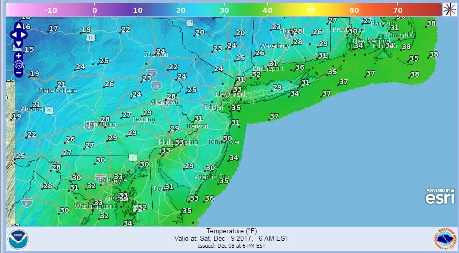
Assuming these temperatures verify and assuming it snows hard enough, the initial burst of snow should stick to most surfaces. As the day wears on Saturday some slight warming will occur in a few coastal areas of Long Island and New Jersey.
HRRR MODEL 11AM TEMPERATURES
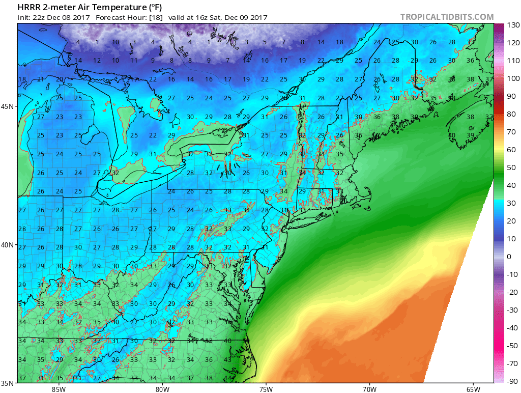
The big question is how close to reality will these temperatures at 11am Saturday will be. Are the models too warm. If they are it will impact snow accumulations greatly in some areas. This is why I have not changed my snow forecast from earlier today.
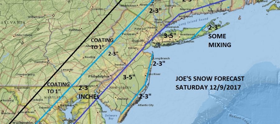
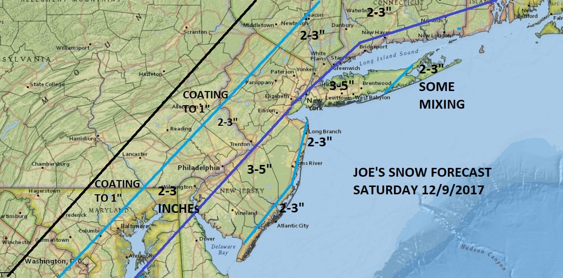
SNOW FORECAST FOR SATURDAY & SATURDAY NIGHT
While there is upside risk there is also downside risk here in snow amounts if temperatures are warmer than model or if they are colder than modeled. The satellite and radar this evening suggest that the system is loaded with moisture so the other factor at work for accumulations will be the intensity of the snow that falls. This could impact the ground temperature by 2 or 3 degrees and that could very well make all the difference.
MANY THANKS TO TROPICAL TIDBITS FOR THE WONDERFUL USE OF THE MAPS

GET JOE A CIGAR IF YOU LIKE!
FiOS1 News Weather Forecast For Long Island
FiOS1 News Weather Forecast For New Jersey
FiOS1 News Weather Forecast For Hudson Valley
NATIONAL WEATHER SERVICE SNOW FORECASTS
LATEST JOESTRADAMUS ON THE LONG RANGE