
SNOW FALLING IN PARTS OF NORTHEAST PENNSYLVANIA
SHOP THE JOESTRADAMUS STORE
SNOW FALLING IN PARTS OF NORTHEAST PENNSYLVANIA
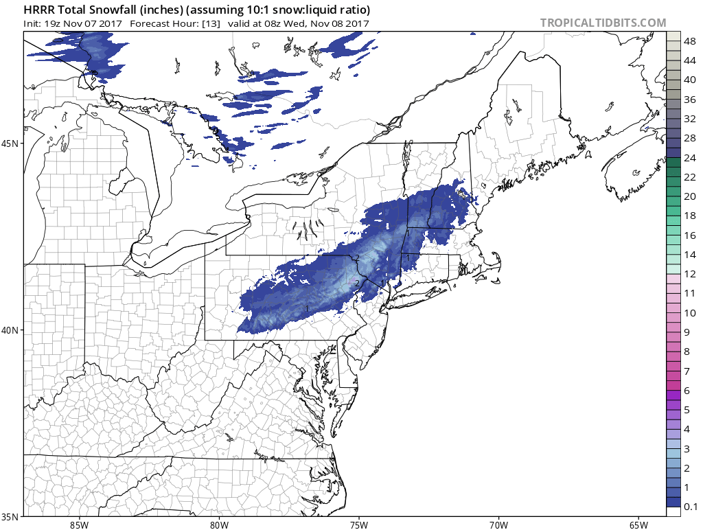
The first snow of the season is falling out of the sky in parts of Northeastern Pennsylvania and the radar is showing snow or some mixed precipitation in the Hudson Valley north of Route 84. Just yesterday we were in the upper 60s to lower 70s. Somebody certainly flipped a switch in the last 24 hours.
3PM WEATHER CONDITIONS
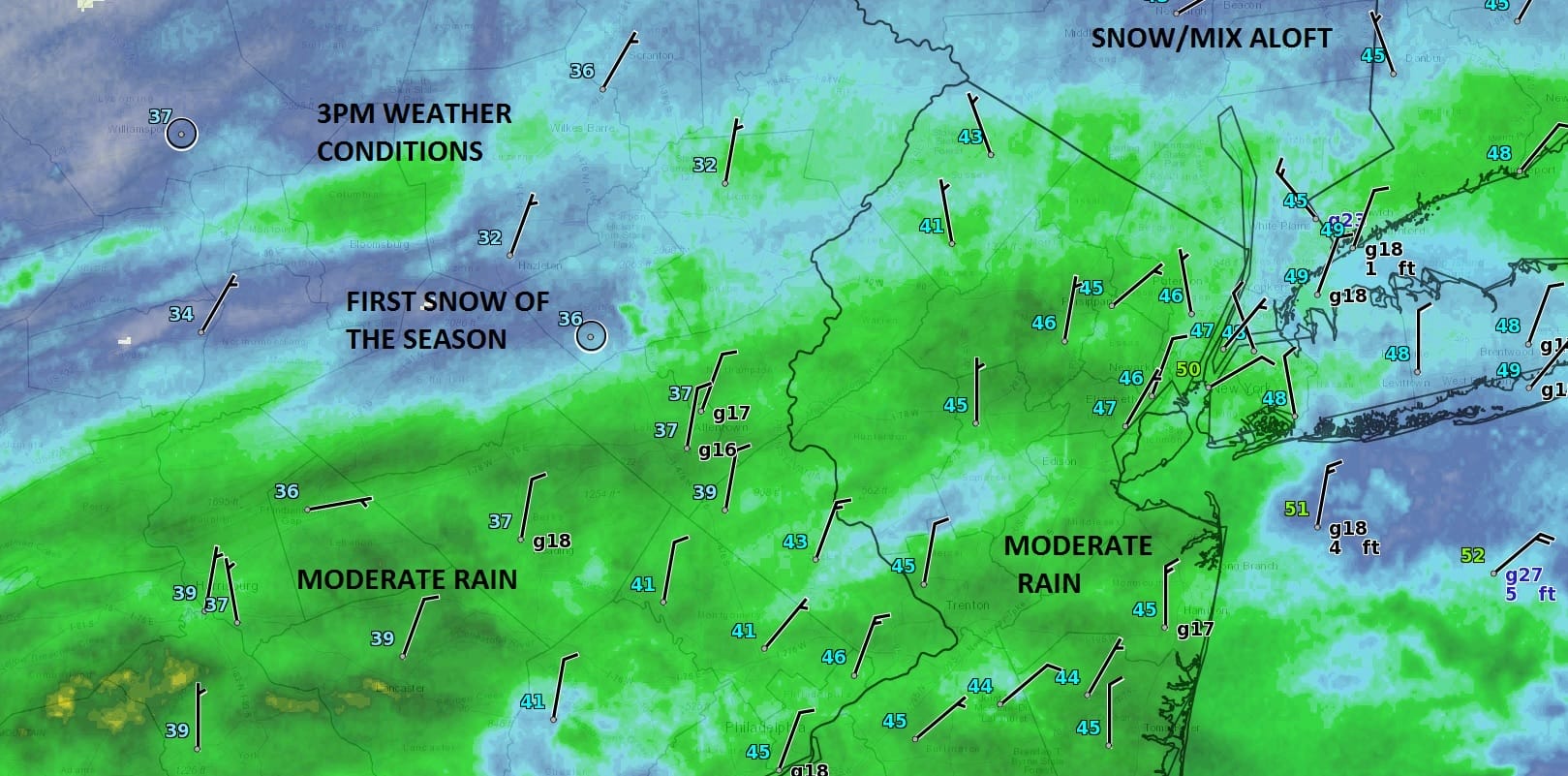
In the “warmer” air a cold rain is falling with some patches of moderate to heavy rain across Southeastern Pennsylvania and Southern New Jersey. The satellite loop shows clouds with this wave of low pressure continuing to move northeast which will make for a raw wet evening commute. Snow could mix in over Northwest New Jersey, The Hudson Valley and in Connecticut mainly north of Route 84 and it will be elevation driven.
SATELLITE LOOP

REGIONAL RADAR

Regional radar shows a large area of precipitation moving across most of Pennsylvania and now poised to move into Southern New England and Long Island.
LOCAL RADAR NEW YORK CITY

LOCAL RADAR PHILADELPHIA


As far as accumulation is concerned in areas that see wet snow it will be mainly on colder surfaces on the order of a coating to an inch or so. As for the rain a half inch to as much as an inch is possible.
The wave is moving to the east and precipitation will end from west to east overnight. Weather conditions improve on Wednesday with decreasing clouds and increasing sun with highs in the 50s. The next change will be Thursday night with a polar front moving through which sets us up for the coldest weather of the season so far. By Saturday morning be ready for teens and lower 20s.
 GET JOE A CIGAR IF YOU LIKE

FiOS1 News Weather Forecast For Long Island
FiOS1 News Weather Forecast For New Jersey
FiOS1 News Weather Forecast For Hudson Valley


