Coldest Air Of Season Arriving Friday Teens 20s Saturday Morning
SHOP THE JOESTRADAMUS STORE
Coldest Air Of Season Arriving Friday
Teens 20s Saturday Morning
Yesterday’s rainfall with a little wet snow thrown in for good measure in some places is now moving away to the northeast. We still have quite a bit of leftover clouds to work through today but there should be some breaks of sunshine developing this morning across Northeastern Pennsylvania and Northern New Jersey and gradually that dry air and sunshine should spread eastward this afternoon. Coastal areaas however from Long Island down the New Jersey shore may have a tough time getting rid of the last of the clouds. Temperatures today will be just into the 50s. There is a bit of a gusty wind this morning along the coast but that should decrease somewhat as we go through the day.
SATELLITE LOOP

REGIONAL RADAR

As far as rain is concerned we are done with that through early Sunday at least. The next system to move through is the polar or arctic front that will pass by late Thursday evening. It won’t have much with it but once it passes winds will shift to the north and it will become windy on Friday. Temperatures Thursday with a mix of sun and clouds will be in the low to mid 50s however on Friday we will fall into the 30s Friday morning and stay in the 30s at best all day.
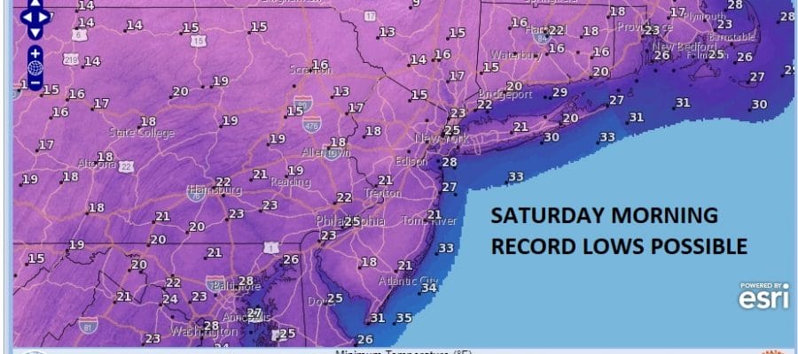
RECORD LOWS POSSIBLE SATURDAY MORNING
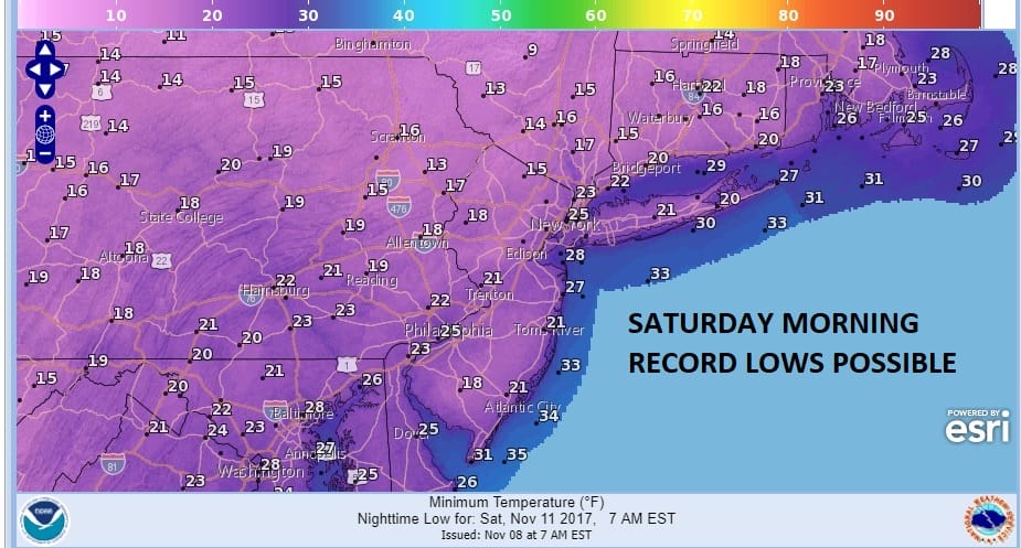
Saturday morning will be very cold with record lows possible in the teens and 20s. Sunshine Saturday will bring afternoon highs back to the upper 30s and lower 40s. Temperatures will be running 15 to 20 degrees below average. We will warm up Sunday with increasing clouds and it looks like low pressure will be developing to our south for Sunday night and Monday which means rain and an ocean wind. We will talk more about this later today.
 GET JOE A CIGAR IF YOU LIKE

FiOS1 News Weather Forecast For Long Island
FiOS1 News Weather Forecast For New Jersey
FiOS1 News Weather Forecast For Hudson Valley


