DOWNLOAD MY NEW FREE JOESTRADAMUS WEATHER APP FOR ANDROID

THE APP IS ABSOLUTELY FREE TO ALL BUT CONSIDERING SUBSCRIBING TO PATREON FOR A WEATHER EXPERIENCE FREE OF ADS, EXCLUSIVE VIDEOS FOR MEMBERS ONLY AND MUCH MORE…STARTS AT $2 A MONTH..MESSAGE ME AT ANY TIME

Light Snow Rain Ending Weather Conditions Improve Christmas Dry Cold
We are seeing a weak weather system moving through this morning and there have been some pockets of rain and snow overnight and into this morning. Much of the precipitation is light. We have no winter weather advisories posted this morning nor do we expect any given the light nature of the precipitation and the overall weak nature of this weather system. Clouds are over us on the satellite loop moving from west to east. We will likely see clouds thin out later today once this weather system pulls far enough offshore.
EASTERN SATELLITE

REGIONAL RADAR

Regional and local radars this morning are showing light snow and rain moving through but the coverage is broken up over a large area so that it is not continuous. If you are travelling this morning is quite likely you will be driving in and out of rain or snow and I don’t believe it is anything that should seriously impede travel. North and west of 287 in NY State and New Jersey and north of Route 15 in Connecticut a coating to an inch or snow of accumulation is about as extreme as this gets today.
LOCAL RADAR NEW YORK CITY

LOCAL RADAR PHILADELPHIA


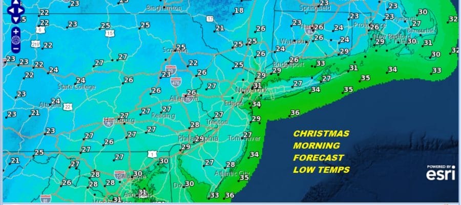
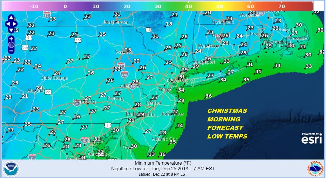
Colder air arrives tonight and Christmas Day. We will have clear skies tonight with smooth travel conditions and no weather issues Yes temperatures will be cold but nothing unreasonable with lows in the 20s to near 30 by Christmas morning.
Tuesday Christmas Day will be nice and sunny with highs in the upper 30s to some lower 40s. Tuesday night will be cold and clear. Wednesday will be nice and sunny with highs in the 30s to near 40. Thursday we will begin to shift our attention to the next storm system coming out of the Plains. The storm is destined for the Great Lakes and that means that warmer air begins to arrive late in the week. Thursday we should see sunshine giving way to arriving clouds.
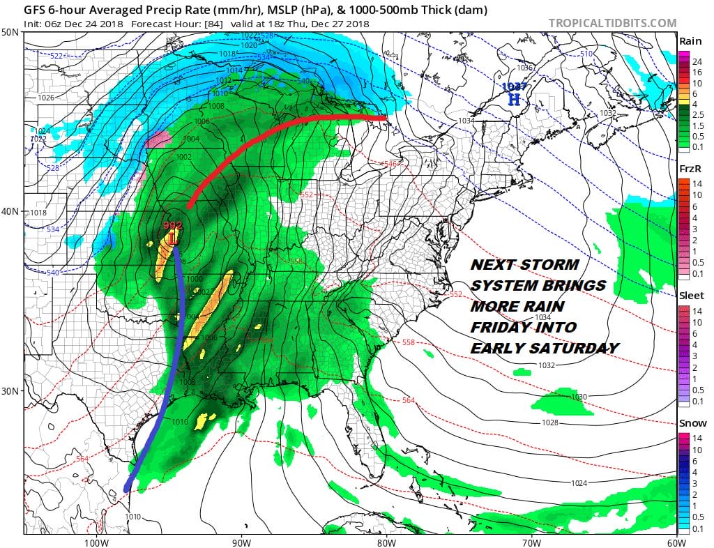
Rain comes in late Thursday night and Friday. It appears that again there is no cold air ahead of this system for anything other than rain even at the start. If everything moves along weather conditions will improve over the weekend. Longer range some weather models have a cold and potentially snowier look as head into the new year. As usual tons of uncertainty in the long range. It is Christmas so take a break from the weather and enjoy.
MANY THANKS TO TROPICAL TIDBITS FOR THE USE OF MAPS
Please note that with regards to any tropical storms or hurricanes, should a storm be threatening, please consult your local National Weather Service office or your local government officials about what action you should be taking to protect life and property.

