DOWNLOAD MY NEW FREE JOESTRADAMUS WEATHER APP FOR ANDROID

THE APP IS ABSOLUTELY FREE TO ALL BUT CONSIDERING SUBSCRIBING TO PATREON FOR A WEATHER EXPERIENCE FREE OF ADS, EXCLUSIVE VIDEOS FOR MEMBERS ONLY AND MUCH MORE…STARTS AT $2 A MONTH..MESSAGE ME AT ANY TIME

Snow Inland Sunday Night Monday Morning, Christmas Dry Cold
We have partially cleared out tonight across the Tri- State Area. We are still seeing some of the backside flow from yesterday’s storm system producing a few clouds but these should thin out overnight. Temperatures have been slowly easing and there is still a bit of a breeze from the northwest. Temperatures should settle in the upper 20s and lower 30s by morning. We can see still see some of the leftover clouds on the satellite loop at the moment but these are mostly dead clouds with little or no precipitation showing up on the regional radar.
EASTERN SATELLITE

REGIONAL RADAR

Sunday during the day should be a nice calm day with sunshine. Some clouds will start arrive during the afternoon. Temperatures should reach the upper 30s and lower 40s in most areas for the highs. An upper air disturbance from the Great Lakes will trigger a weak low to develop off the coast Sunday night. Some precipitation in the form of rain and wet snow will develop in West Virginia and spread across Pennsylvania and then into Northeastern Pennsylvania tomorrow night. Gradually the precipitation will move into Northern New Jersey and then eventually into the Hudson Valley and Southern New England.
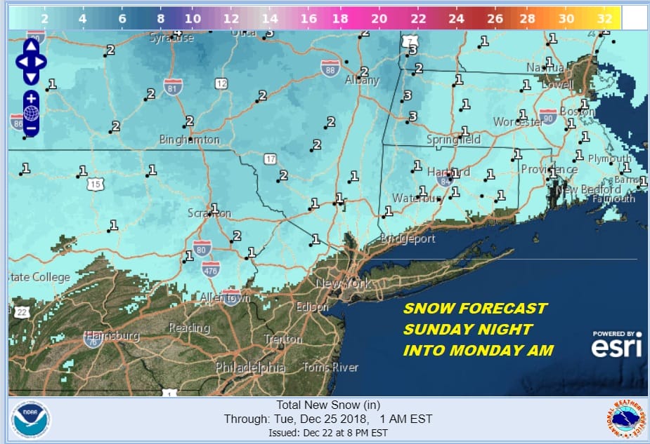
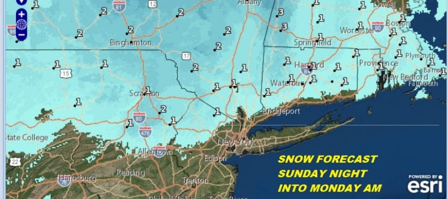
Temperatures tomorrow night will be borderline for rain and snow along the coast. The intensity of the precipitation should not be anything but light so for coastal areas around NYC & Long Island it looks to be mainly rain with perhaps some wet snow mixing in from time to time. Inland however it could be more wet snow than anything else. We could see a coating to an inch or so of accumulation north of 287 in the Hudson Valley, Route 15 in Connecticut, and in Northern New Jersey north and west of 287. North of I-84 1 to 2 inches of snow is possible into Monday morning.
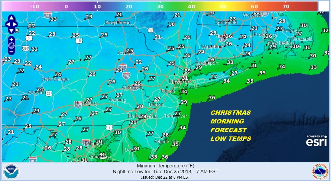
There could be some lingering snow or rain showers Christmas Eve morning before the low moves away. Some sunshine should break through the clouds in the afternoon with highs in the upper 30s and lower 40s. Monday night should be clear and cold with most lows in the 20s by Christmas morning. Christmas day will be sunny and cold with highs mostly in the 30s to near 40.
MANY THANKS TO TROPICAL TIDBITS FOR THE USE OF MAPS
Please note that with regards to any tropical storms or hurricanes, should a storm be threatening, please consult your local National Weather Service office or your local government officials about what action you should be taking to protect life and property.

