Snow Chances Going Forward
Snow Chances Going Forward
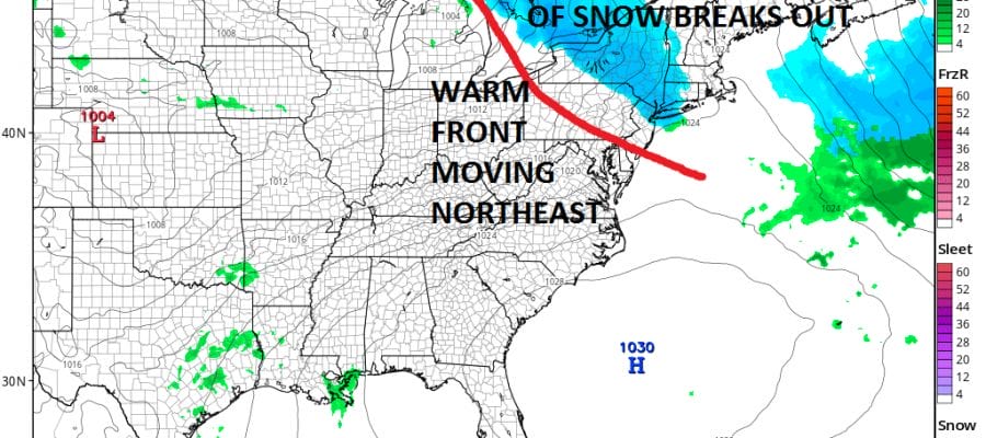
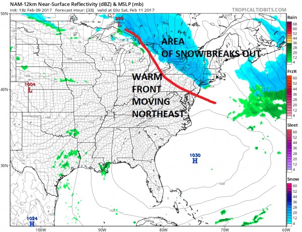
One of the many lessons from a storm like this is that the long range doesn’t always show these things. This storm burst on the scence over the last 5 days or so and once again of all the models, the NAM performed the best and led the way followed by the RGEM which did quiet well showing the nature of the cyclone and where the heaviest snow would fall. Other models seem to be in catch up model Now there are some chances going forward. The first is Friday night into Saturday morning as a warm front sets up to our south and an area of snow breaks out ahead of it.
This has the potential to produce a coating to an inch or two from Northern New Jersey to Southern New England and Long Island. For New Jersey I would cover for areas north of Route 78. After this the next chance may be late Sunday or Sunday night.
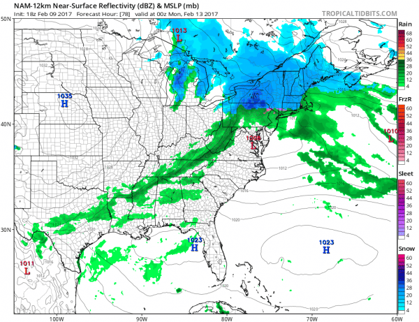
The second one on Sunday is a bit more complex. In some way it looks like what we just went through. However there are some notable differences here. We have a wave moving across Virginia and headed off the Maryland coast. Weather models handle this is all sorts of ways including the European model which bombs this into a major storm near Cape Cod on Monday. All of this is occuring with a crashing North Atlantic Oscillaion which favors a southern track. Models seem to be trending this way. However there are also issues regarding cold air and if there would be enough to cause and issue. The strengthening blocking pattern has me intrigued so I will be watching. For now lets focus on the warm front tomorrow night that looks minor and lets see what the next run of the NAM tonight has to say for itself. The longer term pattern looks active and blocky so don’t be surprised if we get more chances in the next few weeks.
MANY THANKS TO TROPICAL TIDBITS FOR THE WONDERFUL USE OF THE MAPS
SNOW REMOVAL COMPANIES FOR YOUR WINTER NEEDS
LONG ISLAND ROCKLAND COUNTY Connecticut
ROCKLAND COUNTY TRI STATE SNOW REMOVAL JOHNSTOWN PA
FiOS1 News Weather Forecast For Long Island
FiOS1 News Weather Forecast For New Jersey
FiOS1 News Weather Forecast For Hudson Valley
NATIONAL WEATHER SERVICE SNOW FORECASTS
LATEST JOESTRADAMUS ON THE LONG RANGE
Weather App
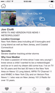
Don’t be without Meteorologist Joe Cioffi’s weather app. It is really a meteorologist app because you get my forecasts and my analysis and not some automated computer generated forecast based on the GFS model. This is why your app forecast changes every 6 hours. It is model driven with no human input at all. It gives you an icon, a temperature and no insight whatsoever.
It is a complete weather app to suit your forecast needs. All the weather information you need is right on your phone. Android or I-phone, use it to keep track of all the latest weather information and forecasts. This weather app is also free of advertising so you don’t have to worry about security issues with your device. An accurate forecast and no worries that your device is being compromised.
Use it in conjunction with my website and my facebook and twitter and you have complete weather coverage of all the latest weather and the long range outlook. The website has been redone and upgraded. Its easy to use and everything is archived so you can see how well Joe does or doesn’t do when it comes to forecasts and outlooks.
Just click on the google play button or the apple store button on the sidebar for my app which is on My Weather Concierge. Download the app for free. Subscribe to my forecasts on an ad free environment for just 99 cents a month.
Get my forecasts in the palm of your hand for less than the cost of a cup of Joe!

