DOWNLOAD MY NEW FREE JOESTRADAMUS WEATHER APP FOR ALL DEVICES
THE APP IS ABSOLUTELY FREE TO ALL BUT CONSIDERING SUBSCRIBING TO PATREON FOR A WEATHER EXPERIENCE FREE OF ADS, EXCLUSIVE VIDEOS FOR MEMBERS ONLY AND MUCH MORE…STARTS AT $2 A MONTH..MESSAGE ME AT ANY TIME
Snow Chance Continues for Wednesday Night Into Thursday
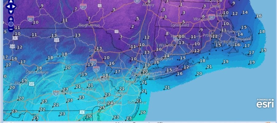
Cold Night Ahead Teens & Some Single Digits By Morning
I’m looking at everything this afternoon and thinking that it is probably better to just continue to roll along with my original thinking. We are still seeing the back edge of the weekend fierce storm over New Foundland. It is still churning away but at least the winds while gusty are way down from yesterday. The US satellite shows clouds across the Gulf States with a weak low there. To the north clouds lie from the Great Lakes west to the Northwest US as snow is streaking across the Plains.
EASTERN SATELLITE

REGIONAL RADAR

Radars remains silent today so at least that is out of the equation tonight which should be clear for most of the night though some clouds will come in late tonight. Temperatures will be cold with most lows in the teens to near 20 and some single digits are likely in areas well north and west of the coast especially where winds drop off.

Wednesday some snow (at least aloft) will show up in the form of a narrow finger reaching across Northern Pennsylvania into Northwest New Jersey. This should not amount to much. Then we have the main system moving into Pennsylvania. The low in the Gulf of Mexico meanders northeastward to off the North Carolina coast. The main area of snow will be Wednesday night into Thursday morning. Weather models have been shifting around keeping more of the snow to the north in recent runs. However the old storm to the northeast might still have a card or two to play here and since I can’t rule out a slight shift to the south at this point. I am leaving my forecast call from yesterday alone.
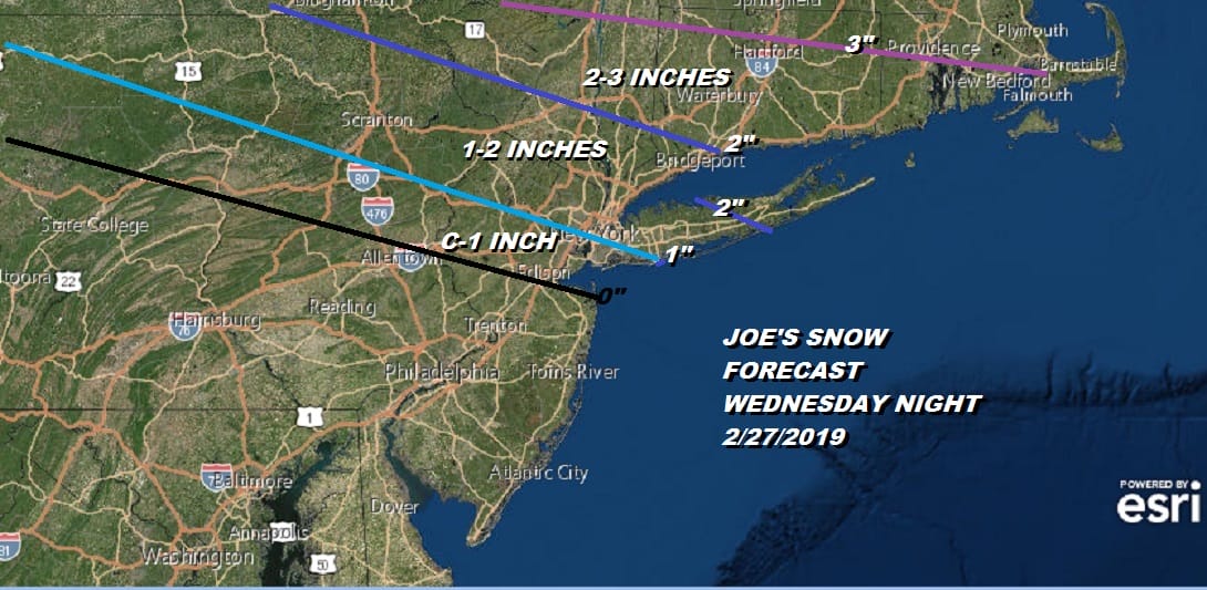
Since for most of the area we are talking about a coating to an inch or two at most, this is not worth expending too much energy trying to get the flake count right. All of this sticks with temperatures Wednesday and Wednesday night just in the 20s. A little fluff factor could play into this inland. It is hard to believe that the lack of snow this season is leading us to count flakes but that is where we are with all of this. There is also much that is unclear regarding the weekend and early next week with weak systems in play and a very messy upper air pattern overall.
We will address the weekend and the long range in a JOESTRADAMUS post later today.
MANY THANKS TO TROPICAL TIDBITS FOR THE USE OF MAPS
Please note that with regards to any tropical storms or hurricanes, should a storm be threatening, please consult your local National Weather Service office or your local government officials about what action you should be taking to protect life and property.


