Slow Warmup Into Thursday But Front Could Bring Rain Ice Snow
Thursday Night Into Friday

Weather in 5/Joe & Joe Weather Show Latest Podcast
Slow Warmup Into Thursday But Front Could Bring Rain Ice Snow
Thursday Night Into Friday
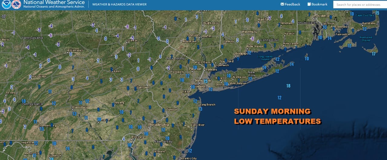
We hit absolute bottom today as far as temperatures are concerned. Morning lows across the region finished in the single digits to around 10. There were even a well inland few places where temperatures went below zero. However the weekend storm is now long gone and we are going to see sunshine today. Winds will slowly ease and temperatures this afternoon will be in the 20s. Relief is where you find it.
SATELLITE

WEATHER RADAR

Often times after big storms the cold trough pattern in the east pulls out, at least temporarily and that is what is happening in this case. Skies will be clear tonight with lows in the single digits to mid teens. If winds drop off to calm, with the deep snow cover it is not out of the question to see some spots below zero. The recovery in temperatures continues on Monday with sunshine taking highs back into the 30s. It appears that any onshore low we have Tuesday and Wednesday will produce some clouds but we are thinking that there should be enough dry air to allow for some sunshine on Tuesday and no worse than mostly cloudy on Wednesday. Highs will be in the mid to upper 30s Tuesday and into the 40s on Wednesday.
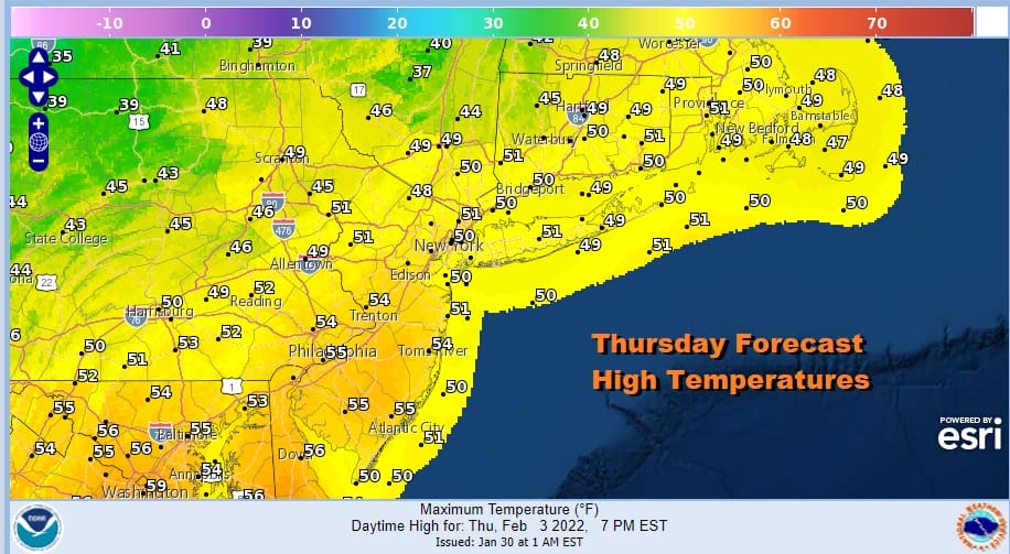
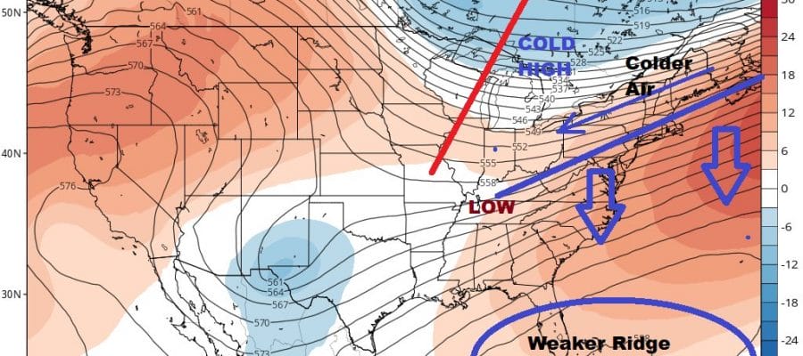
Thursday is the day everyone seems to be talking about but unfortunately it is going to come with rain. Highs will reach the upper 40s to some middle 50s to the south. We talked about an approaching cold front for the end of the week in last night’s post and that we needed to watch the strength of the ridge off the Southeast US coast. There was a chance that ridge would be weaker than advertised and that it seems that it is going to be weaker.

Rain will come in for Thursday with warm temperatures but a cold front will sink southward Thursday night. This is a situation where we have a warm southwest flow aloft, a very cold high over the Great Lakes, and the potential for a developing wave on the front after it has passed and moved to the south. It would be a matter of timing but if the southeast ridge is indeed weaker and flatter than modeled, rain will change over to freezing rain and then to snow from north to south Thursday night before it all comes to an end Friday morning. This is a different weather set up that what we just experienced. We won’t have much of a developing low but the overrunning of warm air over cold air could produce a robust amount of precipitation. It will come to an end on Friday and weather conditions will improve later Friday into the weekend.
BE SURE TO DOWNLOAD THE FREE METEOROLOGIST JOE CIOFFI WEATHER APP &
ANGRY BEN’S FREE WEATHER APP “THE ANGRY WEATHERMAN!
MANY THANKS TO TROPICAL TIDBITS & F5 WEATHER FOR THE USE OF MAPS
Please note that with regards to any severe weather, tropical storms, or hurricanes, should a storm be threatening, please consult your local National Weather Service office or your local government officials about what action you should be taking to protect life and property.


