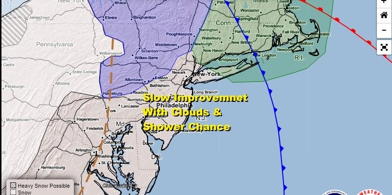
Slow Improvement Chillier Temperatures Mostly Dry Through Friday

Weather in 5/Joe & Joe Weather Show Latest Podcast
Slow Improvement Chillier Temperatures Mostly Dry Through Friday
Yesterday’s storm system and severe weather fireworks have now moved away to the northeast capping a month where we had 3 severe weather outbreaks. For November this is highly unusual but then again it is 2020. Now we begin December which has a reputation for being a stormy month at times. It is also the month that usually brings the first accumulating snows to the Northeast and Mid Atlantic states. Today is a clean up day atmospherically as we have leftover clouds to get through. There will be a gusty breeze and the chance for the odd passing shower around midday or early afternoon.
SATELLITE

REGIONAL RADAR

While the surface low has moved to the north, the strong upper air system remains to the west this morning and is evident by the rotation on the regional radar. Much of what you see in Western Pennsylvania and into Ohio and West Virginia is snow. Some scattered rain shower will pop up later today as the upper low moves to the east.
LOCAL RADAR NEW YORK CITY

LOCAL RADAR PHILADELPHIA


Temperatures are at the highs for the day in the morning as we still have the leftover air from yesterday and overnight. Look for temperatures to fall from the 50s into the 40s as the day wears on. Skies should partially clear tonight but there will still be a gusty wind. Lows by morning. will be in the upper 20s to mid 30s.
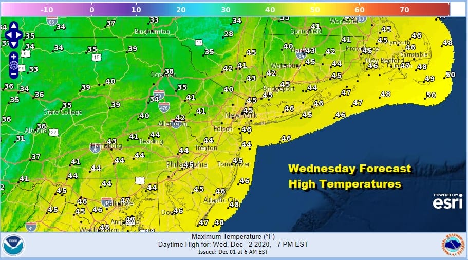
Wednesday look for more sunshine and fewer clouds and a little less wind. Highs will be mostly in the 40s and then we head down to the 20s to lower 30s Thursday morning. Thursday looks nice and sunny with highs in the 40s. We will do it again on Friday with sunshine and highs again in the 40s.
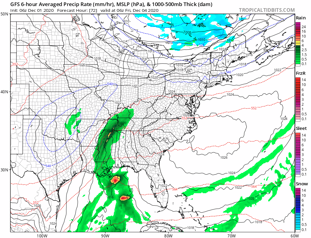
We seem to be back to the idea of a second storm system for this weekend on the GFS model while some of the others are going along the same idea. The European model is in its own little world from overnight showing only a weak system for the weekend well to the south and something more potent for the middle of next week. There is so much energy running around on two separate jet streams and models are having a hell of a time figuring out the timing of these systems and how they interact with each other. For now we will go for increasing clouds Saturday with rain on Sunday and come back to this later today as we see how models handle all these timing issues.
BE SURE TO DOWNLOAD THE FREE METEOROLOGIST JOE CIOFFI WEATHER APP &
ANGRY BEN’S FREE WEATHER APP “THE ANGRY WEATHERMAN!
MANY THANKS TO TROPICAL TIDBITS FOR THE USE OF MAPS
Please note that with regards to any severe weather, tropical storms, or hurricanes, should a storm be threatening, please consult your local National Weather Service office or your local government officials about what action you should be taking to protect life and property.


