
Heavy Rain Severe Weather Risk Strong Winds Coast Storm Moving Northward

Weather in 5/Joe & Joe Weather Show Latest Podcast
Heavy Rain Severe Weather Risk Strong Winds Coast Storm Moving Northward
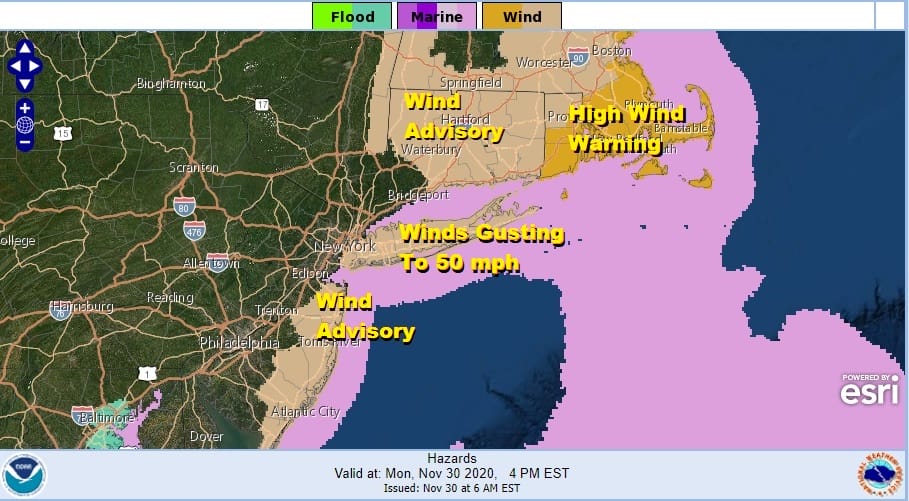
Our work week starting, month ending, storm is underway and it will come with heavy rains, strong winds along the coast, and severe weather. Rainfall amounts of up to a couple of inches are possible. Wind Advisories are up for the coastal counties of New Jersey and Long Island. Most of Connecticut is under a wind advisory and we have Southeastern New England under a high wind warning.
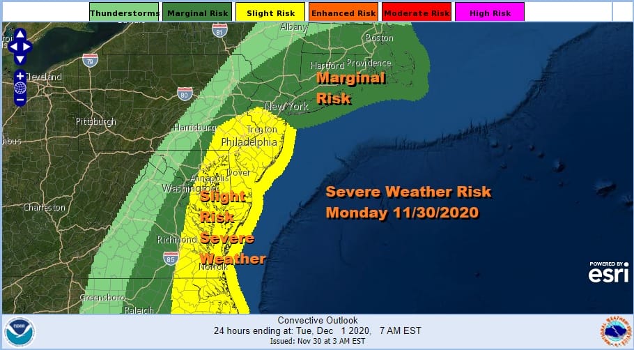
The Storm Prediction Center has pushed the slight risk area for severe weather further north into New Jersey, almost reaching NYC. Marginal risk continues further north into New England. Low pressure in Central North Carolina moves rapidly northward into North Central Pennsylvania. Tropical air surges up the coast and we have a cold front swinging east. All of this adds up to thunderstorms with the highest risk late morning into this afternoon.
SATELLITE

REGIONAL RADAR

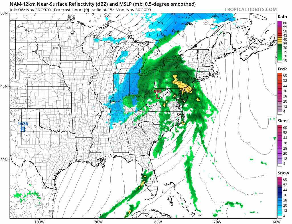
Heavy rain is moving south to north on the regional and local radars The rain has ended in Southern Virginia and North Carolina so this adds up to 6 to 8 hour of rough weather . Thunderstorms should start to pop up on the local radars shortly.
LOCAL RADAR NEW YORK CITY

LOCAL RADAR PHILADELPHIA


High temperatures will reach up into the 60s before the front passes. Later this afternoon wind gusts to 50 mph will kick in which justifies the wind advisories.
We will use the NAM model today as the best idea for how things play out today. The first frame is 10am today, and the last is 1am Tuesday. You can follow the heavy rain on its track up New Jersey and into New England and it is in this we will see the heavy to possibly severe thunderstorms.
Once the rain ends, weather conditions will improve slowly overnight. Tuesday will be a breezy chilly day with variable clouds and the risk of a passing shower. Highs will be in the 40s for the most part though there could be a few leftover 50s during the early morning hours on Tuesday.

The rest of the week looks relatively calm with dry and chilly conditions. We should see some sun Wednesday and Thursday with highs in the 40s and lows in the 20s to mid 30. Weather models have backed off on the idea of a second strong storm for this coming weekend which is going to impact how the pattern changes going forward. We will take a closer look at the long range later today.
BE SURE TO DOWNLOAD THE FREE METEOROLOGIST JOE CIOFFI WEATHER APP &
ANGRY BEN’S FREE WEATHER APP “THE ANGRY WEATHERMAN!
MANY THANKS TO TROPICAL TIDBITS FOR THE USE OF MAPS
Please note that with regards to any severe weather, tropical storms, or hurricanes, should a storm be threatening, please consult your local National Weather Service office or your local government officials about what action you should be taking to protect life and property.


