Slow Improvement But Showers Thunderstorms Possible Into This Evening
While the worst of it from last nights heavy rain and wind are long gone we still have some remaining issues this afternoon and evening. A strong upper low is moving across the area this afternoon creating a rather unstable atmosphere. This is causing everything from self destructing sunshine where the sun comes out only to cause more clouds to develop. We also have this cold unstable air aloft which is causing some scattered showers and thunderstorms to pop up.
SATELLITE

REGIONAL RADAR

You can see the counter clockwise rotation going on near our coastline thanks to that upper low and the resulting showers and thunderstorms that develop. Not everyone sees this activity. We have all so see a couple of severe thunderstorm warnings and special marine warnings from these storms so don’t be shocked if an isolated cell attempts to develop strongly. Temperatures are in the 60s for the rest of the day.
LOCAL RADAR NEW YORK CITY

LOCAL RADAR PHILADELPHIA


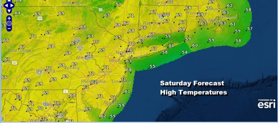
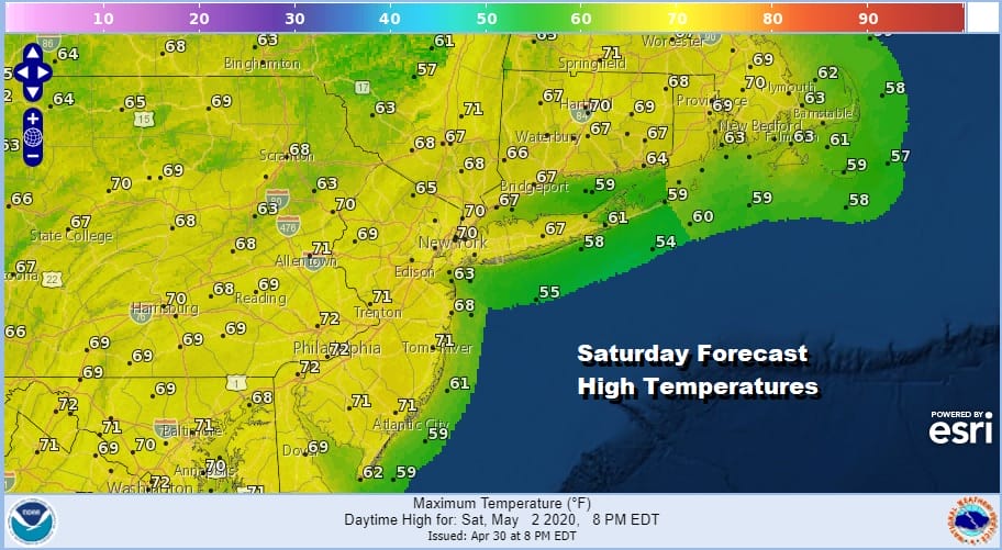
We should start to see improvement later tonight as skies clear with most lows in the 40s. Then we are seeing up for decent Saturday of sunshine with perhaps some late day high clouds. Temperatures will respond to the sunshine by reaching the upper 60s and lower 70s.
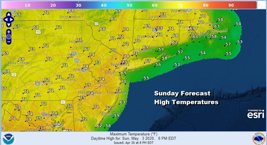
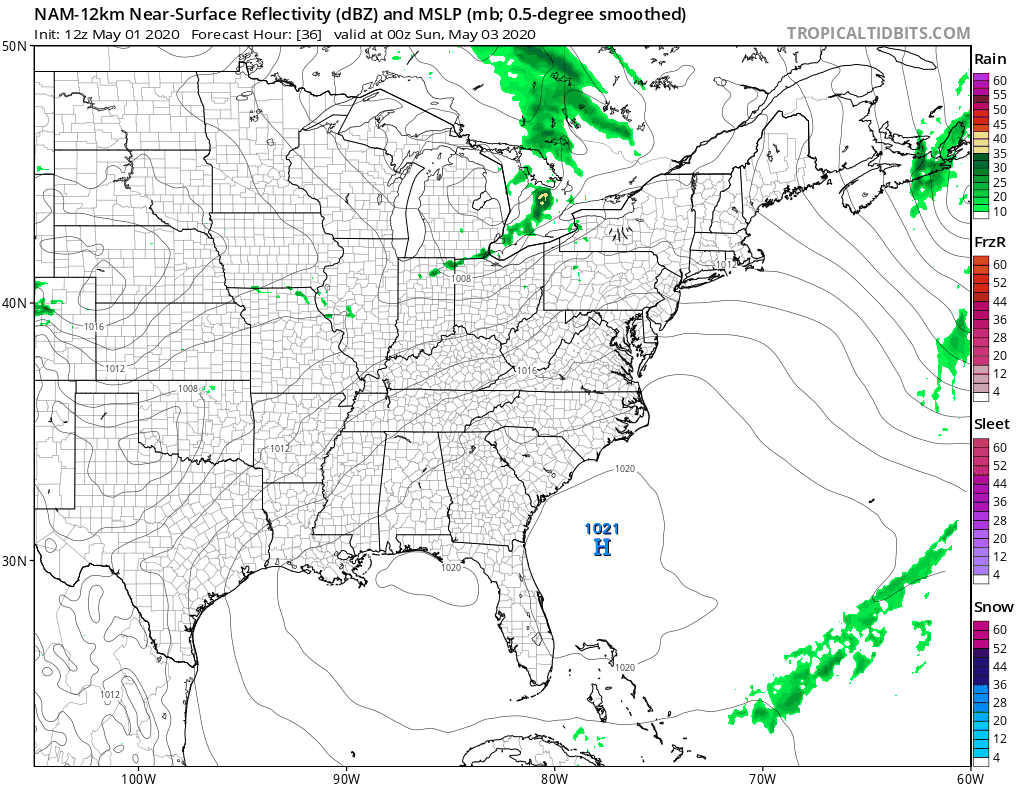
We do have a bit of a complication for Saturday night and Sunday with a weak warm front cold front combo playing through. This could lead to a few scattered showers Saturday night but then we should go to a mix of sun and clouds on Sunday. Sunday’s highs will be in the low to mid 70s in many areas if we get enough sun to heat things up.
We could see maybe another scattered shower or thunderstorm Sunday night and then cooler air from Canada builds in for early next week. We should see some sunshine returning Monday with a gusty wind and highs just in the 60s.
Next week our cooler than normal pattern continues. Monday and Tuesday look to be dry and cooler than average. Then here comes the onshore flow with another low going to our south. This brings rain and raw conditions Tuesday night into Wednesday. Improvement should settle in for late next week.
BE SURE TO DOWNLOAD THE FREE METEOROLOGIST JOE CIOFFI WEATHER APP &
ANGRY BEN’S FREE WEATHER APP “THE ANGRY WEATHERMAN!
MANY THANKS TO TROPICAL TIDBITS FOR THE USE OF MAPS
Please note that with regards to any severe weather, tropical storms, or hurricanes, should a storm be threatening, please consult your local National Weather Service office or your local government officials about what action you should be taking to protect life and property.


