Heavy Rains Flash Flooding Gusty Winds Weather Improves Next Few Days
Flood Watch New Jersey & Hudson Valley West of the Hudson River
High Wind Warning New Jersey to Delaware and Eastern Maryland
It is a busy evening as we have been watching a very slow moving cold front. Heavy rains have fallen over much of Pennsylvania today on the order of several inches in some places and still counting. Flood Watches continue across Eastern Pennsylvania and cover most of New Jersey. The Hudson Valley west of the Hudson River has been added to the flood watch zone. High Wind Warnings continue until 8pm from Delaware to most of Central and South Jersey. Wind Advisories are posted for Southeast Pennsylvania as well as areas around NYC, Long Island and Southern Connecticut. The wind advisories in effect until midnight.
SATELLITE
REGIONAL RADAR
Regional radar shows an arm of rain with the western edge in Central Pennsylvania and the eastern edge about to reach NYC. Gradually this area will shift eastward though it will take all night for the rain to move across and exit Friday morning. Heavy rains extend south to Delmarva but have not moved off the Virginia/North Carolina coast.
LOCAL RADAR NEW YORK CITY
LOCAL RADAR PHILADELPHIA

Most areas will get an inch and half to two and a half inches of rain. It could be a bit less along the immediate coast but with the ground saturated flooding is likely in some areas especially the usual vulnerable spots.
While the rain area has barely moved all day it does start to move a little faster and that’s why the coast gets less. It should be all offshore by daybreak. Then we can look ahead to slow improvement on Friday with leftover clouds, some breaks of sunshine, and the chance for a scattered shower or thunderstorm. Highs will be in the 60s.
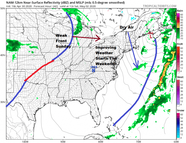
We should see improving weather conditions for Saturday for sure with sunshine and just a few passing clouds. Just having the sun out will send temperatures up into the 60s everywhere and we could see warm spots reach middle to upper 60s if we grind out enough sunshine. Sunday brings the next weak cold front and fortunately it doesn’t have much to work on.
We will call it a mix of sun and clouds for Sunday with the risk of a passing shower. Highs will be in the upper 60s and lower 70s in many areas. Again if we can squeeze out enough sun more areas could touch 70. Many areas especially from NYC north and east have not seen a 70 degree high yet which is unusually late. By now most areas would have seen their first 70 degree days but this year thanks to the chilly pattern this month, the warmer temperatures have been slow to come northward. Monday and Tuesday look dry and cool with the next chance for rain coming Wednesday as low pressure heads our way across the Ohio Valley and makes another run offshore.
BE SURE TO DOWNLOAD THE FREE METEOROLOGIST JOE CIOFFI WEATHER APP &
ANGRY BEN’S FREE WEATHER APP “THE ANGRY WEATHERMAN!
MANY THANKS TO TROPICAL TIDBITS FOR THE USE OF MAPS
Please note that with regards to any severe weather, tropical storms, or hurricanes, should a storm be threatening, please consult your local National Weather Service office or your local government officials about what action you should be taking to protect life and property.


