Siberia Invades Europe As Strong Blocking Develops Long Range
Siberia Invades Europe As Strong Blocking Develops Long Range
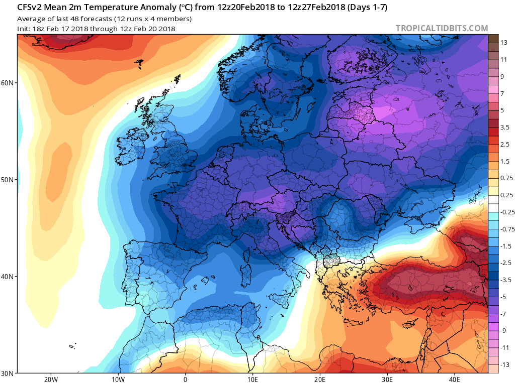
The major pattern change that is getting underway will have its first impact across Europe. The next 2 weeks will be especially cold as blocking develops in the northeast Atlantic and bitter cold air from Siberia is swept westward into Western Europe and the British Isles. Virtually the entire continent will experience temperatures 5 to 10 degrees below average and in some cases even more. This is all part of the developing block which first will be “east based” and later in the forecast period the block will migrate westward across the North Atlantic. This will have large implication on our weather as we head into March.
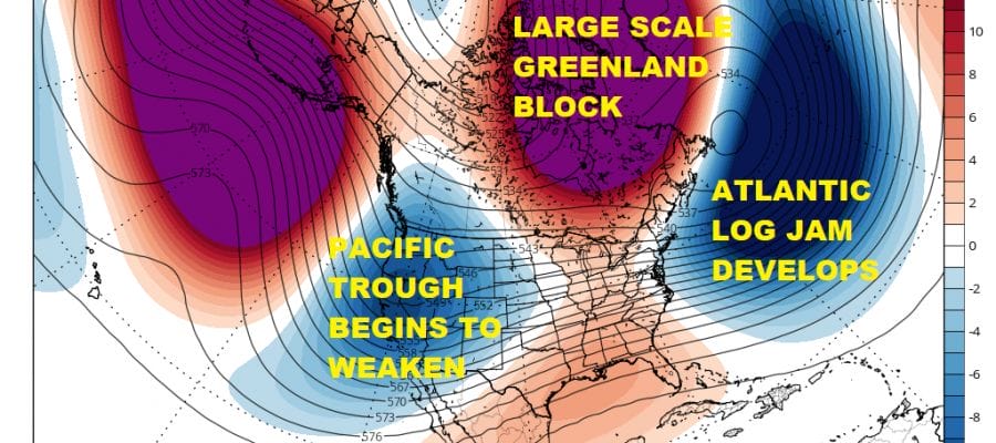
CLIMATE MODELS LONG RANGE FEBRUARY 27 TO MARCH 6 2018
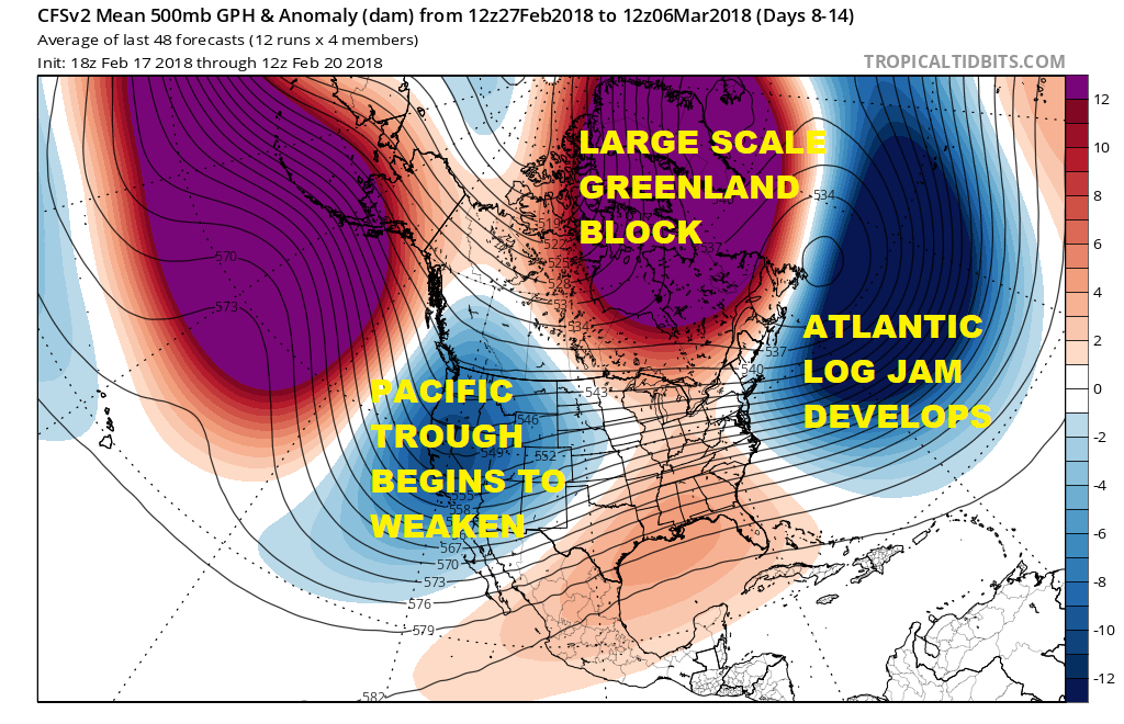
I’m using the climate change models tonight to show how the the block is forecast to move to the west. This creates a blocking signature across the Atlantic Ocean as storms log jam south of 50 degrees north. This will being colder air into the Eastern US over time however at this stage it does not appear to be anything too extreme. Meanwhile in the west some changes are underway there as well as the trough in the west begins to weaken and pressures slowly but surely begin to rise in Northwestern Canada. This will be critical to any potential storm threat and tracks going forward. I also believe this will create a window of opportunity for snow lovers down the road though the specifics of this remain to be seen at the moment.
FREEZING RAIN THREAT WELL NORTH & WEST OF COASTAL AREAS
THURSDAY & FRIDAY
Before this happens however there is some short term activity to deal with. Our run of warm weather continues on Wednesday with another run at record highs into the 70s in many locations. All of this will depend on how fast low clouds and fog burn off on Wednesday but it seems we should have greater success in most areas so there really isn’t anything to stop temperatures from headed higher than Tuesday other than sea breezes along south facing shorelines. Then a cold front moves through early on Thursday. This sets up the first of several systems that will be impacting our weather Thursday right through the weekend. Low level cold air will push southward. Temperatures on Thursday will be in the 30s and 40s. For areas in Northern Pennsylvania north of Route 80 and in the Hudson Valley north of Route 84 this could mean a wintry mix of freezing rain sleet and some snow and then spreading into Connecticut along and north of Route 84.
GFS MODEL FORECAST THURSDAY 1PM FEBRUARY 22

For the areas mentioned above if it is a little colder and wet snow becomes more dominant, a coating to an inch or two can’t be ruled out. The cold high will move into New England on Friday as a second wave of moisture comes in and here too there could be some freezing rain. Both areas won’t produce much in terms of volume but it will make travel a bit difficult in any event especially where freezing rain is the bigger issue. For the coast it is all rain and then over the weekend even more rain is forecast for all areas as low pressure heads out of the Gulf States and toward the Great Lakes.
SHOP THE JOESTRADAMUS STORE
MANY THANKS TO TROPICAL TIDBITS FOR THE WONDERFUL USE OF THE MAPS

GET JOE A CIGAR IF YOU LIKE!
FiOS1 News Weather Forecast For Long Island
FiOS1 News Weather Forecast For New Jersey
FiOS1 News Weather Forecast For Hudson Valley
NATIONAL WEATHER SERVICE SNOW FORECASTS
LATEST JOESTRADAMUS ON THE LONG RANGE