
Showers Tonight Into Monday Morning.
Colder Into Wednesday Thanksgiving Looks Good

Weather in 5/Joe & Joe Weather Show Latest Podcast
Showers Tonight Into Monday Morning.
Colder Into Wednesday Thanksgiving Looks Good
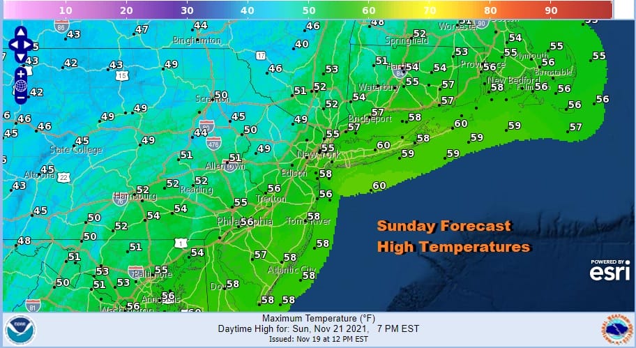
Two cold fronts basically bookend the week. The first front is coming through tonight into Monday morning. The second will come Friday. Each front will produce some showers. Each front will be followed by colder air that will hang around for a couple of days. On the whole this week looks good with minimal weather related travel issues. Today we are seeing sunshine. There have been some patchy clouds that have moved through and more clouds will come in later on. Temperatures this afternoon are rebounding nicely and highs will reach the middle to upper 50s in many areas.
SATELLITE

WEATHER RADAR

As the warmer air arrived this morning it produced a couple of showers on the radar, mostly aloft. Now there is a break in the action and the second area in Western Pennsylvania won’t get here until after sunset. In fact most of the rain will fall after 8pm and will be all gone by 7am Monday. Rainfall amounts will likely be a quarter of an inch or less.

We will be in the 50s early in the day but once the front passes temperatures should either hold or ease back into the 40s on a gusty northwest wind. Leftover clouds will give way to some sun. Then we will have a cold night Monday night into Tuesday morning with lows in the mid 20s to lower 30s under clearing skies.

Tuesday will likely be the coldest day of the week. We are going to see sunshine Tuesday with a gusty wind. Highs will be just into the 40s and another cold night is in store for Tuesday night.

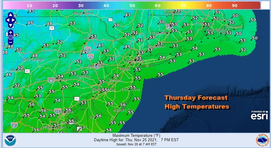
There are no issues Wednesday. We will see sunshine, less wind and highs will reach the mid and upper 40s. Thursday Thanksgiving Day should be a very nice day indeed with sunshine and highs back into the 50s!
Friday brings another cold front through the northeast and it will likely behave much like the one for tonight into Monday morning. Some showers will develop Thursday night and last into part of Friday. Then colder air comes in behind it for the weekend. We do not see any weather systems of importance other than these cold fronts over the next 7 or 8 days.
BE SURE TO DOWNLOAD THE FREE METEOROLOGIST JOE CIOFFI WEATHER APP &
ANGRY BEN’S FREE WEATHER APP “THE ANGRY WEATHERMAN!

MANY THANKS TO TROPICAL TIDBITS & F5 WEATHER FOR THE USE OF MAPS
Please note that with regards to any severe weather, tropical storms, or hurricanes, should a storm be threatening, please consult your local National Weather Service office or your local government officials about what action you should be taking to protect life and property.


