Showers Thunderstorms Into Wednesday Morning Cooler Late Week Weekend Iffy

Weather in 5/Joe & Joe Weather Show Latest Podcast
Showers Thunderstorms Into Wednesday Morning Cooler Late Week Weekend Iffy
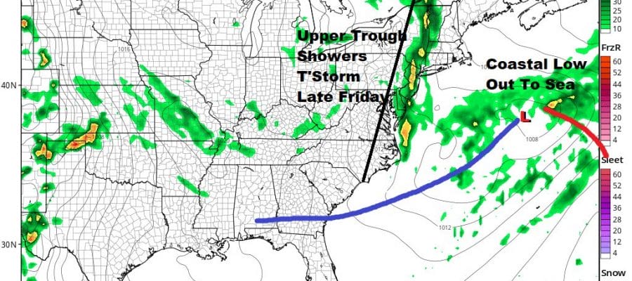
New Jersey and points south got lucky today as the warm front nudged north. Southern New England and Long Island did not with clouds all day long until the late afternoon. Now it is on to getting this warm front through but it will wobble again as low pressure develops to the west and south. That will bring in the chance for a shower or thunderstorm overnight but the better chance will be Wednesday morning into the afternoon. Temperatures overnight will be in the 50s.
SATELLITE

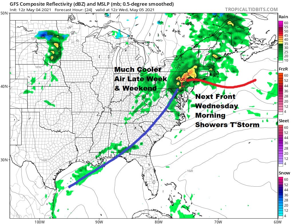
Wednesday we will see a developing low nearby with the warm front pushing north and the cold front pushing east. Look for some showers and maybe a thunderstorm or two into early afternoon until the front passes offshore. Leftover clouds should give way to some late day sun. Temperatures Wednesday will be in the 60s.
Thursday will be the best day of the week as we should have sunshine and while it may be a little breezy early on the winds should ease later in the day. Most highs will be in the 60s. Then we turn to Friday when a storm develops offshore but models seem to be slowing this system down as the upper trough over the Great Lakes swings east. We could stay dry for much of the day Friday with early sun and then arriving clouds. Highs will be just in the lower 60s at best. We will look for a few showers but the slowing trough means we could actually see clouds and showers linger for part of Saturday. Highs Saturday will be in the upper 50s and lower 60s.
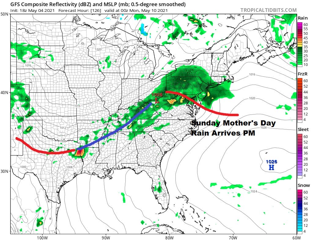
Latest model runs are suggesting 1 wave coming out of the west instead of 2. That means that we get rain arriving Sunday afternoon and it should be gone by Monday morning or shortly afterwards. The bad news is that the rain comes for Mother’s Day so take advantage of the dry morning. Temperatures Sunday might approach 60 but you can expect them to settle in the low to mid 50s once the rain arrives. Improving weather should follow for Tuesday into Wednesday though it remains cooler than normal.

BE SURE TO DOWNLOAD THE FREE METEOROLOGIST JOE CIOFFI WEATHER APP &
ANGRY BEN’S FREE WEATHER APP “THE ANGRY WEATHERMAN!
MANY THANKS TO TROPICAL TIDBITS FOR THE USE OF MAPS
Please note that with regards to any severe weather, tropical storms, or hurricanes, should a storm be threatening, please consult your local National Weather Service office or your local government officials about what action you should be taking to protect life and property.


