Rain Thunderstorms Today Thursday Nice Unsettled Friday Through Sunday

Weather in 5/Joe & Joe Weather Show Latest Podcast
Rain Thunderstorms Today Thursday Nice Unsettled Friday Through Sunday
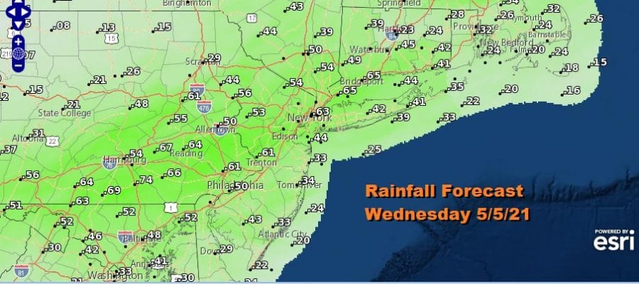
Low pressure and a cold front are on their way and the satellite picture shows lots of clouds. The radars are loaded to the southwest so that will be the story for today. It will be a cloudy rainy day though the rain will vary from place to place. Some areas from South Jersey southward get warm sectored and we have a marginal risk of severe weather in those areas. For everyone else we will watch for the heavier downpour or the chance for a general thunderstorm to be in the mix.
SATELLITE

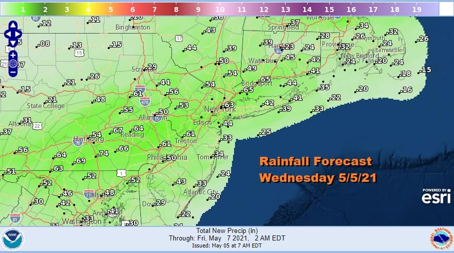
Temperatures today will top out mostly in the 60s. Some areas are already there and they will just hover while areas that are in the 50s this morning could nudge up a little higher. Rainfall amounts look to be on the order of about a half inch or so.
Rain will end from west to east mid to late afternoon. Then weather conditions will improve tonight as it turns breezy and cooler with most lows in the 40s. Thursday will be a nice day of sunshine but it will be cool with highs just into the 60s in most areas.
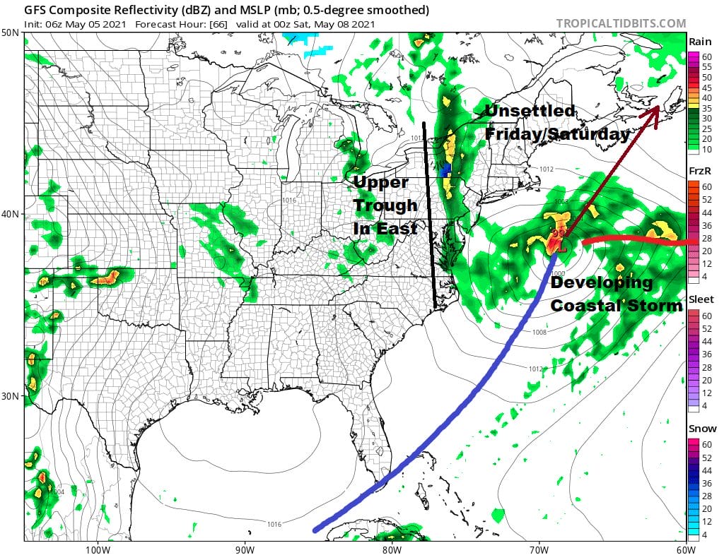
Friday brings some unsettled conditions. A coastal storm develops and intensifies as it heads northeast. This is not a problem here but we do have an upper trough that is diving southward from the Great Lakes and it sets up what looks like a rather bizarre stick of showers to the west. Trying to figure out the exact position of this upper trough is going to be tough. I’m taking a wait and see approach and calling for more clouds than sun on Friday and then throw in the risk for showers late in the day or Friday night. Highs will be in the 60s. This upper trough will be very slow to get out of the way and that will leave us in more clouds than sun for Saturday with the risk for scattered lingering showers. Highs will be in the 60s.
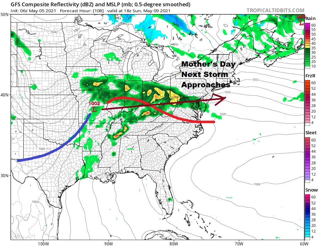
There is no rest for the weary as one system pulls out the next one is waiting in the wings. Models keep going back and forth on timing here so we will go with increasing clouds and rain developing from southwest to northeast during the afternoon and evening. Some areas from NYC north and east might see the rain hold off until Sunday night. Highs Sunday will just be in the upper 50s and lower 60s. It will be raw and rainy Sunday night into Monday before this system moves out and weather conditions improve behind it. The overall pattern remains cooler than average into and through much of next week.

BE SURE TO DOWNLOAD THE FREE METEOROLOGIST JOE CIOFFI WEATHER APP &
ANGRY BEN’S FREE WEATHER APP “THE ANGRY WEATHERMAN!
MANY THANKS TO TROPICAL TIDBITS FOR THE USE OF MAPS
Please note that with regards to any severe weather, tropical storms, or hurricanes, should a storm be threatening, please consult your local National Weather Service office or your local government officials about what action you should be taking to protect life and property.


