A Dry Nice Thursday But Weather Issues Return Friday Through Sunday

Weather in 5/Joe & Joe Weather Show Latest Podcast
A Dry Nice Thursday But Weather Issues Return Friday Through Sunday
Low pressure is heading out to the east and taking rain that moved through Northeastern Pennsylvania to Southern New England with it. This area stayed mainly in the 50s all day. To the south it was a better day from Southern Pennsylvania and Southern New Jersey southward as temperatures reached the 70s. Scattered thunderstorms will move out as well and we are on our way to clearing skies tonight with most lows in the 40s.
SATELLITE

Thursday remains a nice day and really the best day of this entire week with a good deal of sunshine. Temperatures will top out in the 60s. Enjoy it because a series of weather systems will be creating all sorts of issues and they will vary from place to place. Starting with Friday we will see perhaps a little early sun but clouds will increase rather quickly.
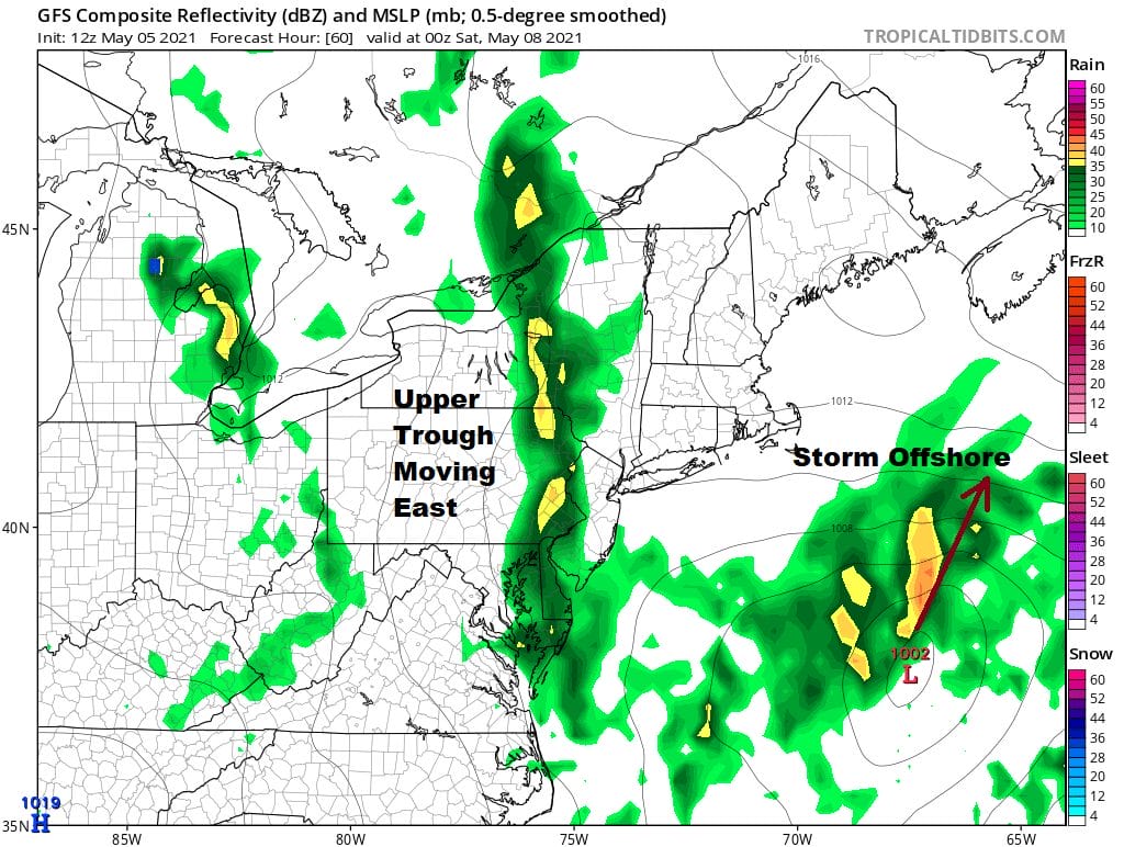
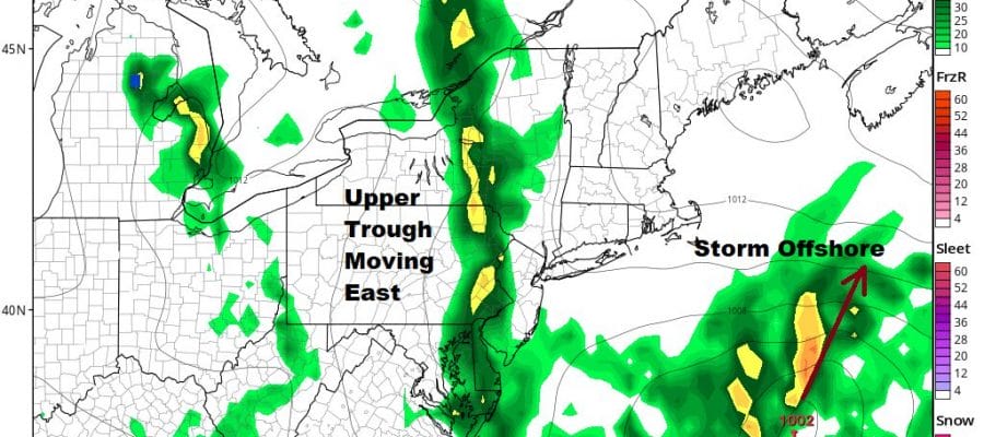
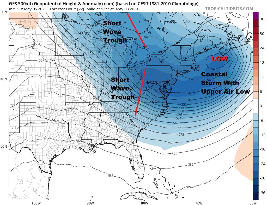
Friday’s issues are a result of a southern jet stream short wave trough that amplifies as it lifts northeastward. This creates a surface storm offshore. At the same time we have the northern part of the jet stream sending along energy and while the two streams remain separate, it means that we have to deal the slow process of getting two systems out of the way.
The troughs to the west will bring a north south band of showers which by Friday evening will line up from Upstate NY southward through Eastern Pennsylvania and New Jersey. Friday’s highs will be in the 60s.

That band of showers will pivot slowly eastward and weaken but the upper troughs to the west and north will cause showers to linger on Saturday. There will also be a lot of clouds around Saturday and highs will be just in the 50s. The showers will be scattered in nature so not everyone will participate leaving some of you dry much of the time. This system does finally pull out Saturday night but another system is right behind it for Sunday, Mother’s Day.
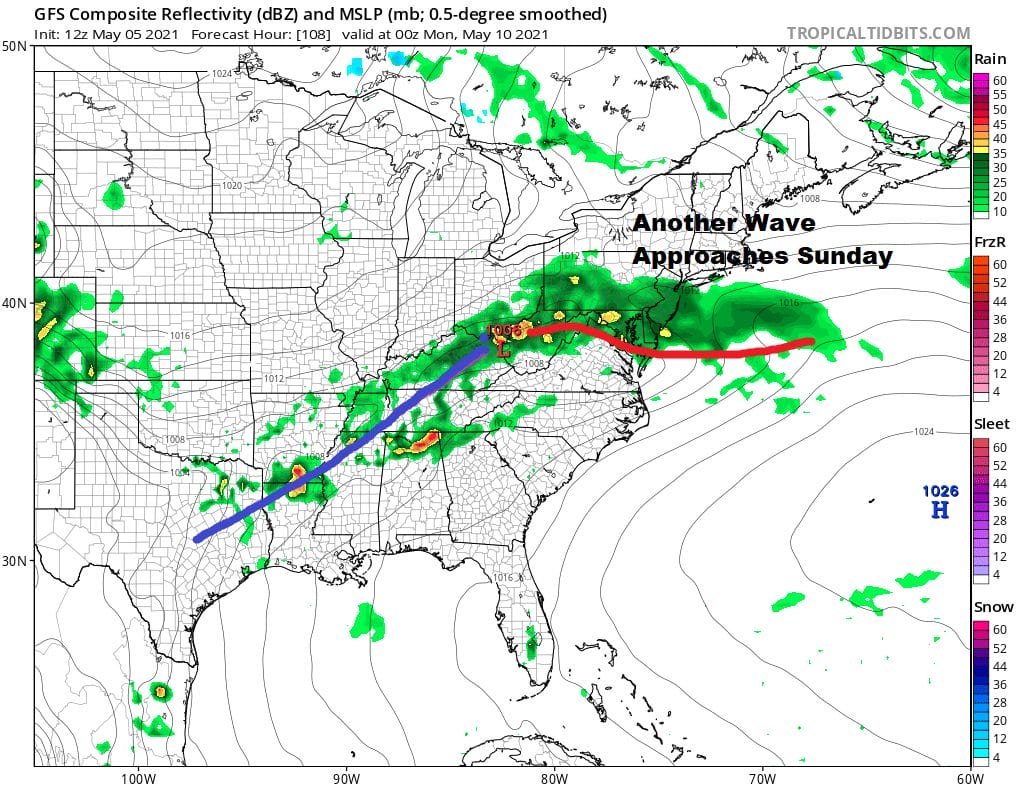
Another wave on a frontal boundary sets up for Sunday which means we may clear out Saturday night but we will cloud up quickly on Sunday with highs just in the 60s before rain arrives late in the day or for Sunday night. This low should slide southeast and offshore leading to improvement later Monday. There may be good news for next week as the northern jet suppresses everything and that could mean dry weather for much of next week. It will also mean a continuation of below average temperatures.

BE SURE TO DOWNLOAD THE FREE METEOROLOGIST JOE CIOFFI WEATHER APP &
ANGRY BEN’S FREE WEATHER APP “THE ANGRY WEATHERMAN!
MANY THANKS TO TROPICAL TIDBITS FOR THE USE OF MAPS
Please note that with regards to any severe weather, tropical storms, or hurricanes, should a storm be threatening, please consult your local National Weather Service office or your local government officials about what action you should be taking to protect life and property.


