
Showers Thunderstorms Colder Tuesday Rain Tuesday Night
SHOP THE JOESTRADAMUS STORE
Showers Thunderstorms Colder Tuesday Rain Tuesday Night
Now that we are in the warm sector of the next warm front cold front combination, the cold front begins its approach today with the chance for showers and thunderstorms this afternoon and evening. Temperatures today will reach the upper 60s to lower 70s. The satellite loop shows the front heading for the coast. The front produced severe weather yesterday in the Ohio Valley. It will be a bit weaker today but there still should be some showers with it before the front passes through this evening.
SATELLITE LOOP

REGIONAL RADAR

Regional radar is picking up on some showers and a few heavier downpours moving through the Western half of Pennsylvania while the local radars show some light showers running well ahead of the front.
LOCAL RADAR NEW YORK CITY

LOCAL RADAR PHILADELPHIA


Once the front passes it will turn colder for the rest of the week. Temperatures will be trending toward or even a little below average. Two waves of low pressure will be moving through. The first on Tuesday night into Wednesday morning will produce an area of rain and it will be a chilly rain at that.
SATURDAY MORNING FORECAST LOW TEMPERATURES
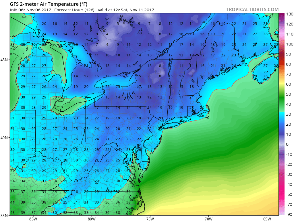
Once that goes by a second low on Thursday will produce another chilly rain before the coldest of the cold air arrives for Friday and Saturday. We will see temperatures drop to the 20s and lower 30s on both mornings though Saturday morning looks colder than Friday. This should be the first widespread freeze for our area.
 GET JOE A CIGAR IF YOU LIKE

FiOS1 News Weather Forecast For Long Island
FiOS1 News Weather Forecast For New Jersey
FiOS1 News Weather Forecast For Hudson Valley


