Gradual Chill Down Week Ahead After Warm Monday
Gradual Chill Down Week Ahead After Warm Monday
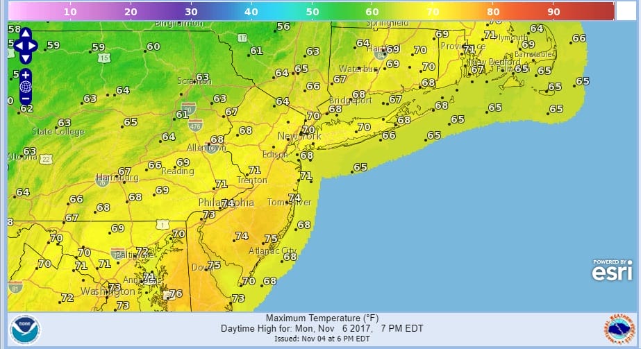
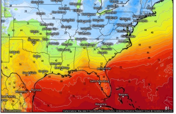
Before we begin what will be a gradual chill down we still have one more warm day to get through and Monday we will see warmer temperatures into the upper 60s and lower 70s. How much sun we get remains to be seen given that clouds will be stubborn. Radar shows showers and thunderstorms to the west in Western NY as the cold front is producing severe weather this evening across that area as well as the Ohio Valley.
SATELLITE LOOP

REGIONAL RADAR

Meanwhile overnight we have been seeing some light rain and drizzle underneath the radar so it is not showing up at all. Where you do see showers they are offshore and moving away to the northeast.
LOCAL RADAR NEW YORK CITY

LOCAL RADAR PHILADELPHIA


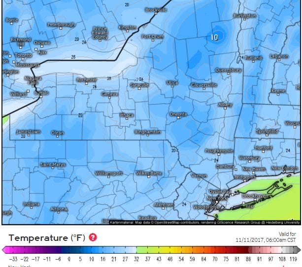
Monday afternoon look for showers and perhaps a thunderstorm as a cold front moves through. Once the front goes by we will see temperatures head lower by Tuesday morning. Two waves of low pressure will pass to our south with one going by Tuesday and the other on Thursday. It is the second one that brings a cold high our way Friday into Saturday. The European is the most aggressive with the cold air.
EUROPEAN FORECAST LOWS SATURDAY MORNING 11/11/2017
EUROPEAN MAPS COURTESY OF WEATHER.US


Right now as long as those waves pass to our south the week should be dry. The next chance for anything important precipitation wise may come later next Sunday into Monday.
 GET JOE A CIGAR IF YOU LIKE

FiOS1 News Weather Forecast For Long Island
FiOS1 News Weather Forecast For New Jersey
FiOS1 News Weather Forecast For Hudson Valley
NATIONAL WEATHER SERVICE SNOW FORECASTS
LATEST JOESTRADAMUS ON THE LONG RANGE


