
Coldest Air Autumn Arrives Friday Early Look
SHOP THE JOESTRADAMUS STORE
Coldest Air Autumn Arrives Friday Early Look
Latest weather model runs continue to show the coldest air of the fall season arriving late this week. With a strong high to our north and a northerly wind down the Hudson Valley we may see some very cold temperatures Friday night into Saturday morning. The numbers on the National Weather Service forecast map for Saturday morning could be too high by a few degrees and teens are possible away from the coast and warmer urban locations.
Coldest Air Autumn Arrives Saturday Morning Forecast Lows
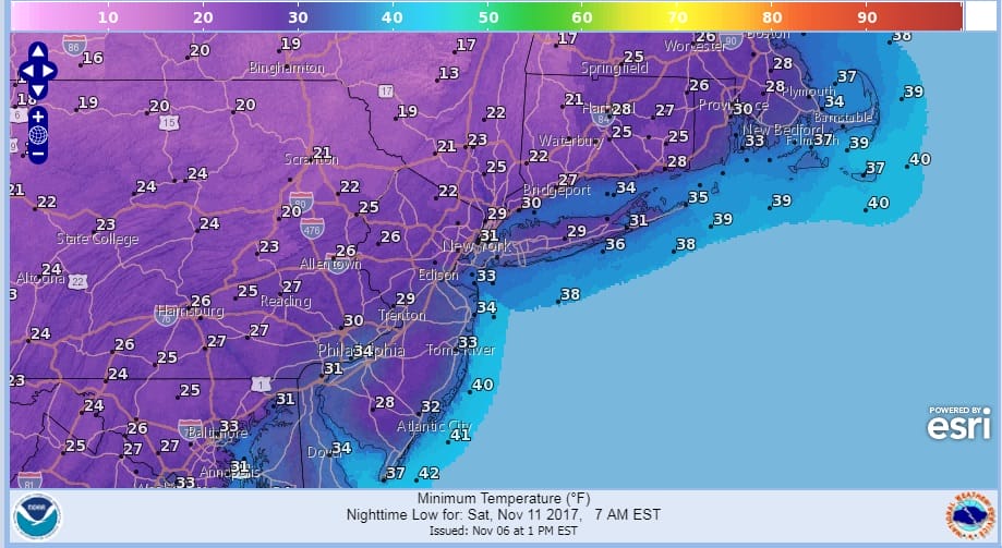
Both the GFS & the European show very low temperatures and a widespread freeze across the entire area.
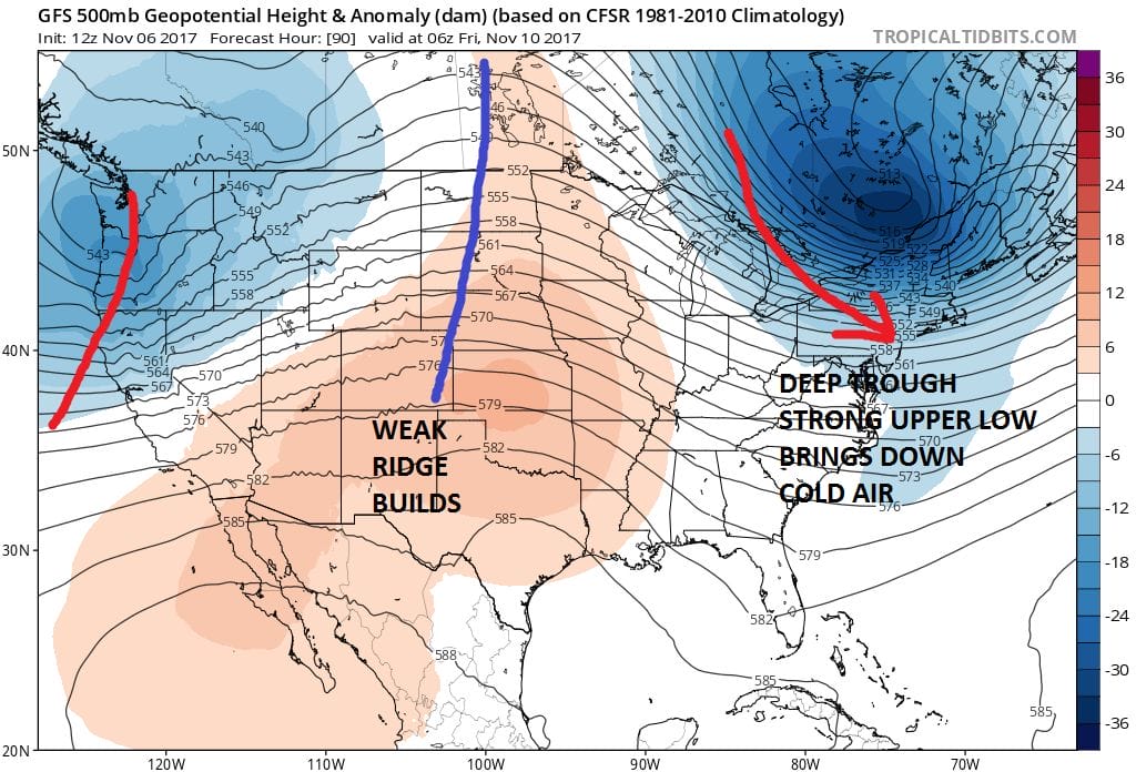
COLDEST AIR EUROPEAN MODEL FORECAST SATURDAY MORNING TEMPERATURES

MAP COURTESY OF WEATHER.US
Meanwhile this afternoon we are waiting for a cold front to pass through with some showers ahead of it as well as the isolated thunderstorm. Clouds continue to push east and showers will be arriving soon as the front passes.
SATELLITE LOOP

REGIONAL RADAR

LOCAL RADAR NEW YORK CITY

Once the front passes we will begin a gradual cool down through Thursday until the main push of cold air arrives. The jet stream is taking a sharp dip in the east bringing the cold air straight south out of Canada.
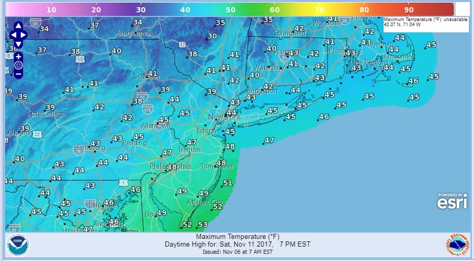
Temperatures on Saturday will have a tough time getting much above the lower 40s.
COLDEST AIR AUTUMN SATURDAY FORECAST HIGHS
Temperatures start to moderate some on Sunday and Monday. There is some question about whether the high to north moves out fast or lingers back westward as the European suggests. Weather models also differ about whether a cold rain arrives Sunday afternoon if the high pulls out or does it wait for energy to swing east as the European suggests with a low developing to our south later Monday into Tuesday.
 GET JOE A CIGAR IF YOU LIKE

FiOS1 News Weather Forecast For Long Island
FiOS1 News Weather Forecast For New Jersey
FiOS1 News Weather Forecast For Hudson Valley


