Showers Thunderstorm Possible By Morning
Lake Effect Snow Storm Parts of Upstate NY, NW Pennsylvania
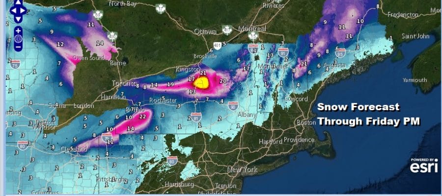
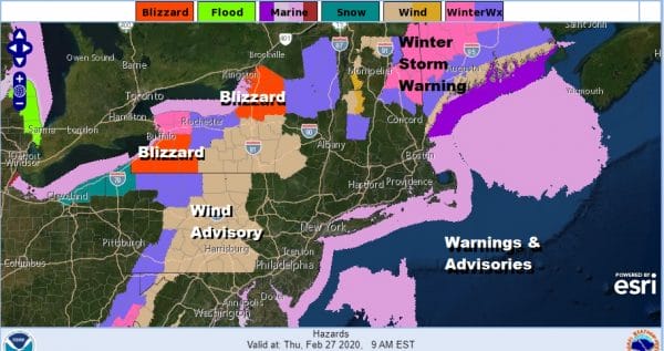
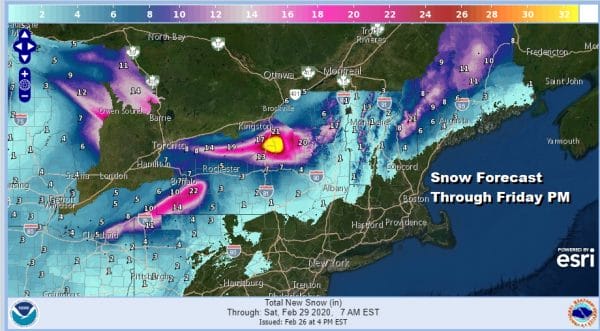
That map above is a very colorful picture of all the different things going on in the Northeast later tonight and Thursday and in some places continuing into Friday. We have everything from Wind Advisories to Lake Effect Snow Warnings to Blizzard and Winter Storm Warnings. This is actually going to be one busy lake effect snow event in NW Pennsylvania and Upstate NY. 1 to 2 feet of snow is likely on the lee shores of both Lake Erie and Lake Ontario.
Once again snow lovers seeing snow if you live in the urban corridor of I-95 requires a road trip to areas long and north of Interstate 90. That’s where it has been all winter and it is no different this time around. Along the coast from Northeast Virginia to Southern New England we are waiting for the arm of downpours and possibly a thunderstorm or two that will move through during the early morning hours on Thursday.
SATELLITE
REGIONAL RADAR
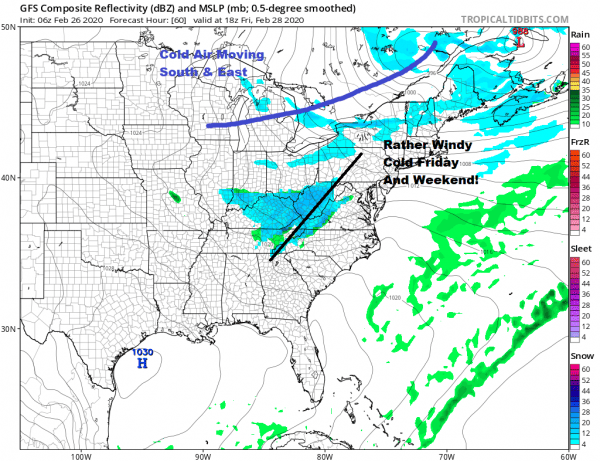
The heavy showers and embedded thunderstorms are starting to set up now across Western Virginia on the regional radar. They haven’t come into range on the local radars but they will do so in a few hours as the area swings around to the northeast. Low pressure is developing in Western Pennsylvania and eventually that moves into Upstate NY and pulls down colder air behind it.
LOCAL RADAR NEW YORK CITY
LOCAL RADAR PHILADELPHIA

The rainfall amounts will be in the 1/2 inch to 1 inch rain. Most areas south and west of Philadelphia and NYC will see the rains end before 7 or 8am while areas north and east of NYC could see the rain last a bit longer. Then it is windy and colder for the rest of Thursday with some sunshine and clouds. Wind advisories are up for Central and Western Pennsylvania from north to south with gusts of 40 to 50 mph while along the coast gusts in the 30 mph plus range will be common but it should not get to out of control. Temperatures Thursday will be in the 40s.
Cold air will be in the Northeast and MId Atlantic states for three days..Friday through Sunday with the coldest air overhead for the weekend. Friday we will see an upper trough moving through producing some clouds with temperatures in the mid 30s to lower 40s. Saturday and Sunday look for some sunshine with highs both days just in the 30s. Then temperatures begin to bounce higher next week as the next weather system approaches on Monday. We may see a few showers of rain from this later Monday or Monday night. Much of next week will be a wash rinse repeat scenario as the weather pattern overall remains unchanged in the long range.
BE SURE TO DOWNLOAD THE FREE METEOROLOGIST JOE CIOFFI WEATHER APP &
ANGRY BEN’S FREE WEATHER APP “THE ANGRY WEATHERMAN!
MANY THANKS TO TROPICAL TIDBITS FOR THE USE OF MAPS
Please note that with regards to any severe weather, tropical storms, or hurricanes, should a storm be threatening, please consult your local National Weather Service office or your local government officials about what action you should be taking to protect life and property.


